Hemkund Sahib Uttarakhand – How to Reach and Places to Visit

Hemkund Sahib Travel Guide

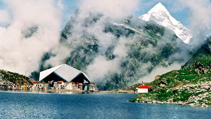
Shri Hemkund Sahib is an important pilgrimage destination site for Sikhs and Hindus. Hemkund Sahib is the breathtaking Lokpal Lake located at an altitude of 4329 meters above sea level. One can reach this beautiful lake through a challenging but very interesting and enjoyable trek from Ghangaria. The natural settings make this hilly region an amazing place for spending vacations.

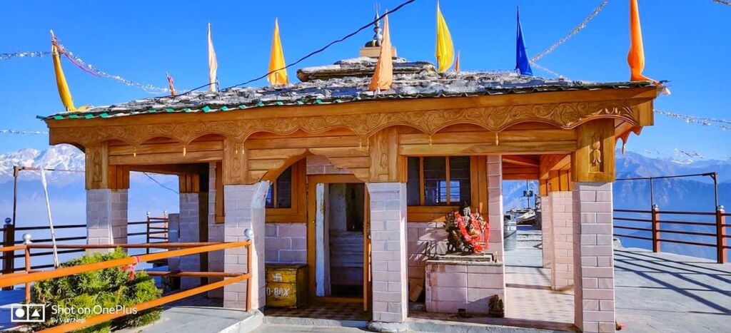
Sikhs consider this site a sacred place where one of the famous Sikh Gurudwara is here in the heart of the region. A Hindu shrine dedicated to mythological the Lord Lakshamana is attractive for Hindu pilgrims. The temple is built on the beautiful banks of Hemkund lake.

Hemkund Sahib is nested amidst seven snow-covered peaks and marvelous snowy glaciers. The natural beauty is reflected here with all its mighty appearance in the crystal clear water of Hemkund Lake.  Hemkund lake is fed by the glaciers from the majestic peaks, which are Saptrishi peak and Hathi Parvat. A small stream which is known as Himganga originates from this imposing lake.

It is written in the holy Granth Sahib that the tenth Guru of Sikhs, Shri Guru Govind Singh meditated on the beautiful scenery banks of Hemkund in one of his earlier births. Guru Govind Singh is believed to be the Guru who founded all present characteristics of present Sikhism. The Gurudwara of Sikhs on the banks of Hemkund lake is located at the place where Guru had meditated.

Hemkund has got mentions in Ramayana. It is believed that the younger brother of Lord Rama, Lakshmana, regained his health by meditating on the banks of Hemkund after the injuries he received from Megnath during the war. The Lakshamana temple is built at the place where Lakshmana meditated to regain his health.

Nearby Places to visit in Hemkund Sahib

Valley of flowers

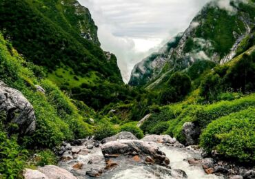
Valley of flowers is a 4Km beautiful easy-grade trek from Ghangaria. The region of the Valley of flowers is rich in flora and fauna. The valley was declared a world heritage site and National park in the year 1982. The virgin beauty of this mystical valley has always lured botanists, trekkers, adventure lovers and photographers.

Ghangaria

Ghangaria is the last human habitation centre on the way to Hemkund Sahib and the Valley of flowers. It is a scenic hamlet perched at an altitude of 3,050 meters above sea level at a distance of 13 km from Govind Ghat and 4 Km before Valley of Flowers.

The trek becomes easy grade to moderate from this point if you travel towards Hemkund Sahib. The region is prone to heavy snowfall during winter, the region remains open only from May to October. A Gurudwara, GMVN rest house and a few more hotels provide accommodation facilities at Ghangaria.

How to reach Hemkund Sahib

Hemkund Sahib is well-connected to roads up to Govind Ghat, from here you have to commence a trek of 19 KMS to reach Hemkund Sahib. Govindghat is well-connected by roads with major travel destinations in Uttarakhand state. Buses to Haridwar, Rishikesh and Srinagar are available from Kashmiri Gate ISBT (Delhi). Shareable vehicles like Ertiga Mahindra Maxx and Buses to Govind ghat are easily available from major stops of Uttarakhand like Rishikesh, Rudraprayag, Srinagar, Pauri, Ukimath, Karanprayag, Chamoli etc. Govind Ghat is situated on national highway NH-58 making it easy to reach the destination.

By Train

The nearest railway station is Rishikesh from Hemkund Sahib, but the roads are well-connected up to Govind ghat, from where you have to trek 19 KMS to reach Hemkund Sahib. Rishikesh railway station is situated at a distance of 273 Kms on NH-58. Rishikesh city, one of the well-developed cities of Uttarakhand state, is well-connected by railway networks with all the major destinations of India. Trains to Rishikesh are frequent. Govind ghat is well-connected by roads with Rishikesh. Sharable vehicles(Ertiga, Mahindra Maxx and Tata sumos) and buses are easily available from Rishikesh, Srinagar, Rudraprayag, Karanprayag, Chamoli and Joshimath.

By Flight

The nearest Airport to Hemkund Sahib is Jolly Grant Airport, Dehradun. Govindghat is situated at a distance of 292 kms from Jolly Grant Airport, Dehradun. Jolly Grant Airport is well-connected to Delhi flights. After that, you have to travel with vehicles like buses, shareable jeeps or personal vehicles to reach Hemkund.

Overview Hemkund Sahib

  • Temperature: -17 to 18 degrees Celcius(in winters) and 2 to 25(in summers)
  • Location: Chamoli, Uttarakhand
  • Famous for: Pilgrim
  • Languages are spoken in the region: Garhwali, Hindi
  • Altitude: 4200 meters
  • Pincode: 249401
  • STD code: 01372
  • Best time to visit: January to October
valley-of-flowers-trek-3

Valley of Flowers – Travel Guide and Trekking Route

Valley of Flowers National Park

Valley of Flowers National Park is an Indian national park in the state of Uttarakhand located in the Chamoli district, known for its beauty. Valley of the Flower is a bouquet in the west Himalayan region of Uttarakhand state. The trek to the Valley of Flowers goes through dense forests, along with the Pushpawati River and can be reached by crossing many bridges, waterfalls, and glaciers on the way. The glaring price of nature is an Indian National Park and UNESCO World Heritage Site.

About Valley of Flowers

The area of the Valley of Flowers is rich in flora and fauna. The Valley of Flowers was declared a National Park in the year 1982 and is now a UNESCO World Heritage Site. The virgin beauty of this beautiful valley has always attracted botanists, nature lovers, travelers, adventure sports and photographers also.

Situated at 3,658 meters in the Bhyundar Valley, the valley of flowers in the Chamoli district sprawls over a vast expanse of 87.50 sq. Kms, measuring 8 km long and 2 km wide, is the second zone of the Nanda Devi Biosphere Reserve with numerous waterfalls, white shiny glaciers and thickets that greet the visitor at every step. Ghangaria is a small hamlet situated at 13 km from Govindghatis the last human habitation center on the way to the Valley of Flowers.

Top 10 Summer Treks in Uttarakhand

The valley of flowers seems to change its color throughout the season from May to October, as it blooms hundreds of different flowers, taking various colors and shades as time progresses. The valley is the home of some rare flowers like the Brahma kamal, the blue poppy and the cobra lily. This place is a much-sought destination for flower lovers, nature lovers, photographers (nature photographers/wildlife photographers), and bird watchers. The valley is very popular among International tourists, and thousands of foreigners come to the Valley of Flowers every year.

Valley of Flowers National Park Travel Tips

Start early from Ghangharia to spend more time in the Valley of Flowers. It is a world heritage site and therefore you need to enter your name in the register, pay the entry fee and declare all plastic bottles you are carrying.

Entry to Valley of Flowers opens at 7:00 AM every morning and the last entry is allowed till 2:00 PM. You should start back around 1 PM so that you can reach back by 5:00 PM.

Carry an extra pair of socks, torches, Raincoats, and Extra Batteries for your Camera. Because you will see every possible opportunity for photography.

The Valley is beautiful in the months of May, June and September. But for the maximum number of flowers, the preferred months are July and August.

History of Valley of Flowers

In the year 1931, three British mountaineers, Frank S. Smythe, R.L. Holdsworth and Eric Shipton lost their path while returning from Mt. Kamet. The group accidentally reached a valley that was blanketed with alpine flowers and was left in awe of its beauty, thus naming it “The Valley of Flowers”. One of the climbers, Frank S. Smythe, later wrote the book ‘Valley of Flowers. In 1939, Joan Margaret Legge (21 February 1885 – 4 July 1939) a botanist deputed by Royal Botanic Gardens arrived at the valley to study the flowers and while traversing some rocky slopes to collect flowers, she slipped off and lost her life. Her sister later visited the valley after her death and erected a memorial near the spot. Professor Chandra Prakash Kala, a botanist at the Wildlife Institute of India, carried out the research study on the floristics and conservation of the valley of flowers for a decade, beginning in 1993. He invented 520 alpine plants exclusively growing in this National Park and authored two important books – “The Valley of Flowers – Myth and Reality” and “Ecology and Conservation of the Valley of Flowers National Park, Garhwal Himalaya.

Management System

The National Park is administered by the Uttarakhand State Forestry Department, the National Ministry of Environment and Forests, India. There is no settlement in the park and grazing has been banned since 1983. The park is open only during summer from June to October and it is covered by heavy snow for the rest of the year.

Mythology about Valley of Flowers

The locals always know about the existence of the valley and it is believed that this area was inhabited by Fairies and Gods.

Entry fee Valley of Flowers

  • For Indians: 150 INR
  • For Foreigners: 600 INR

Trek Update: A swift trek route to the Valley of Flowers has been carved which will easily guide you toward the beautiful floral valley. To make your sojourn rewarding, a new motorable bridge has been built in Govindghat connecting 4 Km towards the Valley of Flowers till Pulna village. So now tourists have to visit only 10 Km to reach Ghangaria(base camp of the Valley of Flower trek).

Travel Guide Valley of Flowers

Planning to visit the Valley of Flowers, but you are not sure about the most popular way, so here we are to help you. Check the details here.

Day 1: Rishikesh – Joshimath (255 Km) 9 Hours

  • Road Distance: 255 Km
  • Time Taken: 9 Hours
  • Altitude Change: 372 meters at Rishikesh to 1875 meters at Rishikesh.

Early morning leave Rishikesh for Joshimath it will take up to 9 to 10 hours to reach. Joshimath is 255 km away from Rishikesh, and it is the winter abode of Lord Badrinath. You’ll reach Joshimath by evening, and check in at any hotel that suits you for a night’s stay.  You can get direct buses from Rishikesh bus station to Joshimath if you are looking for a comfortable journey you can also book a taxi to Joshimath from Rishikesh.

Garhwali Traveller tip 1: To save money, use public transport to Joshimath. In case of no direct bus to Joshimath, break your journey into parts to reach your destination or go for sharable vehicles like Maxx service or Tata Sumos which are easily available.

Road route: Rishikesh – Devprayag – Srinagar – RudraprayagKaranprayagNandprayagChamoli – Joshimath

Day 2: Joshimath – Govindghat – Ghangaria

  • Road distance: 20 Km
  • Trekking distance: 1 hour by road and 6 hours for a trek(trekking distance may vary depending upon your speed and stamina)
  • Trek grade: Moderate
  • Altitude change: 1828 meters at Govindghat and 3049 meters at Ghangaria

After breakfast, drive to Govindghat which is about 22 km away from Joshimath. Start your trek journey towards Ghangaria with a packed lunch. Ghangaria is also known as Govind Dham, it is the base camp for Hemkund Sahib and the Valley of Flowers trek. After completing the 10 km trek journey, you will reach Ghangaria where you will spend the night.

Note: The distance of 4 Km from Govindghat to Pulna village is motorable. Earlier you had to walk 14 km to reach Valley of Flowers National Park. But after the 2013 flood in Uttarakhand, a new route has been constructed by the Uttarakhand government for travelers visiting Hemkund Sahib and the Valley of Flowers.

Garhwali Traveller travel tip 2: If trekking is tough for you then there is also a good option for you at Govindghat, there are plenty of ponies. You can book them for your journey to Ghangaria. However, to enjoy the views and trek route, we will recommend trying to trek yourself to be strong.

Day 3: Ghangaria – Valley of Flowers – Ghangaria

  • Trekking distance: 7.5 Kms for both sides
  • Time took: 2 hours for one side(depending on your strength and speed)
  • Trek grade: Easy
  • Altitude change: 3049 meters at Ghangaria and 3658 meters at Valley of Flowers

Your hard work and the journey will finally pay off in the form of a beautiful Valley of Flowers. Here you will see flowers you have never seen before, exotic Himalayan flowers and wildlife flora and many more.

Day 4: Ghangaria – Govindghat – Joshimath

Now it’s time to return home, post breakfast, start your 10 Kms trek to Govindghat and then drive to Joshimath via Badrinath. On reaching Joshimath, check in for the hotels to stay for the night.

Day 5: Joshimath – Rishikesh

After having breakfast, drive to Rishikesh and say goodbye to the beautiful hills.

Note: You can extend your stay at Ghangaria for one more day and visit Hemkund Sahib as well, which is 6 Kms from Ghangaria.

Valley of Flowers National Park Highlights

  • Easy trek for beginners
  • One of the most beautiful valleys in the world
  • More than 500+ flower species and plants are found here
  • The valley changes its color throughout the season
  • A huge variety of birds and butterflies
  • Snow-covered mountains and glaciers visible from the valley
  • Beautiful waterfalls, streams, lush green meadows and forests during the trek to the valley

Valley of Flowers National Park Overview

  • The Temperature in June: 6 to 16-degree Celcius
  • Trek to Valley of Flowers starts from: Govindghat or Pulna village
  • Trek distance: 17 Km
  • Trek grade: Easy for professionals and difficult trek for beginners
  • Trek duration: 3 days
  • Location: Chamoli District
  • Recommended stay: 4 days minimum
  • Altitude range: 3500 meters
  • Nearest railway station: Rishikesh, 273 Kms
  • Nearest airport: Jolly Grant Airport, Dehradun, 292 Kms
  • Famous for: Trekking, Flowers, Flora and Fauna, UNESCO Site, Vegetation
  • Best times to visit Vally of Flowers: May, June, July, August, September, October and November

What is the best time to visit the Valley of Flowers?

The Valley of Flowers is open for visitors from June to October. However, the best time to visit is between July and August when the flowers are in full bloom.

How do I reach the Valley of Flowers?

The Valley of Flowers is located in Uttarakhand, India. The nearest airport is in Dehradun, and the nearest railway station is in Rishikesh. From there, you can hire a taxi or take a bus to Govindghat and then trek to the Valley of Flowers.

Is there an entry fee for the Valley of Flowers?

Yes, there is an entry fee for the Valley of Flowers. Indian visitors need to pay INR 150 per person, and foreign visitors need to pay INR 600 per person. The fee is valid for three days.

What is the difficulty level of the trek to the Valley of Flowers?

The trek to the Valley of Flowers is considered moderate in difficulty. The trail is around 14 km long and has a gradual ascent. However, it can be tiring for those who are not used to trekking.

Roopkund Trek How to Reach and Places to See

Roopkund Trek Travel Guide and Route

If you are planning to trek in Uttarakhand, the Roopkund trek is a must-do! The trek is filled with deep virgin forests, breathtaking campsites, miles of undulating meadows, snow and ice and the taste of great adventure as you climb from 8000 feet to 16, 000 feet in seven days to nine days.

Roopkund Lake – A Mysterious Lake (Skeleton Lake)

Roopkund is also known as Mystery Lake, since human skeletons and remains of horses from the Paleolithic age were found here. Roopkund is located at the base of Trishul peak and Nanda Ghunti. The lake is nestled amidst panoramic mountain scenery, surrounded by the rock-strewn glacier. Roopkund lake remains frozen for almost all the months of the year. The skeletons around Roopkund are believed to be 500 to 600 years old. While travelling to Roopkund you got a chance to trek through villages rich in Pahadi culture.

Roopkund is one of the most popular treks in India. The Roopkund trail climbs out of splendid dark green forests, suddenly bursting into Ali and Bedni Bugyal, India’s most beautiful high-altitude meadows. Climbing on snow to the Roopkund trek is a heart-pounding thrill. 

Nanda Devi Raj Jat Yatra

The great Nanda Devi Raj Jat Yatra is held every 12 years from Nauti village near Karanprayag city to Homkund near Roopkund. The whole yatra is dedicated to Goddess Devi Nanda. Many people from Garhwal and Kumaon region take part in this tough Yatra.

Many stories are also there about the mystery of the Human skeletons of Roopkund. According to research, it was indicated that people from the 12th century to the 15th century died here.

How to reach Roopkund?

The starting point of the Roopkund Trek is Lohajang Pass, which is well-connected to roads. The trek from Bedni Bugyal to Roopkund Trek is difficult and is meant for those who are properly geared up and have prior trekking experience and also easy for Pahadi guys. Roopkund is situated 14 Kms from Bedni Bugyal.

Roopkund Travel Tips

Travelling in Monsoons should be avoided because due to heavy rainfall in the hilly areas of Uttarakhand you can face problems, roadblocks and landslides.

Avoid hiking alone in the Himalayas. Inform someone in your family or friends about your trek and let them know when the trek will begin and end.

Staying in Roopkund

Being a remote area, there are no hotels and restaurants at Roopkund. The trekkers take tents along with them and camp along the trail when they halt at night.  Few budget accommodation facilities are available at Wan, which is the last habitable village on the trek.

You will find GMVN Guest House in Wan, which is the last point where the accommodation facility can be found while travelling to Roopkund. During the remaining trekking route, you must carry your own camping equipment and tents for accommodation.

Delhi to Roopkund Travel Route

Delhi Haridwar RishikeshRudraprayagKarnaprayagLohajang PassTrek (34 Kms) – Roopkund.

Trek Guide Roopkund

Day 1:

It takes up to 10 to 100 hours from Kathgodam to Lohajung. After the glimpse at Tharali, the sight of Mt Nanda Ghunti welcomes you to Lohajung. A beautiful village with wonderful views of Didina valley. Lohajung is a nerve centre of 12 to 15 villages.

Altitude: 7,700 ft(2,347 m)

Time Taken: 10 to 11 hours from Kathgodam

Day 2: Drive from Lohajung to Wan – Trek to Ghairoli Patal

Trail Type: Initially 30 to 45 minutes ascent to Ran Ka Dhar followed by a 20 minutes descent to the Neel Ganga river. A climb of 3 hours from Neel Ganga river to Ghairoli Patal.

Water sources: Carry sufficient water together from Lohajung refill your water bottles at Neel Ganga.

Time Taken: 1-hour continuous drive to Wan and plus 4-hour trek from Wan to Ghairoli Patal.

Altitude: Drive from 7,700ft(2,347 m). Trek starts from 8000ft(2,438 m) to 10,000ft(3,048 m).

Day 3: Ghairoli Patal to Bedni Bugyal

Altitude: 10,000ft(3,048 m) to 11,500ft(3,505 m).

Trek Type: Stiff climb for about 2 hours to Ali Bugyal followed by a gentle trek to Bedni Bugyal.

Water sources: None, carry a minimum of 2 litres of water from the campsite.

Time took: 2 hours minimum (depends on your strength and fitness).

Day 4: Excursion to Bedni Top

Altitude: 11,500ft(3,505 m) to 12,000ft(3,719 m).

Trek Type: Steep climb to Bedni Top.

Water sources: None, carry at least 2 litres of water from the campsite.

Time took: 1 hour.

Day 5: Bedni Bugyal to Patar Nachuni

Altitude: 11,500ft(3,505 m) to 12,700ft(3,871 m).

Trek Type: Easy grade climb at the beginning to a saddle, followed by a gradual descent to Patar Nachauni.

Water sources: None, carry 2 liters water from the campsite.

Time Taken: 4 hours(depends upon your strength).

Day 6: Patar Nachauni to Bhagwabasa

Altitude: 12,700ft(3,871 m) to 14,100ft(4,298 m).

Trek Type: 3 hours sleep ascent to Kalu Vinayak followed by a gradually descending trail to Bhagwabasa.

Water sources: None, carry at least 2 litres of water from the campsite.

Time took: 5 Hours

Day 7: Bhagwabasa to Roopkund to Junargali – Return to Patar Nachauni via Bhagwabasa

Altitude: 14,100ft(4,298 m) to 15,750ft(4,800 m) to 16,000ft(4,877 m) at Junargali and down to 12,000ft(3,719).

Trek Type: Gradual ascent to Roopkund with the last 20 minutes consisting of steep switchbacks. After that 20 to 25 minutes steep climb to Junargali. Tricky descent on the switchbacks from Roopkund and descending trek to Patal Nachuani.

Water sources: None, carry at least 2 litres of water together from the campsite always and refill your water bottles from Patal Nachauni.

Time Taken: 3 hours approx to Roopkund + 2.5 hours return to Bhagwabasa +3.5 hours return to PatalNachuani

Tourist Places to visit in Roopkund

Bedni Bugyal: Bedni Bugyal is the most scenic spot on route Roopkund, which offers the best views of the mighty Trishul Parvat(7, 120 metres). Ali Bugyal is a vast expanse of green meadows with coniferous trees on the slopes. Both Bedni Bugyal and Ali Bugyal act as perfect camping spots while trekking to Roopkund.

For what Roopkund is famous for?

  • Roopkund is famous for Mysterious Lake and Trekking.
  • A recommended destination for Foreigners and Groups.
  • Roopkund is a popular destination for the activities/interests – Adventure, Trekking

Overview  Roopkund

  • Roopkund trek starting point: Lohjang Pass
  • Location: Chamoli Garhwal
  • Trek Distance: 38 Kms
  • Trek Grade: Tough
  • Trek Duration: 7 Days
  • Altitude Range: 4900 meters
  • Famous for: Mysterious Lake, Trekking
  • Best times to visit Roopkund: May, June, July, August, September and October

Auli Artificial Lake Chamoli

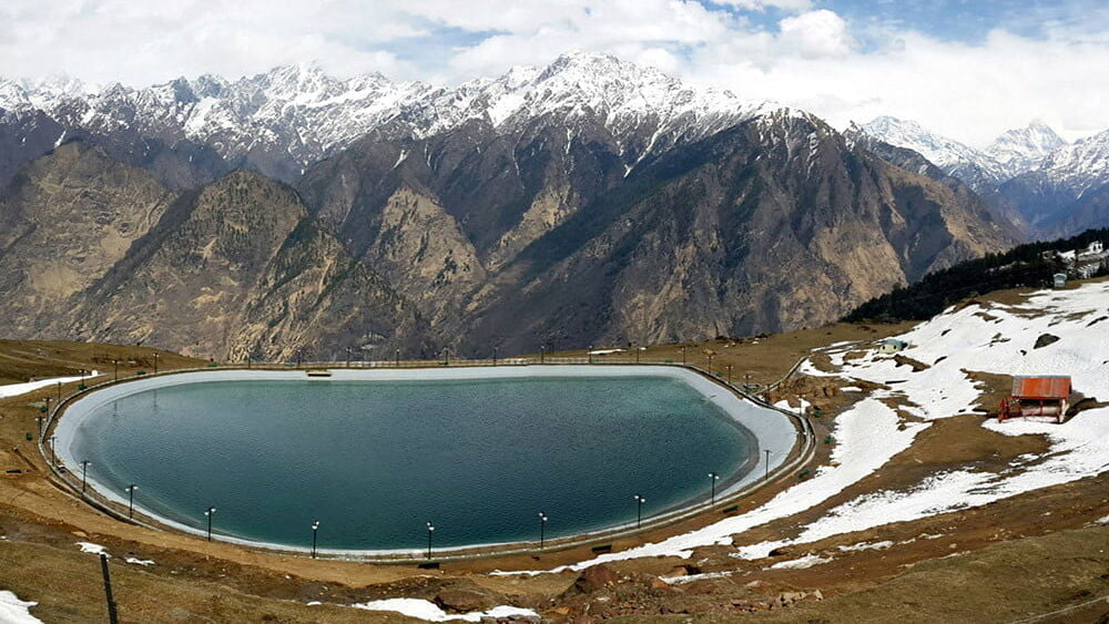
Auli artificial lake is the highest artificial man-made lake in the world. Auli Lake is located in the Chamoli district of Uttarakhand, It is the attraction point at this beautiful hill station. Auli is one of the best and most visited hill stations and winter destinations in Chamoli thousands of visitors visit every year, especially in winter to see the beauty of Auli in the snow. If you are in Joshimath, then you must visit this beautiful man-made lake in Auli.

35089468900 0788d12dae b edited
Auli Artificial Lake – Image Source(Flickr)

Auli is one of the favorite honeymoon destinations for couples. There is an artificial lake in Auli and in winter it’s the must visiting location here. Auli can be the perfect snow destination for you during winters you must visit there. It is a perfect hill station to spend your holidays during winter as well as in the summer. When it comes to choosing the best summer destinations, Auli is the first preference among tourists, because during summers the weather at Auli remains very cool and you are going to love it. You must consider visiting this beautiful place in Uttarakhand. If you are planning to visit Badrinath then you can consider visiting Auli because it lies in between the Badrinath route.

Artificial Lake at Auli is a pristine lake perched at an astounding elevation. It is one of the world’s highest man-made lakes. The Government has created this artificial lake to provide artificial snow on the ski slopes during scanty rainfall.

Auli is located in the Chamoli district of Uttarakhand, located in Joshimath in between the Badrinath route. Badrinath temple is just at approx 1 and half hour distance from Joshimath. Auli is surrounded by lush forests with beautiful scenes of nature around. Auli is one of the best and most popular travel and tourist destinations in India. There are many other places to visit in Auli, but the biggest attraction point at Auli is Auli Lake, which is artificially made by the Uttarakhand Tourism Development Board.

Fact – Auli Lake is known as the highest man-made artificial lake in the world.

Location of Auli Lake

Near Clifftop Auli, Joshimath

A short trek from the GMVN Auli will lead you to Auli Artificial Lake.

Entry

Free Entry, no charges for all (Indians as well as Foreigners).

Distance/ Travel Time

1.5 km/ 15 minutes from GMVN tourist rest house, Auli.

Exploration Time

You can cover the area within an hour, but it all depends upon how long you spend time there.

Auli Artificial Lake

The water of this lake is used to feed the snow guns stationed along the ski slopes in order to offer a good snowy surface for skiing during winter. This beautiful lake has helped in extending the ski season in Auli.

Location of Auli Lake

Auli artificial lake is located near Clifftop (famous Auli slopes). It will take up to 15 minutes to get there from the road (GMVN guest house).

The artificial lake in Auli is famous for?

Auli artificial lake is a popular tourist place in Joshimath Auli as well as a picnic spot – Lakes.

Overview Auli

  • Temperature: 20 Maximum and 10 Minimum (Summers)
  • Location: Chamoli Garhwal
  • Best times to visit Auli Lake: January, Feb, and March (throughout the year)
  • Famous for: Artificial Lake, winter games, honeymoon destination

Frequently Asked Questions

Q – Where is Auli located?

A – Auli is a hill station located in the Chamoli district of the Indian state of Uttarakhand.

Q – What is Auli famous for?

A – Auli is famous for its skiing slopes and panoramic views of the Himalayan mountain range. It is also known for its apple orchards and the Auli Artificial Lake.

Q – What is the Auli Artificial Lake?

A – The Auli Artificial Lake is a man-made lake located in Auli. It was created to provide artificial snow for skiing activities during the winter months.

Q – How was the Auli Artificial Lake constructed?

A – The Auli Artificial Lake was constructed by the government of Uttarakhand in the year 2003. It was built by diverting water from the nearby Nanda Devi mountain stream.

Q – Can visitors participate in skiing activities at Auli?

A – Yes, visitors can participate in skiing activities at Auli. The skiing season usually lasts from December to February.

Q – What other activities can visitors do in Auli?

A – Apart from skiing, visitors can also go trekking, camping, and hiking in Auli. They can also visit the Nanda Devi National Park, which is located nearby.

Q – What is the best time to visit Auli?

A – The best time to visit Auli is from November to March when the snowfall is at its peak and the skiing season is in full swing. However, visitors can also visit during the summer months (April to June) to enjoy the scenic beauty of the place.

Q – How can visitors reach Auli?

A – Visitors can reach Auli by road or by air. The nearest airport is the Jolly Grant Airport in Dehradun, which is about 286 km from Auli. The nearest railway station is in Rishikesh, which is about 256 km from Auli. From there, visitors can hire a taxi or take a bus to reach Auli.

Q – Is Auli safe for tourists?

A – Yes, Auli is a safe place for tourists. However, visitors are advised to take necessary precautions while participating in adventure activities like skiing and trekking.

Q – What is the climate like in Auli?

A – Auli has a cool and pleasant climate throughout the year. The temperature ranges from 10°C to 20°C during the summer months and from -4°C to 7°C during the winter months.

deoriatal lake

DeoriaTal Lake Travel Guide Rudraprayag Uttarakhand

Deoriatal Lake

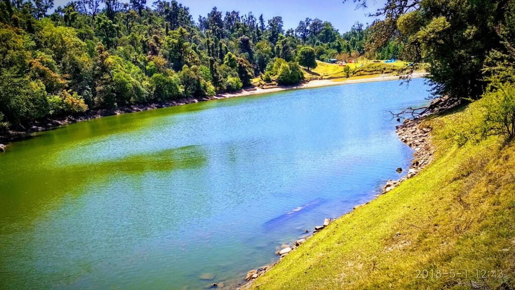
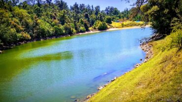
Deoriatal Lake is one of the beautiful lakes of Uttarakhand. It is a pristine lake in the Ukhimath area of Rudraprayag district. It is a popular place to visit in Rudraprayag. Deoriatal is a beautiful lake situated at a height of, 2438 meters above sea level. In the early morning time on a clear day, Deoriatal blesses the tourists with miraculous reflections of Chaukhamba Peaks on its crystal clear water.

DeoriaTal is an easy trek for beginners. If you want to extend the trek you can also trek to Bisuri Tal, Chopta via Rohini Bugyal and even to the Tungnath Trek and Chandrashila Trek.

Why is Deoriatal Famous?

The beauty of this translucent lake attracts visitors from all around the world. DeoriaTal falls under the Kedarnath Musk Deer Sanctuary, in the early morning, you can see a

The lake is situated up into a lush green inclined field surrounded by dense green forest. DeoriaTal is a popular trekking destination in the region because of its ease of access and natural scenic beauty. DeoriaTal lies in the Kedarnath Musk Deer Sanctuary region. Therefore, an overnight stay at DeoriaTal is recommended.few animals near the lake. This beautiful and majestic lake offers a panoramic view of Chaukhamba, Neelkantha, Bandarpunch, Kalanag Peaks and Kedar Ranges.

At DeoriaTal there are two things to experience, the first one being the real world and the other one being the reflection of the beautiful surroundings on the lake.

The lake is situated up into a lush green inclined field surrounded by dense green forest. DeoriaTal is a popular trekking destination in the region because of its ease of access and natural scenic beauty. DeoriaTal lies in the Kedarnath Musk Deer Sanctuary region. Therefore, an overnight stay at DeoriaTal is recommended.

Activities to do in DeoriaTal

Other than trekking, Deoriatal Lake is a perfect picnic, destination. Devariyatal is an easy trekking destination in the Himalayas rather than a tourist paradise. There is not much more sightseeing available at Deoria Tal apart from the majestic Himalayan peaks that are visible from Deoriatal like Chaukhamba, Sumeru, Meru and Kedar Dome and some more.

Camping: Deoriatal is an ideal location for camping with friends and family. Camping just beside the lake is an amazing and peaceful experience. The reflection of Chaukhamba peak can be seen clearly on the Deoriatal.

Trekking: The trekking route to Deoria Tal is easy to medium grade. The 2 Km trek offers some breathtaking bird-eye views of Saari village and its lush green fields.

Village Tourism: Sari is the last village before the Deoria Tal trek starts. You can walk around the village and learn about their way of lifestyle and culture. The people are warm and welcoming.

Bird Watching: The meadows, lake water, jungle and secluded location make it a habitat for various species of birds. You will see many birds in the proximity of the lake itself. Many wildlife photographers and bird watchers come here every year.

Deoria Tal Travel Tips

Deoria Tal trek is an easy, medium-grade travel route, it is just a 2 Km trek from the last Saari village. The location is perfect for trekkers, groups, kids and families also.

Littering in and around the lake is a punishable offense and visitors, and trekkers must take extra care of nature not to pollute the lake and location.

DeoriaTal Lake comes under the preview Kedarnath Wildlife Sanctuary. So, follow the proper guidelines outlined by forest authorities to protect the region.

Staying in Deoria Tal

Deoriatal lake is a very beautiful Tal (pond) at a height of 2,400 meters in Uttarakhand. Due to its pristine nature, camping is allowed at Deoria Tal under the vigilance of forest officials there. A forest rest house is available for staying at Deoria Tal. One has to trek 2 Km downhill from Devriyatal to Sari village to find accommodation. Few budget guesthouses are available there.

Food Guide Deoria Tal Trek

There are small shops located some 100 meters away from the lake where food items are prepared and served. The shacks have limited food items and a menu, so you would have to manage. Food facilities are also available in Sari village, where local food joints and restaurants are available. Packaged food can also be carried to Devriyatal, but make sure not to leave the waste there.

Overview Deoria Tal

  • Location: Rudraprayag, Garhwal
  • Deoriatal Trek, Distance: 3 km
  • Trek starts from Saari Village
  • Altitude range: 2438 meters
  • Trek Grade: Easy
  • Nearest Railway station: Rishikesh, 194 Kms
  • Nearest Airport: Jolly Grant Airport, Dehradun (208 Kms)
  • Recommended Stay: 2 Days
  • Best times to visit Deoria Tal Trek: Jan, Feb, March, April, May, June, September, October, Nov and December (Throughout the year)

Nainital Uttarakhand and Travel Guide, Uttarakhand

Nainital is one of the most popular hill stations in the Kumaon region of Uttarakhand. It is a very famous travel destination in India. The town not only attracts domestic travelers but also foreign tourists. It is surrounded by beautiful Himalayan mountains and lakes.

Nainital is a paradise for nature lovers. The most beautiful aspect of Nainital is the hilly region and the Nainital Lake. “Naini Lake” offers an amazing experience to tourists and is also known as the Queen of Lakes.

For what Nainital Hill Station is famous?

Nainital is famous for the “Naini Lake”, awesome views and pleasant weather. There are some other tourist places like Mall, which is presently known as Govind Ballabh Pant Marg. Nainital Zoo is also the best visiting point where you can see the rare species of Snow Leopard, Steppe Eagle, and the Himalayan Black bear. The Raj Bhawan’s Governor house is one of the few Raj Bhawans for public visits and viewing. Nainital’s latest attraction is Eco-Cave Garden, where children can learn about the ecosphere.

Activities to do in Nainital?

There are several types of activities you can do in Nainital like Boating, trekking, picnic spots, Shopping, Sightseeing, Ropeways and many more. Nainital is also the best destination for honeymoons for newly married couples. Tourists from all around India and from other countries come here.

Boating in Nainital: Naini Lake is the main attraction of Nainital and Boating is one of the most popular activities done by tourists and honeymoon couples. Yachting is another form of boating that is also gaining more attention and popularity in Nainital.

Trekking and Hiking: There are many hiking and trekking spots in and around Nainital where adventure lovers can hike and camp to explore the beauty of nature. Nainital – Betalghat, Nainital – Kilbury Trek, Nainital  Kainchi and Snow view trek are some famous hiking trails in Nainital.

Shopping: There are some local markets in Nainital like Tibetan Market, Bara Bazaar and Mall Road market from where you can shop for handicrafts, artifacts, apparel and souvenirs. The markets of Nainital are known for keychains, scented candles, books and artificial jewelry.

Picnic spots & Ropeway: Nainital has an aerial ropeway that connects the town with the snow viewpoint which offers an amazing view of Naini Lake as well as the surrounding places like a Tiffin Top, Snow view point and China Peak.

There are many more exciting places to visit in Nainital and it is like heaven, the blue lake and you are boating in the lake with your loved ones. Imagine how the best feeling will be. Every year hundreds of visitors from European countries, Gulf countries like – Dubai, Saudi Arabia, etc and other different parts and countries of the world visit Nainital every year.

Travel Tips Nainital

  • Nainital is a perfect weekend getaway from New Delhi. You will reach Nainital within 6 to 8 hours from Delhi.
  • There are some more beautiful places around Nainital like Haldwani, Bhowali, Snow view point Nainital, Ramnagar, Mukteshwar, Ghorakhal, Ramgarh, Betalghat, Sat-Taal and Bhimtal.
  • During the peak season, there is a high rush of people, so it is better to book your rooms in advance. Otherwise, you can face problems with accommodation in Nainital.

Nainital travel guide on how to reach

Overview Nainital

  • Temperature: 15 (Max) and 6 (Min)
  • Location: Kumaon
  • Stay (Recommended): 2 days (Min)
  • Nearest Railway Station: Kathgodam(41 Km)
  • Nearest Airport: Pantnagar (72 Km)
  • Famous for: Hill Station, Naini Lake, Picnic Spots, Himalayan views
  • Best times to visit Nainital: March, May, June, September, October, November, December

Rishikesh Uttarakhand – Top Places to Visit, Things to Do

Rishikesh – The Yoga Capital of the World

Rishikesh is the only place in the world-famous for adventure sports, Yoga, and tourism. It is located on the bank of the Ganga River in the Shivalik range of Uttarakhand. Rishikesh is located at a distance of just 20- 25 Km from Dehradun. Rishikesh is the hub of yoga, meditation, and spirituality.

Rishikesh has also become a popular and famous destination for adventure sports like river rafting, Bungee Jumping, Rock climbing, camping, hiking, and many more which attracts tourists not only from India but also from all over the world.

Mythology About Rishikesh

Rishikesh is widely known as one of the Holiest places in India, it is associated with many legends & mythological tales. The first myth says that once upon a time, Risi Raibhya performed a hard penance on the banks of the river Ganga. Lord Vishnu was impressed by his strict penance and appeared in front of them as “Hrishikesh” meaning “Lord of Senses” in the Sanskrit language. After that, the place became popular by the name Hrishikesh (another name of Lord Vishnu) and then later was named “Rishikesh”. In Kedar Khand of Skand Purana, there is the existence of Indrakund at that place.

The second myth tells that Lord Rama came there thousands of years ago for meditation and for annihilating Ravana with his younger brother Lakshamana who crossed the river Ganga by a jute rope bridge which is named Lakshmana Jhoola. In 1889 the bridge was reconstructed and replaced by steel and Iron rope suspension. A similar bridge was made in 1986 which was named Ram Jhoola. Also, there are many ancient temples in Rishikesh made by Adi Guru Shankaracharya.

There are several ancient temples, Ashrams in Rishikesh which are related to our historical & mythological background. A dip in the holy water of the river Ganga cleanses all the sins(bad works paap) of a person.

Rishikesh Travel Destination

Rishikesh is a medium-populated town famous for Yoga & Meditation. It is the gateway to the Himalayan Ranges and is the bank of the river Ganga and the ideal destination for adventure sports and camping and enjoying holidays.

Rishikesh is situated at an altitude of 356 meters above sea level and is distinct with three areas Muni- Ki- Reti, Rishikesh & Swargashram. It is located at the foothills of the Himalayan region of Uttarakhand and is easily accessible by road. It is the starting point of exploring the Himalayan region.

Rishikesh – Meditation & Yoga destination

Thousands of years ago, saints came there for meditation & spirituality because this place was fulfilled with peace. After that, Rishikesh became the birthplace of Yoga, Meditation, Spirituality, Spa therapies, and Ayurveda.

Rishikesh, also known as “The world Capital of Yoga” has many Yoga centers which attract tourists all over the world. It is believed that meditation and a dip in the flow of Ganga bring one closer to the Moksha.

Activities to do in Rishikesh

Yoga & Meditation: Rishikesh is also considered the “Yoga Capital of the World”. Tourists from all over the world come here for meditation and spirituality and to find inner peace.

Rafting: Rafting in Rishikesh is popular all over India where huge waves of Ganga make it a more popular adventure sport in Rishikesh. Adventure and rafting seekers come here in large amounts to feel the thrill of the river Ganga.

Adventure Sports: Apart from rafting there are many other adventure sports which are also the attraction point for tourists in Rishikesh like Bungee Jumping, flying fox, Kayaking, Mountain Biking, Rock climbing, etc.

For what Rishikesh is famous?

  • Rishikesh is famous for Yoga, Meditation, Rafting, Adventure Sports, Bungee Jumping, Pilgrimage, Tourism, Temples & Ashrams.
  • Rishikesh is recommended for all people as Family, Couples, Friend Groups, Solo, Kids, and Foreigners.
  • Rishikesh is a popular destination for the following activities: Rafting, Adventure Sports, Bungee Jumping, Pilgrimage, Tourism, Temples, Yoga & Meditation, Spirituality, Peace, Trekking and Mountain climbing, Hiking, New Year and Christmas, and Weekend trip.

Overview Rishikesh

  • Temperature: 29(Max) and 14(Min) in Celcius
  • Location: Dehradun, Garhwal
  • Stay(Recommended): 2 days(Min)
  • Nearest Railway Station: Haridwar, Dehradun(22 Km)
  • Nearest Airport: Jolly Grant Airport Dehradun(20 Km)
  • Famous for: Yoga, Meditation, Adventure Sports and Rafting, Temples and Ashrams
  • Best time to visit:  January – December(All the months of the year are recommended)

Rishikesh’s distance from Delhi, India is 250 Km and it will take up to 5 Hours 49 Minutes approx

Note: River Rafting at Rishikesh closes in the monsoons due to high rainfall in the hilly areas, as a result, the water level of Ganga increases.

Gangotri Temple Travel Guide and How to Reach

Gangotri Dham – The Origin of Ganga

Gangotri is one of the important Char Dham destinations in the Hindu religion and is one of the original sources of the holy river Ganga. The main origin source of river Ganga is “Gaumukh” which is a glacier situated 19 Km away from Gangotri Dham. River Ganga is one of the longest and most sacred rivers in the world.

Gangotri temple is located at an altitude of 3100 meters above sea level, on the banks of the river Bhagirathi. Gangotri is the starting point of the Ganga river, where the goddess Ganga is worshipped by the pilgrims. In ancient times the river was known as Bhagirathi and attained the name Ganga from Devprayag onwards where Bhagirathi meets with Alaknanda river from Ganga river. Gangotri is the home place of many ashrams, temples and small shrines.

The Gangotri temple opens in the month of May on the auspicious day of Akshay Tritiya and closes on Bhai Duj or Yama Dwitiya which falls in the month of November. The Gangotri temple remains closed for the rest of the six months.

History, Mythology and Importance of Gangotri

According to Hindi mythology, it is said that the river Ganga is a result of the reward given by Lord Shiva to the king Bhagirath for his hard penance. However, due to her pride and the fact that the earth would be devastated if Ganga came down in her full force, Lord Shiva caught Ganga in his locks to reduce the force. The sacred stone near the Gangotri temple denotes the place where Ganga came first to the earth. That’s why Ganga is also called by the name of Bhagirathi.

The present temple of Gangotri was constructed by Gorkha Commander Amar Singh Thapa in the 18th century. It is said that at the time of construction of the temple Gaumukh glacier was there but due to global warming it disappeared. Gangotri is well-connected with National highways and state highways. The nearest airport is in Dehradun.

Gangotri Travel Guide

There are many shops near Gangotri which sell prasad and small bottles to carry water from Gangotri after darshan. Ganga water is pure and is used in worship in the temple. There are some hotels and Ashrams for the accommodation of tourists on the other side of the temple. Gangotri is home of a variety of flora and fauna. There are many temples around Gangotri where tourists can learn more about the origin of the Ganga.

Gangotri Overview

  • Temperature: 16(Max) and 5(Min)
  • Location: Uttarkashi, Garhwal
  • Stay (Recommended): 2 days
  • Nearest Railway Station: Dehradun (240 Km)
  • Nearest Airport: Jolly Grant Airport, Dehradun (250 Km)
  • Famous locations: Gangotri temple and Popular treks
  • Best times to visit: April, May, June, September, October and November

Uttarkashi Uttarakhand, How to Reach and Places to See

Uttarkashi Travel Guide

Having spectacular hilly terrain, stunning natural beauty, ancient temples, rivers, and lush green forests. The district of Uttarkashi is one of the best spots for tourists to visit. The place is a paradise for tourists to visit. This is a real paradise for adventure and sports lovers. The Nehru Mountaineering Institute which is located in Uttarkashi District is also popular among tourists.

The holy town of Uttarkashi is the district headquarters, considered to have similar religious importance as Kashi. The famous Vishwanath temple here is dedicated to Lord Shiva. In front of the temple, there is a unique Mahadev Ka Trishul or Shiva’s Great Trident, made with 8 major metals. Other important temples are dedicated to Lord Pharsuram ,Lord Rudra and Goddess Kali. It is an important stopover for pilgrims visiting Gangotri.

Places to Visit in Uttarkashi

Gangnani(39 Kms):

Lies on the way to Gangotri. There is a famous temple dedicated to Sage Parashar. Visitors and pilgrims bathe at Rishikund near the shrine in a hot water spring.

Sat Tal:

SatTal or “Seven Lakes” a group of lakes with scenic surroundings is located just above Dharali, 2 Kms beyond Harsil.

Harsil(73 Kms):

A beautiful spot on the way to Gangotri Dham is noted for its natural beauty and delicious apples.

Dayara Bugyal(28 Kms):

Bugyal or high altitude meadows at an altitude of 3048 metres offers a majestic view of the Himalayas. There is also a small lake here. The road route to the Dayara Bugyal branches off near Bhatwari, 28 Kms from Uttarkashi to Gangotri marg.

Maneri(13 Kms):

It lies on the Gangotri route and has a Dam across the Bhagirathi river. Maneri lake adds extra beauty to the site.

Nachiketa Tal:

The beautiful natural lake can be reached via Chaurangi – Khal(29 Kms) from where one has to trek for a 3 km route, a small temple is located on the banks of the Nachiketa lake.

Gangotri:

The origin source of the river Ganga, one of the holiest rivers in the country. Gangotri is one of the Char Dham of Uttarakhand. The Gangotri Temple is situated at an altitude of 3048 meters above sea level and approx 99 Kms from Uttarkashi.

Gaumukh(18Kms):

Gaumukh is one of the famous glaciers of Uttarakhand. The Gaumukh glacier is the physical source of Bhagirathi(Ganga) river and has great importance to the pilgrims.

Kedartal(18 Kms):

The trek to the beautiful lake surrounded by the majestic peaks.

How to Reach Uttarkashi

By Road:

Uttarkashi is well connected by road to the major districts like Dehradun, the capital of Uttarakhand.

By Train

The nearest railway station is Rishikesh(145 Kms) and the other one is Dehradun.

By Air:

The nearest airport to Uttarkashi is Jolly Grant Airport, Dehradun(162 Kms).

Stats of Uttarkashi District

  • District Headquarters: Uttarkashi
  • The Population of Uttarkashi: 3, 29, 686
  • Literacy Rate: 67.58%
  • Languages are spoken in Uttarkashi: Garhwali and Hindi
  • Altitude: 1165 m
  • Best seasons to visit Uttarkashi: March to June and September to November
  • Area: 7951 sq Km