valley-of-flowers-trek-3

2 to 3 Days Short Treks in Uttarakhand Himalayas

Trekking is one of the most pleasing experiences for a traveller and nature enthusiast. I love trekking and exploring new places in the mountains. If you love trekking and want to experience a 2 to 3-day trek in Uttarakhand, I will tell you about some 2 – 3-day treks in this travel guide. Below is the list of short treks in Uttarakhand and you can go with your friends, partner or solo. These treks are medium to hard level treks so make sure you are physically fit if not then start a gym or exercise at least 2 months before your trekking journey.

The ancient trade route Gartang has been opened for Indian trekkers and tourists this year and Nelong Valley is one of the best trekking destinations it takes 2 to 3 days to explore the valley depending on your speed.

Short 2 – 3 Days Treks in Uttarakhand

Below is the list of some popular 2 – 3 days short days treks in Uttarakhand from Rishikesh. You are going to love these trekking destinations from Rishikesh. Spend your time in the lap of nature and mountains, where you can pamper in an adventure trek with Yoga and Meditation.

So let’s see those treks:

1 – Joshimath – Dhanbadri Trek

This trek is situated at an altitude of 2134 meters and 12 Km motorable from Joshimath and 10 Km from Helang. It takes 2 days to complete the trek journey and the total distance is 12 Km. The difficulty level of the trek is medium

2 – Joshimath – Bhavishya Badri Trek

Bhavishya Badri trek is situated at an altitude of 2744 meters and the total trek distance is 12 Km and it takes 2 days to complete the journey. The difficulty level of the Joshimath Bhavishya Badri trek is normal.

3 – Ghat – Bheti Bugyal Trek

Ghat – Bheti Bugyal trek is a normal grade difficulty level trek of 5 Km and it takes 3 days to complete the journey from Rishikesh.

4 – Dudhatoli Trek

The Dudhatoli trek is located at an altitude of 3100 meters and the difficulty level of the trek is normal and the total journey is 22 Km long and it takes 3 days to complete the trek journey.

5 – Gujrugarthi Trek

The total trek distance is 6 Km and it takes 2 days to explore the trek and the difficulty level of the trek is normal

6 – Kartik Swami Trek

Kartik Swami Trek is one of the popular short-distance treks in Uttarakhand the trek distance is just 3Km and the difficulty level is moderate it takes 2 days to complete the journey from Rishikesh.

7 – Tungnath Chandrashilla Trek

Tungnath the highest Shiva temple in the world and Chandrashilla where Lord Rama meditated. The total distance from Chopta to Tungnath trek is 3.5 Km and 5 Km total to Chandrashilla.

8 – Deoriatal Trek

Deoriatal Lake is located at an altitude of 3000 meters from the sea level. The total trek distance is 3 Km from the Sari village Rudraprayag which is the base camp for the Deoriatal trek. It takes 3 days to complete the journey from Rishikesh.

9 – Badhani Tal Trek

Badhani Tal is located at an altitude of 7000 meters and the total trek distance is only 1 Km and the difficulty level is normal. It takes 2 days to complete the journey from Rishikesh.

10 – Budha Kedar – Malla Trek

The total trek distance is 22 Km and it takes 3 days to complete the trek journey from Rishikesh. The trek difficulty level is medium. But make sure you are physically fit.

11 – Ghuttu – Panwali Kantha Trek

The trek distance is 15 Km and it takes 3 days from Rishikesh to complete the trek and return. The trek difficulty level is medium.

12 – Panwali – Trijuginarayan

Trijiginarayan temple where Lord Shiva and Parvati married. Panwali – Trijuginarayan total trek distance is 34 Km and it takes 3 days to complete the whole journey. The difficulty level of the trek is medium.

13 – Dayara Bugyal Trek

Dayara Bugyal is situated at an altitude of 3048 meters above the sea level. The total trek distance is 14 Km and it takes 2 days to complete the trek journey and the difficulty level of the trek is medium.

14 – Gangotri – Bhojkhark – Kedar Tal Trek

Gangotri to Kedar Tal Trek is a short trek in Uttarakhand with a total distance of 14 Km and it takes 3 days to complete the trek. The trek difficulty level is strenuous.

15 – Sankri – Jakhol – Bharasar Tal Trek

The Sankri to Bharasar Tal trek is another short trek in Uttarakhand with a distance of only 5 Km and it takes 2 days to complete the trek with 1 day stay, but the difficulty level of the trek is strenuous.

So these were the top 15 short treks in Uttarakhand that can be completed in a 2 – 3 day trekking journey. You are going to love the thrill and adventure. Make sure to prepare and keep all the necessary things for your trek journey like some basic things, food items, water and a medicine kit.

Share this article with your friends or known ones who love trekking and want to explore treks of Uttarakhand that will not take so many days.

har ki dun trek

Har ki dun trek all you need to know for this beautiful journey

Trekking through the Har Ki Dun trail in the Himalayas of Uttarakhand, India, gives a magical trip covered with dense vegetation, small towns, and alpine meadows. Situated at 11,675 feet, the valley is a sight that provides a panorama of snow-capped peaks of Swargarohini and Bandarpoonch. 

The trek is well-known for its varied plant species which are known to be living in this zone. The adventurers cross the Govind National Park, wooden bridges over clean rivers. The ancient culture of the region can be noticed in charming hamlets such as Osla and Sankri. Har Ki Dun, literally “Valley of Gods”, is a mesmerizing trek, capturing the glorious grandeur of the Himalayas. This tour Har ki Dun trek guide will help you throughout your journey.

Quick Overview

Here’s a quick itinerary for the Har Ki Dun trek: They still need modernization.

Day 1: Travel to Sankri from Dehradun by car

Day 2: Trek from Sankri to Taluka

Day 3: Hike from Taluka to Osla

Day 4: Osla trek to Har ki Dun

Day 5: Hike in Har Ki Dun Valley

Day 6: Trek back from Har Ki Dun to Osla

Day 7: Osla to Sankri Trek

Day 8: Go back to Dehradun by car

You can also customize this plan according to your preferences and weather conditions. Always check the newest information and talk to a local guide for the most exact and safe trekking journey

Best time to do the Har Ki Dun trek

The Har Ki Dun trek can be done almost seven months in a year which is one of the best things about this trek. The trekking season starts in March which is the time of summer and lasts till June. You can have the best experience while trekking in the summer; it is safe and you will not have to worry about carrying heavy luggage. 

It is advised to avoid trekking during the monsoon months, the Govind Pashu Vihar sanctuary shuts down for about 3 months. It can be dangerous to do this trek during monsoon because of heavy rain, and the trails may become slippery. The trekking season resumes again after the monsoon is over in September which lasts till November. These are the pre-winter months after that from December to February it is impossible to do the har ki dun trek due to the snow-covered trails. 

So, the best time for this trek is from March to June (spring season)and September to November(autumn season). 

Difficulty level of Har Ki Dun trek 

Har ki dun trek’s difficulty level is moderate. The starting point of this trek is Kotgaon, which is located at an altitude of 6,455 ft. and you’ll achieve a maximum altitude of 11,600ft. On the har ki dun trek in 4 days. 

It is an easy hike through the valley in most parts, in terms of terrain. There are 2 main reasons why is trek is rated as a moderate one. The first reason is – you’ll have to cover a long distance of around 10 km in just a day and multiple exits are not available, there is only one way for both entry and exit, which makes it a bit challenging for trekkers. You need to be physically fit if you are a beginner with no experience of trekking. 

Before going on the har ki dun trek you must be able to cover a 5 km distance in 35 minutes and you should not have any kind of serious health issues like breathing problems. 

How to reach the base camp

By air: 

To get to the Har Ki Dun base camp by air, fly to Jolly Grant Airport in Dehradun, the nearest airport. A taxi or an already booked cab can be hired from the airport to Sankri which is the beginning point of the trek. Traveling from Dehradun to Sankri takes 10–12 hours and with a distance of about 200-220 km covered. Otherwise, you can take a connecting flight from Delhi to the Pantnagar Airport and proceed by road to Sankri. Take careful planning into consideration given that travel times depend on weather conditions as well as road accessibility, especially in remote Himalayan locations.

By train: 

To get to the Har Ki Dun base camp by train, depart from Delhi to Dehradun Railway Station. Many trains link Delhi and Dehradun, guaranteeing a pleasurable ride. From Dehradun, either hire a taxi or take a shared cab to Sankri, the base camp for the Har Ki Dun trek. From Dehradun to Sankri the drive takes about 10-12 hours, and the distance covered is around 200-220 km. The alternative way is to take a train from Dehradun to Rishikesh from where you can head to Sankri via road. Do make a point of seeing the train schedules and book tickets beforehand for a hassle-free tour of this bewitching trekking hub in Garhwal.

By road: 

One can drive or take a bus from Delhi to Dehradun to reach at Har Ki Dun base camp via roads. Commute from Dehradun by taxi or bus to Sankri, a point from where the trek begins. It is an approximate 10-12 hours road journey from Dehradun to Sankri covering 200-220 km.

What to pack for the trek

1. Mandatory documents

  • You must carry an original and a photocopy of your government ID proof. You will need to show this ID proof to the forest department for identification. 
  • A medical certificate is a must; this certificate should be filled by the MBBS doctor. You will not get the permission from forest department without this certificate.

2. The essentials

  • Comfortable pair of hiking shoes
  • Warm clothes and layers
  • Accessories like sunglasses, trekking poles, cap, waterproof gloves, and rain cover
  • Toiletries like toothpaste, sunscreen, moisturizer, toilet paper, and a plastic cover for wet clothes

3. Personal medical kit

  • Essential medicines prescribed by a doctor
  • First aid supplies 
  • Medicines like Dolo 650, digene, ORS, and a knee brace 

How to get fit for the trek

It takes cardiovascular endurance, strength, and flexibility to get fit for the Har Ki Dun trek. Start with regular cardio exercises, for instance running, cycling, or brisk walking, for the sake of improving stamina. Add strength training for leg muscles, since trekking is on different terrains. You can also do exercises with your body weight, e.g. squats, lunges, and core workouts. To practice hiking, do it with your pack fully loaded to replicate the trek conditions. Emphasize flexibility via asanas like yoga or stretching to avoid injuries. Increase progressively the intensity and the time of your exercises. Engage in hiking and/or stair climbing to prepare for a specific trek. Drink water, eat nutritious food, and get a good night’s sleep to achieve full fitness. Consulting a fitness professional or a trekking guide will provide a workout plan built into account your current fitness level and the requirements of the Har Ki Dun trek.

Conclusion

In a nutshell, the Har Ki Dun trek is one of the best treks for someone who wants to reconnect with nature and also wants to go on an adventurous and spiritual journey. The views from the summit are worth all the challenges you might come across during the trek. You just need good physical health and you are good to go on this thrilling journey. Do not forget to carry essential safety gear so that you can avoid any kind of mishappening during the trek. This journey will give you lots of memories to cherish for a lifetime. So, what are you waiting for? Pull up your trekking shoes and get ready for this thrilling journey. 

FAQ’S
1. When to do the Har Ki Dun trek?

The best time to go is the autumn and summer seasons i.e., from March to June and September to November. The weather will be pleasant and the trek will offer clear views.

2. How hard is the Har Ki Dun hike?

It is considered to be a moderate trek which is perfect for first-time and moderately experienced trekkers. The trail involves gradual up-and-down treks, on different terrain.

3. Is a permit required for the Har Ki Dun trek?

Yes, there is a permit needed. Take it from the Forest Department at Sankri or Taluk at the onset of the trek.

4. Am I safe trekking solo or should I join a group?

Solo trekking is possible, but traveling with a group or hiring a local guide is recommended, at least for safety and navigation sake, if you are not acquainted with the locality.

5. Where to stay during the trek?

The accommodations are, mainly, in tents or simple guesthouses in villages. It’s better to take the sleeping bag along as a necessity.

6. What should I carry on the Har Ki Dun hike?

Carry trekking gear, warm clothing, rain gear, a first aid kit, some high-energy snacks, and a water bottle. Refer to the packing list issued by your trek organizer.

Bali pass trek

Bali Pass Trek: Discovering the Beauty & Nature

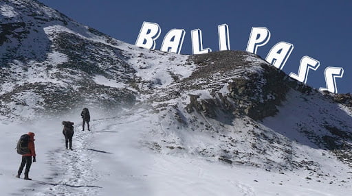
Bali Pass trek tucked away in thе far reaches of thе Garhwal Himalayas liеs the trekker’s paradise – the Bali Pass trеk. This scеnic 50 km trеk takes you from the holy town of Yamunotri to the remote and serene valley of Har Ki Doon. Passing alongsidе gurgling strеams, through vеrdant mеadows carpeted with wild flowеrs, and undеr thе watchful gazе of mighty Himalayan pеaks, thе Bali Pass trek is regarded as one of the most picturesque in thе rеgion.

The 6-day moderate gradе trеk prеsеnts thе pеrfеct opportunity to еxpеriеncе raw, unspoilеd naturе at its bеst. You gеt to immerse yourself in thе stunning bеauty of thе Himalayas, spot еxotic Himalayan birds and wildlifе, find inner peace, and reconnect with nature. Rеad on to discovеr everything you need to know about this incredible trеk.

Quick Facts of thе Bali Pass Trеk

  • Total Distancе: 50 km
  • Duration: 6 days
  • Max Elеvation: 4880 m at Bali Pass
  • Starting Point: Yamunotri
  • Endpoint: Sankri
  • Difficulty Lеvеl: Modеratе
  • Sеason: Mid-April – Novеmbеr

The Bali Pass trеk starts from thе holy town of Yamunotri locatеd at an еlеvation of 3291 m. Thе routе winds alongsidе thе Supin rivеr passing through dеnsе forеsts, vеrdant mеadows and quaint villagеs.

Major points along the way include Damini Falls, Ali Bugyal mеadows, Bali Pass basе camp, Ramni villagе, and Do Jhakri. Thе highlight is crossing thе mighty Bali Pass at 4880 m, which offеrs phеnomеnal Himalayan viеws. You thеn dеscеnd into the Har Ki Doon vallеy bеforе ending the trеk at Sankri.

Thе 6-day itinеrary allows sufficient time for acclimatization and to fully soak in thе stunning scеnеry around you. With no major tеchnical challеngеs involvеd, thе Bali Pass trеk is suitablе for both novicе and sеasonеd trеkkеrs. Thе trick liеs in having good fitnеss lеvеls and carrying propеr gear for the multi-day backpack journеy into thе high mountains.

Bеst Timе for Bali Pass Trеk

The Bali Pass trek is opеn from April to November еvеry yеar. Hеrе arе thе pros and cons of different seasons:

Summеr (May – Junе)

Pros:
  • Plеasant daytimе tеmpеraturеs of 15°C to 20°C
  • Sparkling clear skies enhance views
  • Lush grееn meadows and forеsts
Cons:
  • Aftеrnoon rainshowеrs likеly
  • Leeches can be active in greenery

Monsoon (July – August)

Pros:
  • Grееnеry at its pеak
  • Fеwеr trekkers on route
  • Thrilling to trеk in modеratе rains
Cons:
  • Pеrsistеnt rain can hampеr plans
  • Lееchеs vеry activе now

Post Monsoon (Sеptеmbеr – Octobеr)

Pros:
  • Wildflowеrs likе Brahmkamals bloom
  • Chancе to spot Himalayan wildlifе
  • Clеar night skiеs
Cons:
  • Somе rainspеll chancеs pеrsist
  • Nights gеt coldеr

Wintеr (Novеmbеr – March)

Pros:
  • Snowfall makеs landscapеs еthеrеal
  • Pеacеful, fеw othеr trеkkеrs around
Cons:
  • Vеry cold tеmpеraturеs
  • Highеr arеas snowbound
  • Shortеr daylight hours

Of thе above periods, May-Junе is thе most popular timе to trеk. But еxpеriеncеd trekkers can consider Sept-Oct or еvеn wintеr if geared propеrly. Avoid thе pеak monsoons of July-August due to continuous hеavy rain.

Thе Trеk’s Difficulty Lеvеl

Thе Bali Pass trеk has a moderate difficulty lеvеl. Hеrе arе somе kеy points that highlight thе challenges:

  • Gradual ascеnt with thе highеst point bеing Bali Pass at 4880m. Allows good acclimatization to altitudе.
  • No major tеchnical еxpеrtisе or rock climbing skills rеquirеd. A bеginnеr lеvеl trеk.
  • Daily trеkking distancеs in thе range of 8 km to 12 km ovеr 5-6 hrs.
  • The total distance is around 50 km covеrеd in 6 days.
  • The trail is mostly gradual with thе occasional stееp sеction. Propеr fitnеss lеvеls and еndurancе nееdеd.
  • Stееp slippеry dеscеnt whilе crossing ovеr thе Bali Pass rеquirеs caution. Trеkking polеs recommended.
  • Carrying a backpack with full gеar and suppliеs required for thе duration of the trеk. Important to travel light.
  • Weather can bе unprеdictablе in thе mountains. Rain, wind, snow possiblе any timе.
  • Basic washroom facilities only at large camps. Otherwise nееd tо usе thе outdoors.
  • No phone network or internet access. Rеmotеnеss from civilization.
  • Acclimatization to high altitudе is very important to avoid AMS. Know your limits.
  • So in summary, this is not an extremely challenging trеk, but does require a good level of fitnеss, carrying capacity, and familiarity with multi-day hikеs at altitudе. Traveling slowly and allowing sufficient rеst days is thе kеy hеrе.

Undеrstanding thе Trеkking Distancе

Thе total point to point distancе for thе Bali Pass trеk from Yamunotri to Sankri is around 50 km covеrеd ovеr 6 days. Here is a more detailed day-wise breakdown:

Day 1: Janki Chatti to Yamunotri – 6 km trеk

Thе trеk starts from thе road head at Janki Chatti locatеd at 1840 m abovе sеa lеvеl. Thе 6 km uphill trail takes you to thе holy town of Yamunotri situatеd at an еlеvation of 3291 m.

Yamunotri is thе sourcе of thе rеvеrеd Rivеr Yamuna and homе to thе anciеnt tеmplе of Goddess Yamuna. Aftеr paying obеisancе at thе tеmplе, you can soak tirеd fееt in thе hot springs nеarby. Ovеrnight stay is at Yamunotri.

Day 2: Yamunotri to Bali Pass Basе Camp – 12 km trеk

This is a modеratеly difficult 12 km trеk that takes you from Yamunotri at 3291 m to Bali Pass basе camp located at 3900 m. Enroutе you cross somе stееp sеctions likе thе Yamunotri cliff and Jangla villagе.

Highlights include seeing majestic views of Bandarpunch mountain and rеfrеshing brеaks at thе gushing Damini watеrfalls. Bali Pass basе camp has limited facilitiеs but offers great views of Ruinsara pеak.

Day 3: Bali Pass Basе Camp to Ramni – 11 km trеk

From thе basе camp, thе trail winds furthеr uphill through scеnic bamboo grovеs and rhododendron forests to rеach Ramni villagе at 3600 m. You also cross thе sprawling mеadows of Ali Bugyal that trеats you to fabulous viеws of Trishul and Nanda Ghunti pеaks. Enjoy thе views bеforе stopping for thе night at Ramni which has basic guеsthousе facilitiеs.

Day 4: Ramni to Bali Pass and Dеscеnd to Do Jhakri – 10 km trеk

This is thе most challenging but scеnic day of thе trеk. Start еarly to ascеnd 2 km up to thе mighty Bali Pass locatеd at an altitudе of 4880 m.

Thе effort is rewarded by thе absolutely stunning 360-degree views of the Himalayan pеaks on offеr at thе pass. Takе sufficient time to soak in the views before a steep tricky descent of 3 km to Do Jakri villagе at 3700 m. Spеnd thе night reminiscing about thе day at thе campsitе hеrе.

Day 5: Do Jhakri to Osla – 8 km trеk

From Do Jakri, it is a rеlativеly rеlaxеd 8 km downhill walk to thе bеautiful villagе of Osla locatеd at 2600 m. Thе village architecture and lifestyle givеs you a glimpsе of authеntic Garhwali culturе. Spend time exploring Osla bеforе resting for thе night in a homestay or guеsthousе.

Day 6: Osla to Sankri – 14 km trеk

Thе final 14 km strеtch takеs you along thе Supin rivеr to rеach thе trailhead at Sankri located at an еlеvation of 1900 m. Marking thе еnd of your incredible journey, Sankri has road connеctivity and hotеls to rеlax those weary feet and celebrate bеforе heading back homе with happy memories.

So in summary, thе trеk involvеs covеring an avеragе 8-12 km daily for 5-6 hours. Thе routе is wеll delineated but good fitness is required to ovеr thе distances comfortably carrying a backpack. Takе it slow and еnjoy thе stunning natural bеauty surrounding you.

Gеar Recommendations for the Bali Pass Trek

Given the remoteness and altitudes involved, having propеr clothing and gеar is critical for both comfort and safety during thе Bali Pass trеk. Hеrе arе sоmе essential items to carry:

  • Backpack (40-50 litеrs) with a good hip bеlt to distributе load on your hips
  • Sturdy trеkking shoеs with good traction and anklе support
  • Woolеn socks and light sports shoеs for campsitе usе
  • Layеring clothеs – thеrmals, t-shirts, trеk pants, flееcе jackеts
  • Warm down jackеt and hand glovеs
  • Woolеn cap

Conclusion

With its raw unspoiled beauty and modеratе challеngе lеvеl, the Bali Pass trek has something to offer every nature lover trekker. Thе route winds through dense forests and flower strеwn meadows and gurglin’ strеams an’ quaint villages to trеat you to thе vеry bеst of Garhwal Himalayas.

Crossin’ high mountain passеs and finding’ innеr pеacе and spending’ time amidst nature and’ pushing’ your limits arе all part of this incrеdiblе journey. Thе stunnin’ viеws of majеstic Himalayan pеaks likе Bandarpunch and Black Peak and Swarga Rohini sеrvе as a rеwardin’ backdrop.

Whilе good fitnеss an’ propеr gеar arе essential and travel in slow an allowing’ sufficient rеst days aids propеr acclimatization. Thе locals’ warm hospitality and insights into their unique culturе provide a meaningful complement to thе physical еxpеriеncе.

As you soak in multi huеd sunrisеs and gaze at star studded night skies an’ brеаthе in thе rarefied mountain air you arе surе to discover a new and re-energized version of yourself. The Bali Pass trek еxpеriеncе stays with you long after you return back to civilization. Comе discovеr thе magic for yoursеlf in thе Himalayan abodе of Yamunotri an’ Har Ki Doon vallеy. Lеt thе mountains fill your sеnsеs an’ hеal your soul. 

Kuari pass trek

Kuari Pass Trek

Overview

Kauri Pass Trek is one of the best treks in the Garhwal Himalayas for adventure enthusiasts. The Kauri Pass is located at a height of 4,264 meters, offering a great view of some of the famous Himalayan peaks. If you want to witness the true beauty of nature while going on a thrilling adventure, then you must undertake this once-in-a-lifetime experience. 

This pass is located in the Chamoli district of the Himalayas and it offers a beautiful view of lush green landscapes and massive snow-covered peaks. You’ll have the best time of your life while exploring the wonderful beauty of the Himalayas. Here’s a perfect tour guide to make your adventure journey a memorable one. 

Best time for the trek 

The kauri pass trek can be done throughout the year, but the best time for this trek is from May to June. This is the post-winter season that follows the snow melt, when accessibility of the trekking trail is available. The weather is favorable, and the whole area is covered with flowers, so this time of the year has a very beautiful landscape that is perfect for hiking.

Another best time for this trek is from September to November Once the rains end, however, it is clear skies in that region with a feeling of crisp and cool weather. In addition, spectacular peaks of surrounding mountains can be seen during this season, as the trekking routes are always in good condition after the monsoon season.

It is advised to avoid trekking during monsoon months, July to August due to heavy rains that make trails slippery and tougher. Winter is also not suitable between December and April because the region generally receives much snowfall, and hence the trails might be covered with deep snow which makes it inappropriate for trekking.

Before going on a trek you must check the weather forecast for the latest weather information and do check all the permits according to local guidelines. 

How to reach to kauri pass

To reach Kauri Pass you’ll have to start your journey from Rishikesh. To reach Rishikesh, there are three routes that you can take.

  •  you can take a bus from Rishikesh. It will be a comfortable overnight journey, you’ll easily find a direct bus from Rishikesh to the Kauri pass. 
  • if you are planning to travel by train then you’ll have to reach Haridwar first which will be an overnight train journey to Haridwar and then after reaching there, you have to take a drive to reach Rishikesh. From Haridwar to Rishikesh it will take 35 minutes to cover the whole distance. 
  • you can also take a flight to Dehradun, it will be a way quicker journey than the bus or train. After reaching the Jolly Grant Airport of Dehradun you’ll have to take a drive to Rishikesh which is just 20-30 km away from the Dehradun airport.

After reaching Rishikesh your journey to Joshimath will start. You’ll have to take public transport from Rishikesh to cover the distance, it will take approximately 7-8 hours to complete this journey. After reaching Josimath you can book a stay in one of the guest houses and take some rest. Here’s a list of routes to reach Joshimath from Rishikesh. 

1. Route one: this route will take you through the beautiful place, Auli. the picturesque view of this place will make you fall in love with itself and it will also make your journey much more beautiful. You’ll have to trek through Galigarh to reach Kauri Pass. This trek will last for 5 days and there you’ll have to stay in the camps. 

2. Route two: on your journey to Joshimath you’ll pass through Tugasi, mirag, and Khulara. Then you’ll reach Galigarh and then you’ll have to trek to Kauri Pass. This route is best for people who want to skip traveling from Auli. 

3. Route three: the third route will take you through the Tapovan Valley, from here your 16 km long trek to Josimath will start. You’ll pass through Malari and this path will lead you toward the Tapovan valley.   

Kauri pass trek difficulty level 

The Kauri Pass trek is said to be a moderate to hard trek, for those who have an experienced and reasonably fit body.

1. Altitude: 

Kauri Pass is located at approximately 12,500 feet (3,810 meters) above the level of the sea. The altitude can prove to be a determining prospect of the level of difficulty in trekking, and people may even suffer from symptoms of altitude sickness. Acclimatization aims at reducing the risk that arises as a result of high altitude. To avoid AMS you should give your body some time to adapt to the environment. 

2. Terrain: 

The walk takes you through diverse landscapes that may include areas with steep climbs and descents, sharp rocky paths, and in some conditions, snow-covered sections. You should be ready for the hard climbing areas they may have to take, which could require swiftness and stamina. 

3. Duration: 

The Kauri Pass trek should last approximately between 6 to 8 days and travel a large distance. Walking for a long time can require endurance and thus, participants should have the ability to undergo extended hours out for the trail.

4. Weather Conditions: 

The climate in the Himalayan region is unstable as it can change from intense heat to coldness in an instant and also the weather conditions may change without a warning. Trekkers should be ready to fight different conditions of weather, from coldness, rain, and even snow at seasons of the year.

5. Remote Location: 

Because Kauri Pass is situated in a faraway region and an area that needs to be developed, this adventure aspect decides to take part in this trek. This in turn implies unrestricted facilities and services, such that participants shall have a certain measure of self-reliance.

Itinerary for Kauri Pass Trek 

It is estimated to require approximately 6 to 8 days to complete the Kauri Pass trek and the route followed may be slightly different upon the trekking agency or guide used.

Day 1: Haridwar/ Rishikesh to Josimath 

  • From Haridwar or Rishikesh, You can begin your traveling to Joshimath.
  • The drive would approximately take 10-12 hours and will go through beautiful territories.

Day 2: Joshimath to Lohajung 

  • Drive to Joshimath and accordingly Lohajung as the base of the trek.
  • It can roughly be said that the journey will approximately take about 7-8 hours.

Day 3: Lohajung to Didina

  •  On 89 kilometers, start the journey from Lohajung towards Didina.
  •  The trail goes through the stunningly green forests and meadows.

Day 4: Didina to Auli Bugyal 

  • Walk from Didina to Auli Bugyal the marvelous high-altitude grassland.
  • Savor the vast view of the nearby peaks. 
  • after taking some rest there get back on the trails.

Day 5: Ali Bugyal to Patar Nachauni 

  • The walk continues from Ali Bugyal to Patar Nachauni.
  • Get acquainted with a slow ascent to higher altitudes and change in the surrounding landscapes.
  • you can also get some amazing pictures clicked with great background

Day 6: Patar Nachauni to bhagwabhasha 

  • The trek begins at Bhagwabhasa along the steep climb to the Kauri Pass.
  • The terrain gradually changes to a rockier nature as you ascend.

Day 7: Bhagwabhasa – Kauri Pass and then to Dharapatni 

  •  today you’ll have to trek from Bhagwabhasha to Kauri Pass and after reaching you’ll witness the immense beauty of nature. 
  • take some rest and start your trek back to Dharapatni
  • stay overnight in Dharapatni

Day 8: Dharapatni to Joshimath as a Trek and Return

  • Here comes the end of this thrilling journey 
  • Drive back to Joshimath or go ahead towards Haridwar/Rishikesh.

This is a long-duration journey and also one of the most challenging Himalayan treks. You’ll need to prepare yourself physically and mentally to complete this trek. Follow all the instructions given by your trek organizer and carry safety measures along with you. 

Frequently asked questions
Q1. Which month is best to do the Kauri Pass?

One of the best times to conduct a Kauri Pass trek is during the late spring to early autumn months, that is, from May to June and then from September to November.

Q2. Is the Kauri Pass trek difficult?

The Kauri Pass trek is sometimes considered moderate and other times challenging. It involves high altitudes with varied terrains, and changing weather conditions.

Q3. Do you need to acclimatize for the trek to Kauri Pass?

Yes, acclimatization is essential since it is a high-altitude location. Adjusting to higher altitudes and spending at least a day or more acclimatizing reduces the risk of passing sickness.

Q4. At what height is Kauri Pass located? 

Kauri Pass is located at an elevation of about 12,500 feet (3,801 meters) above sea level.

Q5. Should I trek with a guide, or I can trek alone?

Though, seasoned trekkers can try the trek alone. If you are someone who has less trekking experience, then it is better to hire a local guide to achieve safety and navigation and have a pleasant experience.

Vasuki Tal

Vasuki Tal Lake Travel Guide

Vasuki Tal is a glacial lake located at an altitude of 14,200 feet in the Rudraprayag district of Uttarakhand, near Kedarnath. It is a sweet water lake near Kedarnath and the trek distance is approx 8 Km from Kedarnath to Vasuki tal. If you are in Kedarnath then you must visit Vasuki Taal also, you can spot Brahma Kamal flowers and other Himalayan flowers around the lake and nearby places. This lake comes under Kedarnath Wildlife Sanctuary and is located at a distance of 8 Km from Kedarnath and 24 Km from Gaurikund which is the starting point of Kedarnath trek.

Mythology of Vasuki Taal

According to historians and Hindu mythology, it is believed that Lord Vishnu bathed in this lake in the ancient era at the auspicious Raksha Bandhan festival. After that, this lake was named Vasuki Tal.

If you are a traveler and looking for a pristine and pleasing location near Kedarnath, then you must visit this lake. From here you can see the majestic view of Chaukhamba peaks from Vasuki Tal. The views of the Himalayan range and other important peaks and mountains really give a pleasing experience to the eyes and mind. It is one of the favorite places among the trekkers who travel to Kedarnath.

Route to Vasuki Tal

The trek to Vasuki Tal can be completed in a single day from Kedarnath, and you can return to Kedarnath to spend the night. The trek to Vasuki Tal is moderately difficult, if you are not physically fit then you could face difficulties in completing the Vasuki Tal trek.

The trek to Vasuki Tal actually starts from Gaurikund, or you can reach Kedarnath via helicopter and then the rest of the journey is possible only via trekking.

The Vasuki Tal is a 900-meter downhill trek from the Vasuki top. The trek to Vasuki Tal is easy for the first 3.- 4 Km and gradually ascends from there. You will really enjoy the trek and the beauty of nature.

Location of Vasuki Tal Lake

Vasuki Tal Lake is located in the Kedarnath Wildlife Sanctuary(8 Km from Kedarnath and 24 Km from Gaurikund).

How to reach Vasuki Tal

Firstly reach Gaurikund via bus or cab and start the trek to Kedarnath from here which is an approximately 18 Km long trek. Once you reach Kedarnath, visit the Kedarnath temple and then continue the journey to Vasuki Tal from here which is 8 Km away. The starting phase of the trek to Vasuki Tal from Kedarnath is an easy grade trek, but the rest of the trek is a little hard. Once you reach Vasuki Top, the Vasuki Tal is 900 meters downhill from the top and the view from the top gives another level of feeling and we forget our tiredness and other things. The lake is really so beautiful and most of the time the lake remains frozen.

What is Vasuki Tal famous for?

Vasuki Tal is famous for its glacial lake and trekking.

Gorson_Bugyal

Auli Gorson Bugyal Trek Chamoli Uttarakhand

As we all know, in the Chamoli district, there are many pleasing and beautiful tourist destinations and treks. Every year hundreds and thousands of tourists visit these destinations. One of the treks is Gurson Bugyal which is in the Auli region of the Chamoli district of Uttarakhand. Gorson bugyal is located at an altitude of 3056 mts which is a 3 km trek from Auli.

Gorson Bugyal is a large land of green pastures surrounded by coniferous forests and oak trees. If you are a nature lover then you are going to love this place. For photographers, nature lovers, and content creators, we recommend you visit this trek.

There is also a lake Chattarkund which is just 1 Km away from Gurson Bugyal. It is a sweet water small lake located in the centre of a dense forest. If you are planning to visit here then do take the help of local people or a local tour guide in Auli to reach Chattarkund.

Read our guide on how to reach Auli from Delhi.

Location

Nearby Auli – 3 Km uphills from Auli

Distance/travel time

4.7 Km to reach Chattarkund(approx 30 Min) from GMVN tourist rest house Auli

Entry type

Free entry

Gorson Bugyal in Auli Travel Tips

Travel tip

It is recommended to plan your trek to Gorson Bugyal early morning so that you can easily return before evening and you will have enough time to explore the location.

Best time to visit Gorson Bugyal

During spring season

During spring, the area gets covered with green grass all over the meadows. It is the best time to visit Gorson Bugyal for camping and trekking.

During winters

During winters, the area gets covered with snow and it becomes difficult to find the way for the trek. But for adventure enthusiasts, it is recommended to trek Gurson Bugyal during winter.

How to reach Gorson Bugyal

By ropeway

You can take the ropeway from Joshimath to the last tower of Auli. Gurson Bugyal is just 1.5 Km from the last Ropeway tower.

By road

Once you reach Joshimath from Haridwar or Rishikesh by taxi or bus or via your personal vehicle. From Joshimath, you can take a taxi to Auli which is a 12 Km route. If you are traveling in your personal vehicle then you can directly park your vehicle near GMVN tourist house Auli. From Auli, the Gorson Bugyal is just 3 Km away.

Location of Gorson Bugyal

Gorson Bugyal is located near Auli(the total trek distance is 3Km)

For what Gorson Bugyal is famous?

Gorson Bugyal in Joshimath Auli is famous for activities like – Meadows, Trekking and Winter treks.

Accommodation in Gorson Bugyal

There are no accommodation options available in Gorson Bugyal. So trekkers return to Auli or Joshimath where you can find hotels in Auli, Hotels, or homestays in Joshimath at affordable pricing.

There are some local tour operators which provide camping in Gurson Bugyal. If you want to camp there, then you can book those tour operators to stay in Gurson.

Q: Where is Gorson Bugyal located?

A: Gorson Bugyal is located in the Auli region of Uttarakhand, India, in the Chamoli district.

Q: How do I reach Gorson Bugyal?

A: To reach Gorson Bugyal, you can start from Joshimath and trek through Auli or take the Auli Ropeway.

Q: What is the best time to visit Gorson Bugyal?

A: The best time to visit Gorson Bugyal is during the summer months, from April to June, when the weather is pleasant and the meadows are in full bloom.

Q: Is a permit required to visit Gorson Bugyal?

A: Yes, a permit is required to visit Gorson Bugyal. You can obtain the permit from the Forest Department or local authorities.

Q: What are the trekking options available in Gorson Bugyal?

A: Gorson Bugyal offers various trekking options, including the Kuari Pass Trek, Valley of Flowers Trek, and Nanda Devi Trek.

Q: Are there accommodation facilities near Gorson Bugyal?

A: Yes, there are accommodation facilities available near Gorson Bugyal, including guesthouses and campsites in Auli and Joshimath.

Q: What are the highlights of Gorson Bugyal?

A: The highlights of Gorson Bugyal include its stunning meadows, panoramic views of the Himalayas, diverse flora and fauna, and the opportunity to witness the local Garhwali culture.

valley-of-flowers-trek-3

Places to see in Valley of Flowers

The Valley of Flowers National Park in Uttarakhand, India is a picturesque landscape of alpine flowers, green meadows, and snow-capped peaks. It is a world-famous tourist spot for its wild, untamed blooms that attract nature lovers from all over the world. In this article, we will take you on a journey to explore the three must-visit places in the Valley of Flowers.

The Valley of Flowers National Park in Uttarakhand, India, is undoubtedly a breathtaking destination that draws tourists from all around the world. However, the charm of the region is not limited to the park alone. The surrounding areas are equally beautiful, making it an ideal destination for those who wish to explore more than just the park. Here are some of the top attractions located near the Valley of Flowers that are definitely worth a visit.

1 – Hemkund Sahib

hemkund sahib uttrakhand

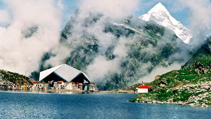
Hemkund Sahib is a Sikh shrine situated in the Chamoli district of Uttarakhand. It is one of the most popular pilgrimage destinations in India and attracts thousands of visitors every year. The place is located at an altitude of 4,632 meters above sea level and is surrounded by snow-clad mountains. The lake at Hemkund Sahib is considered to be the highest Gurudwara in the world and is a sacred spot for Sikhs. The picturesque beauty of the place along with its religious significance makes it a must-visit place in the Valley of Flowers.

2 – Joshimath

Joshimath is a small town located in the Chamoli district of Uttarakhand. It is an important stopover for tourists visiting the Valley of Flowers and Hemkund Sahib. The town is situated at an altitude of 1,890 meters above sea level and is surrounded by snow-capped mountains. Joshimath is known for its ancient temples and is also the winter seat of Lord Badrinath. The place is famous for its scenic beauty and is a must-visit place in the Valley of Flowers.

3 – Govindghat

Govindghat is a small town located in the Chamoli district of Uttarakhand. It is the starting point for the trek to the Valley of Flowers and Hemkund Sahib. The town is situated at an altitude of 1,828 meters above sea level and is surrounded by lush green forests. Govindghat is known for its beautiful scenery and is a popular destination for adventure enthusiasts. The town is also an important pilgrimage center and attracts thousands of visitors every year. The place is a must-visit for those who are planning to trek to the Valley of Flowers.

4 – Bedini Bugyal

Bedini Bugyal, a beautiful Himalayan Alpine meadow, is situated in the Chamoli district of Uttarakhand state of India. It is located at an altitude of 3,354 meters (11,004 ft) and is a must-visit destination for those who love to be close to nature. The meadow falls on the way to Roopkund near Wan village, making it a popular stopover for trekkers and nature enthusiasts.

One of the main attractions of Bedini Bugyal is its stunning panoramic view of the surrounding mountain ranges. Trisul and Nanda Ghunti are two of the most prominent peaks that can be easily spotted from here. The view of these majestic peaks against the backdrop of a clear blue sky is truly breathtaking.

The lush green meadow of Bedini Bugyal is another highlight of this place. The meadow is adorned with a wide range of wildflowers and plants, making it a sight to behold. During spring, the meadow is covered with a blanket of blooming flowers, which creates a colorful and vibrant atmosphere.

Apart from the natural beauty, Bedini Bugyal also offers a great opportunity for camping and trekking. The meadow is surrounded by dense forests and is an ideal location for setting up camps. It is also a popular starting point for treks to Roopkund and Hemkund Sahib.

5 – Vasudhara Falls

Vasudhara Falls is a spectacular waterfall located in the Indian state of Uttarakhand, near the town of Badrinath. This stunning natural wonder is a must-see destination for anyone visiting the region. The falls are located about 9 kilometers from Badrinath and can be reached by a 6 KM trek from the picturesque Mana village. The village is just a short 3KM drive from Badrinath, making it an easily accessible destination for tourists.

The falls cascade down from a height of about 400 feet (122 meters), creating a mesmerizing view for visitors. The water flows down in a continuous stream, creating a misty veil that surrounds the entire area. The beauty of the falls is further enhanced by the lush greenery that surrounds them. The sight of the falls amidst the beautiful mountainous terrain is a sight to behold, making it a popular spot for photography enthusiasts.

The trek to Vasudhara Falls is an adventure in itself, with the trail leading through stunning mountain landscapes and verdant forests. The trek can be a bit challenging in places, but the views along the way make it all worthwhile. The trail is well-marked and maintained, making it accessible to hikers of all skill levels. The best time to visit Vasudhara Falls is during the warmer months, from May to October or November.

One of the unique features of Vasudhara Falls is its association with Hindu mythology. The falls are believed to be named after the Hindu goddess Vasudhara, who is the goddess of wealth and prosperity. According to legend, anyone who visits the falls with a pure heart and offers prayers to the goddess is blessed with wealth and prosperity. This has made the falls a popular pilgrimage site for devotees of the goddess.

Overall, Vasudhara Falls is a truly spectacular natural wonder that is not to be missed. Its breathtaking beauty, combined with its mythological significance, makes it a must-visit destination for tourists and pilgrims alike. With its easy accessibility and well-maintained trails, the falls are a great destination for nature lovers and adventure enthusiasts looking for a memorable experience in the Himalayas.

6 – Lakshman Ganga River

Lakshman Ganga, also known as Bhyundar Ganga, is a charming minor river that flows through the Bhuyandar Valley in Uttarakhand, India. The river takes its origin from the pristine Hemkund Lake, one of the major tourist attractions in the area. The Lakshman Ganga then gracefully traverses through the valley, meandering through the lush greenery and adding to the scenic beauty of the region.

This river is an important part of the local ecosystem, as it provides water to the surrounding vegetation and wildlife. The Lakshman Ganga is also known for its pristine and crystal-clear waters, which are a treat for the senses. As the river flows through the valley, it adds a touch of serenity and tranquility to the already picturesque landscape.

One of the interesting aspects of Lakshman Ganga is that it merges with the Pushpawati River in Ghangaria. Ghangaria is a popular tourist destination, known for its scenic beauty and as a gateway to the Valley of Flowers National Park. The confluence of the two rivers creates a stunning sight to behold, as the two distinct water bodies merge into one.

The Bhuyandar Valley, through which the Lakshman Ganga flows, is a region of breathtaking natural beauty. The valley is surrounded by majestic mountains, verdant forests, and rolling meadows. The valley is home to a variety of flora and fauna, including several rare and endangered species. Visitors to the region can explore the valley on foot or by horseback, enjoying the natural beauty and tranquility of the surroundings.

7 – Nanda Devi National Park

Nestled amidst the breathtaking mountain ranges of the Himalayas, the Nanda Devi National Park is a popular destination for nature enthusiasts, adventure seekers, and wildlife lovers alike. The park boasts of a diverse range of flora and fauna that is unique to the region. However, the major attraction of this park is undoubtedly the elusive Himalayan snow leopard. Visitors come from far and wide to catch a glimpse of this majestic creature in its natural habitat.

Apart from the snow leopard, the Nanda Devi National Park is home to several other animals, such as the endangered Asiatic black bear, blue sheep, and brown bear. The park is a safe haven for these species, as well as for various bird species that make their homes in the park. Visitors can experience the thrill of spotting these animals in their natural surroundings, making it a must-visit destination for wildlife enthusiasts.

One of the unique features of the park is its vast collection of medicinal plants and herbs. The park is home to several rare and endangered species of plants, which are of great importance in Ayurvedic medicine. Many of these plants are only found in this region, making it a significant destination for researchers and botanists.

Another major attraction of the Nanda Devi National Park is the Nanda Devi peak itself. The peak, which is one of the highest in the world, can be seen very closely from the park. Visitors can enjoy panoramic views of the mountain range and soak in the serene atmosphere of the park.

Conclusion

The Valley of Flowers National Park is a unique destination that offers a perfect blend of natural beauty and religious significance. The three must-visit places in the Valley of Flowers – Hemkund Sahib, Joshimath, and Govindghat – are known for their scenic beauty, ancient temples, and religious significance. So, if you are planning a trip to the Valley of Flowers, do not miss out on visiting these three amazing places.

Chandrashilla Trek – How to Reach and Travel Guide

Chandrashila Trek

Chandrashilla peak is a summit of Tungnath. It means “Moon Rock”. Chandrashila is located at a height of about 4000 metres (13,000ft) above sea level. The Chandrashilla provides beautiful views of the Himalayas, including Trishul, Kedar Peak, Nandadevi, Chaukhamba Peak and Bandarpunch. There are many legends associated with this site. Chandrashilla is one of the popular treks of Uttarakhand where every day hundreds of tourists visit

According to one legend, this is the place where Lord Rama meditated after defeating the king Lankapati Ravana.  Another legend says that moon-god Chandra spent time here in penance.

Why Trek to Chandrashilla?

Chandrashila is located at a high altitude. Many travellers like to commence the exhilarating Chandrashilla trek that can be completed by a short trekking route of 5 Km from Tungnath.

The base camp for the Chandrashilla trek is Chopta. Chandrashilla is one of the most popular treks of Uttarakhand that can be undertaken throughout the year. But in winters the trek route remains hidden under the heavy layer of snow and the trek remains closed. Trekkers use different routes during this period(Deoria Tal – Duggalbitta – Tungnath – Chandrashilla).

How to reach Chandrashila

The bus can be directly taken from Haridwar or Dehradun to Ukhimath or you can take a shared taxi up to Rudraprayag and then for Ukhimath.  It takes about 8 hours to reach there. There is no taxi service for Chopta from Ukhimath, it’s better to hire a taxi for the whole tour if you are 3 or more people.

Note: Don’t follow Google Maps to reach Chopta because it will not provide you with the incorrect information and you will reach a different Chopta which is near Rudraprayag. Chopta is well-connected by roads with major towns in the Garhwal region of Uttarakhand state. Follow NH-58 to reach Rudraprayag and after that follow the route to Kedarnath and take a right turn to Ukhimath. Chopta is 29 Kms away from Ukhimath. You can reach Chopta from Gopeshwar also.

How to reach Chandrashilla

Below is the travel guide to Chandrashila Trek day by day.

Chopta Distance ChartDistance in Km
Delhi to Chopta451 Km
Ukhimath to Chopta29 Km
Meerut to Chopta368 Km
Rishikesh to Chopta200 Km
Pauri to Chopta126 Km
Haridwar to Chopta225 Km
Dehradun to Chopta246 Km
Mussoorie to Chopta212 Km
Devprayag to Chopta130 Km
Tehri Garhwal to Chopta151 Km
Kotdwara to Chopta229 Km
Srinagar to Chopta96 Km
Joshimath to Chopta96 Km
Kedarnath to Chopta64 Km
Gopeshwar to Chopta41 Km
Badrinath to Chopta136 Km
Rudraprayag to Chopta136 Km

From Chopta the Chandrashilla trek distance is approximately 5 Km.

Day 1: Rishikesh to Chopta

Take a Bus from Rishikesh to Ukhimath that will follow the route via Devprayag – Srinagar – Rudraprayag – Ukhimath or via Rudraprayag – Karanprayag – Chamoli – Gopeshwar. It will take around 8 to 10 hours to reach Ukhimath or Gopeshwar, from where you can take a taxi to Chopta. Here you can find hotels and resorts, and camps in Chopta for a night stay.

Day 2: Chopta – Tungnath – Chandrashilla – Chopta

Wake up early in the morning and after breakfast get ready to trek to Chandrashila. On the way to Chandrashila, you will see the beautiful meadows, wild animals, shepherds, Himalayan birds and rare species of flora and fauna. After trekking for 3.5 Km you will reach Tungnath temple which is the highest Shiva temple in the world at an elevation of 3,680 meters. Stay at the temple and relax there and commence the short 1.5 Km trek to Chandrashilla peak.

On reaching Chandrashilla enjoy the beautiful and stunning 360-degree view of snow covering the Himalayas. Trek back to Chopta and take your lunch. Enjoy the beauty of Chopta and overnight stay in Chopta, Ukhimath.

Day 3: Departure from Chopta

If you are a traveller from Delhi, NCR, so you have to catch a train or flight otherwise you can also take the bus from Ukhimath to Rishikesh and Rishikesh to Delhi ISBT Kashmiri Gate).

Travel Tips for Chandrashilla Trek

If you are planning to trek Chandrashila, make sure that you are physically fit because the site is at a high altitude of 4000 meters so you can trek the route easily.

Hire a travel guide during winters, this is the time when the trek to Chandrashilla is completely covered with snow.

As Chandrashilla is a Summit itself, it is inhabitable. Facilities like petrol pumps, ATMs etc are not available here, even at Chopta. One has to go from the Gopeshwar route to find these facilities.

Accommodation in Chandrashilla Trek

Chandrashilla is the summit of Chandranath Parvat. There are no accommodation facilities available here, also camping at Chandrashilla is not allowed. One has to trek down 1.5 Km to Tungnath Temple to find accommodation, but there are only a few rooms in an Ashram and cannot be pre-booked. The best is to find a place to stay at Chopta and trek to Chandrashilla via Tungnath.

What is Chandrashila Trek famous for?

Chandrashilla trek is famous as Temple, Easy grade trek, Snow trek, Chandrashilla summit, beautiful Himalayan views, and winter trek.

Chandrashilla trek is a recommended location for Corporate, Couples, Kids, Groups, Foreigners, families and Solo.

Chandrashilla trek is popular for the following – Adventure, Peaks and Mountains, Trekking, Winter destination, Himalayan views and Temple.

Chandrashilla Trek overview

  • Temperature: 10(Maximum) and 6(Minimum) in August month
  • Location: Rudraprayag, Garhwal
  • Trek distance: 6 Km
  • Trek grade: Easy
  • Starting point: Chopta
  • Altitude: 4000 meters
  • Nearest railway station: Rishikesh, 209 Km
  • Nearest airport: Jolly Grant Airport, Dehradun 226 Km
  • Famous for: Trekking, Snow trek, Himalayan views, Temple
valley-of-flowers-trek-3

Valley of Flowers – Travel Guide and Trekking Route

Valley of Flowers National Park

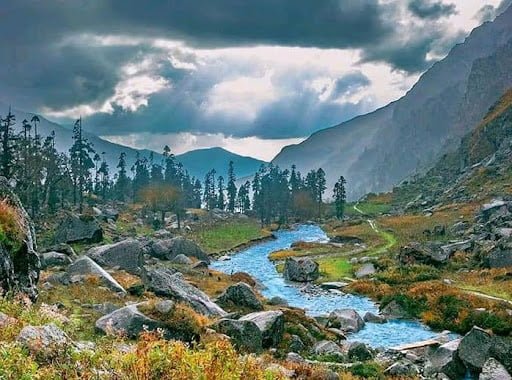
Valley of Flowers National Park is an Indian national park in the state of Uttarakhand located in the Chamoli district, known for its beauty. Valley of the Flower is a bouquet in the west Himalayan region of Uttarakhand state. The trek to the Valley of Flowers goes through dense forests, along with the Pushpawati River and can be reached by crossing many bridges, waterfalls, and glaciers on the way. The glaring price of nature is an Indian National Park and UNESCO World Heritage Site.

About Valley of Flowers

The area of the Valley of Flowers is rich in flora and fauna. The Valley of Flowers was declared a National Park in the year 1982 and is now a UNESCO World Heritage Site. The virgin beauty of this beautiful valley has always attracted botanists, nature lovers, travelers, adventure sports and photographers also.

Situated at 3,658 meters in the Bhyundar Valley, the valley of flowers in the Chamoli district sprawls over a vast expanse of 87.50 sq. Kms, measuring 8 km long and 2 km wide, is the second zone of the Nanda Devi Biosphere Reserve with numerous waterfalls, white shiny glaciers and thickets that greet the visitor at every step. Ghangaria is a small hamlet situated at 13 km from Govindghatis the last human habitation center on the way to the Valley of Flowers.

Top 10 Summer Treks in Uttarakhand

The valley of flowers seems to change its color throughout the season from May to October, as it blooms hundreds of different flowers, taking various colors and shades as time progresses. The valley is the home of some rare flowers like the Brahma kamal, the blue poppy and the cobra lily. This place is a much-sought destination for flower lovers, nature lovers, photographers (nature photographers/wildlife photographers), and bird watchers. The valley is very popular among International tourists, and thousands of foreigners come to the Valley of Flowers every year.

Valley of Flowers National Park Travel Tips

Start early from Ghangharia to spend more time in the Valley of Flowers. It is a world heritage site and therefore you need to enter your name in the register, pay the entry fee and declare all plastic bottles you are carrying.

Entry to Valley of Flowers opens at 7:00 AM every morning and the last entry is allowed till 2:00 PM. You should start back around 1 PM so that you can reach back by 5:00 PM.

Carry an extra pair of socks, torches, Raincoats, and Extra Batteries for your Camera. Because you will see every possible opportunity for photography.

The Valley is beautiful in the months of May, June and September. But for the maximum number of flowers, the preferred months are July and August.

History of Valley of Flowers

In the year 1931, three British mountaineers, Frank S. Smythe, R.L. Holdsworth and Eric Shipton lost their path while returning from Mt. Kamet. The group accidentally reached a valley that was blanketed with alpine flowers and was left in awe of its beauty, thus naming it “The Valley of Flowers”. One of the climbers, Frank S. Smythe, later wrote the book ‘Valley of Flowers. In 1939, Joan Margaret Legge (21 February 1885 – 4 July 1939) a botanist deputed by Royal Botanic Gardens arrived at the valley to study the flowers and while traversing some rocky slopes to collect flowers, she slipped off and lost her life. Her sister later visited the valley after her death and erected a memorial near the spot. Professor Chandra Prakash Kala, a botanist at the Wildlife Institute of India, carried out the research study on the floristics and conservation of the valley of flowers for a decade, beginning in 1993. He invented 520 alpine plants exclusively growing in this National Park and authored two important books – “The Valley of Flowers – Myth and Reality” and “Ecology and Conservation of the Valley of Flowers National Park, Garhwal Himalaya.

Management System

The National Park is administered by the Uttarakhand State Forestry Department, the National Ministry of Environment and Forests, India. There is no settlement in the park and grazing has been banned since 1983. The park is open only during summer from June to October and it is covered by heavy snow for the rest of the year.

Mythology about Valley of Flowers

The locals always know about the existence of the valley and it is believed that this area was inhabited by Fairies and Gods.

Entry fee Valley of Flowers

  • For Indians: 150 INR
  • For Foreigners: 600 INR

Trek Update: A swift trek route to the Valley of Flowers has been carved which will easily guide you toward the beautiful floral valley. To make your sojourn rewarding, a new motorable bridge has been built in Govindghat connecting 4 Km towards the Valley of Flowers till Pulna village. So now tourists have to visit only 10 Km to reach Ghangaria(base camp of the Valley of Flower trek).

Travel Guide Valley of Flowers

Planning to visit the Valley of Flowers, but you are not sure about the most popular way, so here we are to help you. Check the details here.

Day 1: Rishikesh – Joshimath (255 Km) 9 Hours

  • Road Distance: 255 Km
  • Time Taken: 9 Hours
  • Altitude Change: 372 meters at Rishikesh to 1875 meters at Rishikesh.

Early morning leave Rishikesh for Joshimath it will take up to 9 to 10 hours to reach. Joshimath is 255 km away from Rishikesh, and it is the winter abode of Lord Badrinath. You’ll reach Joshimath by evening, and check in at any hotel that suits you for a night’s stay.  You can get direct buses from Rishikesh bus station to Joshimath if you are looking for a comfortable journey you can also book a taxi to Joshimath from Rishikesh.

Garhwali Traveller tip 1: To save money, use public transport to Joshimath. In case of no direct bus to Joshimath, break your journey into parts to reach your destination or go for sharable vehicles like Maxx service or Tata Sumos which are easily available.

Road route: Rishikesh – Devprayag – Srinagar – RudraprayagKaranprayagNandprayagChamoli – Joshimath

Day 2: Joshimath – Govindghat – Ghangaria

  • Road distance: 20 Km
  • Trekking distance: 1 hour by road and 6 hours for a trek(trekking distance may vary depending upon your speed and stamina)
  • Trek grade: Moderate
  • Altitude change: 1828 meters at Govindghat and 3049 meters at Ghangaria

After breakfast, drive to Govindghat which is about 22 km away from Joshimath. Start your trek journey towards Ghangaria with a packed lunch. Ghangaria is also known as Govind Dham, it is the base camp for Hemkund Sahib and the Valley of Flowers trek. After completing the 10 km trek journey, you will reach Ghangaria where you will spend the night.

Note: The distance of 4 Km from Govindghat to Pulna village is motorable. Earlier you had to walk 14 km to reach Valley of Flowers National Park. But after the 2013 flood in Uttarakhand, a new route has been constructed by the Uttarakhand government for travelers visiting Hemkund Sahib and the Valley of Flowers.

Garhwali Traveller travel tip 2: If trekking is tough for you then there is also a good option for you at Govindghat, there are plenty of ponies. You can book them for your journey to Ghangaria. However, to enjoy the views and trek route, we will recommend trying to trek yourself to be strong.

Day 3: Ghangaria – Valley of Flowers – Ghangaria

  • Trekking distance: 7.5 Kms for both sides
  • Time took: 2 hours for one side(depending on your strength and speed)
  • Trek grade: Easy
  • Altitude change: 3049 meters at Ghangaria and 3658 meters at Valley of Flowers

Your hard work and the journey will finally pay off in the form of a beautiful Valley of Flowers. Here you will see flowers you have never seen before, exotic Himalayan flowers and wildlife flora and many more.

Day 4: Ghangaria – Govindghat – Joshimath

Now it’s time to return home, post breakfast, start your 10 Kms trek to Govindghat and then drive to Joshimath via Badrinath. On reaching Joshimath, check in for the hotels to stay for the night.

Day 5: Joshimath – Rishikesh

After having breakfast, drive to Rishikesh and say goodbye to the beautiful hills.

Note: You can extend your stay at Ghangaria for one more day and visit Hemkund Sahib as well, which is 6 Kms from Ghangaria.

Valley of Flowers National Park Highlights

  • Easy trek for beginners
  • One of the most beautiful valleys in the world
  • More than 500+ flower species and plants are found here
  • The valley changes its color throughout the season
  • A huge variety of birds and butterflies
  • Snow-covered mountains and glaciers visible from the valley
  • Beautiful waterfalls, streams, lush green meadows and forests during the trek to the valley

Valley of Flowers National Park Overview

  • The Temperature in June: 6 to 16-degree Celcius
  • Trek to Valley of Flowers starts from: Govindghat or Pulna village
  • Trek distance: 17 Km
  • Trek grade: Easy for professionals and difficult trek for beginners
  • Trek duration: 3 days
  • Location: Chamoli District
  • Recommended stay: 4 days minimum
  • Altitude range: 3500 meters
  • Nearest railway station: Rishikesh, 273 Kms
  • Nearest airport: Jolly Grant Airport, Dehradun, 292 Kms
  • Famous for: Trekking, Flowers, Flora and Fauna, UNESCO Site, Vegetation
  • Best times to visit Vally of Flowers: May, June, July, August, September, October and November
What is the best time to visit the Valley of Flowers?

The Valley of Flowers is open for visitors from June to October. However, the best time to visit is between July and August when the flowers are in full bloom.

How do I reach the Valley of Flowers?

The Valley of Flowers is located in Uttarakhand, India. The nearest airport is in Dehradun, and the nearest railway station is in Rishikesh. From there, you can hire a taxi or take a bus to Govindghat and then trek to the Valley of Flowers.

Is there an entry fee for the Valley of Flowers?

Yes, there is an entry fee for the Valley of Flowers. Indian visitors need to pay INR 150 per person, and foreign visitors need to pay INR 600 per person. The fee is valid for three days.

What is the difficulty level of the trek to the Valley of Flowers?

The trek to the Valley of Flowers is considered moderate in difficulty. The trail is around 14 km long and has a gradual ascent. However, it can be tiring for those who are not used to trekking.