Pauri Garhwal Uttarakhand

How to reach Pauri Garhwal Uttarakhand

Pauri is one of the most visited hill stations in the Garhwal region of Uttarakhand. This place attracts thousands of tourists and devotees. Pauri in itself is a district of Uttarakhand and Kotdwara is the biggest and most popular town of Pauri Garhwal. Pauri is a popular summer destination because during summers this place remains cold like some other hill stations of Uttarakhand, such as Auli, Munsiyari, Nainital, Mussoorie, etc. If you are planning to visit Pauri and want to know how to reach Pauri Garhwal then below we explained all the details about the journey. Pauri is well-connected with most of the important towns and cities of Uttarakhand with road and railway networks.

This article will guide you on how you can reach Pauri via different routes and modes of transport. Hope this pauri travel guide will help you properly.

By Road

Pauri District is well-connected with the road network. Tehri – Moradabad state highway connects the major cities of Pauri district like Kotdwar, Lansdowne, Pauri, Srinagar Garhwal, etc. You can take a direct bus from most of the major cities and towns of Uttarakhand or from ISBT Kashmiri Gate, to Delhi. Pauri is connected with all the major cities of Uttarakhand like DehradunHaridwarTehri Garhwal, Srinagar Garhwal, Almora etc.

By Train

The nearest railway station to Pauri is Kotdwara which is one of the oldest railway stations in Uttarakhand. Kotdwar railway station is approx 108 Km away from the main Pauri town. Trains are frequent from other major cities of India. After reaching Kotdwar you can take a direct cab or bus to Pauri.

By Air

Jolly Grant Airport is the nearest airport to the Pauri district, which is located approx 155 Km away from Pauri. Frequent flights are available from Delhi to Dehradun and from other major airports in India. After reaching Jolly Grant, you can take a cab or bus to Pauri. Also, you can take a helicopter from Sahastradhara to Srinagar Garhwal and then from Srinagar take a direct sharable taxi or Bus to Pauri.

If you are searching for a cab from Dehradun to Srinagar Garhwal then you can book a sharable cab with Garhwali Traveller Cab Network.

Hope this article was useful for you if you are planning to visit Pauri Garhwal then you can choose any mode of transport as per your need and budget. By road is the cheapest and easy option to reach Pauri.

Pauri Garhwal Uttarakhand

Pauri Garhwal Uttarakhand Travel Guide

Pauri Garhwal Demographics and Locations Nearby

Pauri is a heavily enriched district with natural phenomena like swift rivers, meandering valleys, snow-covered peaks of beautiful Himalayas, and intense green forests Many activities can be done here. The majestic beauty of the Himalayas is in deep jungles filled with pine and Deodar trees, blessing rhododendrons and rich wildlife. Pauri Garhwal is rich in a spectacular way. Various pilgrimage sites are there which attract devotees to this beautiful hilly land.

Kyunkaleshwar Mahadev temple is one of them. Popular festivals like Uttarayani Mela, Bhandara, and Sharadostav in the Pauri district are celebrated with pomp and show. Pauri is a very beautiful district, having chilly weather it is a paradise landscape to visit around.

Places to visit in Pauri Garhwal

Chaukhamba Viewport: 4Km far away from the location can be seen, the ridge overlooks the splendid ideal valley and Chaukhamba mountain peak.

Khirsu:

The majestic site, having a height of 1,700 meters above sea level, affords a fine and beautiful view of snow-covered mountains. The ancient temple of Ghandiyal Devta is worth visiting.

Jwala Devi Temple:

The holy pilgrim site lies on the main Pauri – Kotdwara road. During Navratri, a special festival is celebrated here which is attended by many devotees.

Srinagar Garhwal:

The ancient capital of the Garhwal kings is set on the banks of the river Alaknanda, about 30 Kms away from Pauri. Srinagar was an important centre of art and architecture. HNB(Hemwati Nandan Bahuguna) Garhwal University is located here.

Keshorai Math:

The ancient temple was perhaps built in the year 1962 and is noted for its architectural beauty.

Kandoliya:

The temple is dedicated to Kandoliya Devta, a folk deity, located on the Lansdwone road with beautiful scenic surroundings.

Kyunkaleshwar Mahadev:

An ancient 8th-century Shiv Temple provides stunning views of snow-covered peaks and mountains.

Kamleshwar Temple:

The ancient Shiv temple is associated with an interesting legend. It is said that Lord Rama worshipped Lord Shiva here with thousands of lotus flowers in ancient times.

Devalgarh:

It was set up by King Deval of Kangra. Main attractions – Laxmi Narayan Temple, Gauri Devi Temple, and Rajeshwari Temple. The site also has archaeological value.

Dhari Devi:

Pilgrimage center, devotees assemble here to worship Goddess Dhari Devi. The temple is located on the bank of the Alaknanda River near Dhari village.

How to reach Pauri Garhwal

By Road:

Pauri district is well-connected to the road network of Uttarakhand. Delhi is approx 293 Km away from here, while Haridwar is 170 km from Pauri district.

By Train:

The nearest railway station from Pauri is Kotdwara which is 108 km away from here. This station is well-connected to the other major cities and railway stations of the country.

By Air:

The nearest airport from Pauri Garhwal is Jolly Grant Airport at Dehradun which is 155 km away.

Stats of Pauri District

  • District Headquarters: Pauri
  • Population of Pauri district: 6,86,572
  • Altitude: 1814 meters
  • Languages spoken in the Pauri district: Garhwali and Hindi
  • Best season to visit Pauri: March – June, September to December
  • Literacy rate: 78%
  • Area: 5438 sq Km
  • Pauri garhwal pin code: 246001
Rivers in Uttarakhand

Rivers in Uttarakhand – Tributes of Ganga and other Rivers

Rivers of Uttarakhand

“Uttarakhand” is a state which is known for its hundreds and thousands of small and big rivers, sacred temples, and holy places, situated on the banks of the holy rivers. Some rivers have relevance in Hindu mythology and these rivers have religious significance in India. The Source of these rivers is the glaciers of the Himalayas (western Himalayas) situated within India, Nepal, and Tibet borders. These rivers play a very important role in economic, social, cultural, and environmental issues in India.

The important dams in Uttarakhand on these rivers are providing electricity to thousands of homes in India. These rivers are the backbone of the Indian economy because of their huge usage in farming, drinking water, fishing, trading, electricity, etc. In some parts of Uttarakhand rivers like Tons, Ganga (rafting in Rishikesh), Yamuna and Kali are very famous for a wide variety of water sports. These rivers are clean and less polluted till they enter the plains (Tarai region).

Some Major Rivers of Uttarakhand

Alaknanda River

The Alaknanda River is a major headstream of the Ganges River in the Indian state of Uttarakhand. It originates from the confluence of the Satopanth and Bhagirath Kharak glaciers and flows through the Garhwal Himalayas. The Alaknanda is a sacred river in Hinduism, and is known for its scenic beauty and whitewater rafting opportunities.

Origin and Course:

  • It originates from the confluence and foot of the Satopanth and Bhagirath Kharak glaciers.
  • It flows through the Garhwal Himalayas, traversing scenic landscapes.
  • It merges with the Bhagirathi River at Devprayag, and from that confluence, the river is known as the Ganges (Ganga).

Significance:

  • It’s one of the two major headstreams of the Ganges.
  • It holds immense religious importance in Hinduism, with numerous pilgrimage sites along its banks, including Badrinath.
  • The confluence of the Alaknanda with its tributaries, known as the “Panch Prayag” (five confluences), is considered sacred.
  • Those confluences are; Vishnuprayag, Nandprayag, Karnaprayag, Rudraprayag, and Devprayag.
  • It is also used for hydroelectric power generation.

Key Features:

  • The Alaknanda contributes a larger volume of water to the Ganges than the Bhagirathi.
  • The river is also known for its white-water rafting opportunities.

In essence, the Alaknanda River is a vital waterway in Uttarakhand, characterized by its spiritual significance, scenic beauty, and hydrological importance.

Ganga River

The Ganga River’s presence in Uttarakhand is profoundly significant, marking the river’s initial descent from the Himalayas. It originates at Devprayag, where the Alaknanda and Bhagirathi rivers converge. The Bhagirathi’s source lies at Gaumukh, the foot of the Gangotri Glacier.

Flowing through the sacred landscapes of Uttarakhand, Ganga’s course is punctuated by key pilgrimage sites like Haridwar and Rishikesh. This region holds immense spiritual importance in Hinduism, with the river considered a divine entity. The pristine waters of the Ganga in Uttarakhand are vital to both the ecological balance and the cultural heritage of the area.

Origin and Course:

  • It originates at Devprayag, the confluence of the Alaknanda and Bhagirathi rivers.
  • It flows down from the Himalayan mountains, through the valleys of Uttarakhand.
  • It then flows out of the mountains at Rishikesh, and onto the plains at Haridwar.

Significance:

  • It is the most sacred river in Hinduism, with immense religious importance.
  • Haridwar is a major pilgrimage site where millions of devotees gather for religious ceremonies.
  • The Ganga is believed to purify the soul and liberate from the cycle of rebirth.
  • It is the main river that is used for the last rites of Hindus.
  • It is vital for the irrigation of agricultural land in the plains below.

Key Features:

  • The Ganga’s course in Uttarakhand is characterized by its clear, pristine waters.
  • The river supports a rich biodiversity and is essential for the region’s ecology.
  • The river is used for rafting in the area around Rishikesh.
  • The river is also used for hydroelectric power generation.
  • The river’s health is a major concern due to pollution from urban and industrial waste.

In essence, the Ganga River in Uttarakhand is a river of profound spiritual significance and environmental importance, serving as a lifeline for both the region’s people and its ecosystem.

Gaula River

Gaula River originates in the lesser Himalayas of the Nainital district in Uttarakhand. It flows through several important towns and eventually joins the Ramganga River. The river is significant for irrigation and drinking water supply in the region. While researching, I also found mentions of a dam built on the river, which is an important feature.

Key Highlights:

✅ Origin: High-altitude glaciers near the Indo-Tibet border, Pithoragarh district

Confluence: Joins the Kali River at Tawaghat

Significance: Crucial for hydroelectric projects, irrigation, and local biodiversity

Scenic Attractions: Tawaghat, Dharchula, and the rugged landscapes of the Darma Valley This glacial-fed river is important for irrigation, freshwater supply, and hydropower generation, particularly the Dhauliganga Hydroelectric Project. Flowing through remote valleys and breathtaking Himalayan terrain, it remains a hidden gem of Uttarakhand’s river network.”

Dhauliganga River (Kumaon) – A Tributary of the Kali River

The Dhauliganga River in Kumaon is a tributary of the Kali River, flowing through the Pithoragarh district of Uttarakhand. It originates from the snow-clad peaks near the Indo-Tibet border and merges with the Kali River at Tawaghat.

Key Highlights:

Origin: High-altitude glaciers near the Indo-Tibet border, Pithoragarh district
Confluence: Joins the Kali River at Tawaghat
Significance: Crucial for hydroelectric projects, irrigation, and local biodiversity
Scenic Attractions: Tawaghat, Dharchula, and the rugged landscapes of the Darma Valley

This glacial-fed river is important for irrigation, freshwater supply, and hydropower generation, particularly the Dhauliganga Hydroelectric Project. Flowing through remote valleys and breathtaking Himalayan terrain, it remains a hidden gem of Uttarakhand’s river network.

Dhauliganga River – A Mighty Tributary of the Alaknanda

The Dhauliganga River is a glacial-fed tributary of the Alaknanda River, flowing through the Garhwal region of Uttarakhand. It originates from the Niti Pass near the Indo-Tibet border and merges with the Alaknanda River at Vishnuprayag, one of the Panch Prayags (five confluences) of the Ganga.

Key Highlights:

Origin: Niti Pass, Chamoli district
Confluence: Joins the Alaknanda River at Vishnuprayag
Significance: Supports hydroelectric power projects and is crucial for the river system
Scenic Attractions: Vishnuprayag, Joshimath, Niti Valley, and the surrounding Himalayan landscapes

The Dhauliganga River is essential for hydroelectric projects, including the Tapovan Vishnugad Hydropower Plant. Its pristine waters, rugged terrain, and spiritual significance make it an important river in Uttarakhand.

Bhagirathi River – The Sacred Source of the Ganga

The Bhagirathi River is one of the two main headstreams of the Ganga River, originating from the Gaumukh Glacier near Gangotri in Uttarakhand. It flows through the Garhwal Himalayas, passing Gangotri, Uttarkashi, and Tehri, before merging with the Alaknanda River at Devprayag, where it officially becomes the Ganga River.

Key Highlights:

Origin: Gaumukh Glacier, Uttarkashi district
Confluence: Merges with the Alaknanda River at Devprayag to form the Ganga
Significance: Holy river in Hinduism, associated with the legend of King Bhagirath bringing the Ganga to Earth
Scenic Attractions: Gangotri Temple, Gaumukh Glacier, Tehri Dam, and Devprayag

The Bhagirathi River is spiritually, ecologically, and hydrologically important. It supports irrigation, hydroelectric projects, and religious tourism, making it one of the most revered rivers in Uttarakhand and India.

Bhilangana River – A Pristine Tributary of the Bhagirathi

The Bhilangana River is a scenic tributary of the Bhagirathi River, flowing through the Tehri district of Uttarakhand, India. Originating from the Khatling Glacier at an altitude of around 3,717 meters, it is known for its crystal-clear waters, rugged landscapes, and spiritual significance.

Key Highlights:

Origin: Khatling Glacier, Garhwal Himalayas
Confluence: Joins Bhagirathi River near Old Tehri
Significance: Vital for irrigation, local biodiversity, and tourism
Scenic Attractions: Khatling Glacier, lush valleys, and trekking routes

The Bhilangana Valley offers breathtaking views, adventure opportunities, and a peaceful escape for nature lovers and trekkers. Its pristine beauty and cultural importance make it a hidden gem of Uttarakhand.

Gori Ganga River – The Lifeline of Munsiyari

The Gori Ganga River is a glacial-fed river flowing through the Pithoragarh district of Uttarakhand, India. It originates from the Milam Glacier, near the India-Nepal-Tibet border, and merges with the Kali River at Jauljibi.

Key Highlights:

Origin: Milam Glacier, Kumaon Himalayas
Confluence: Merges with Kali River at Jauljibi
Significance: Essential for local irrigation, hydroelectric projects, and biodiversity
Scenic Attractions: Munsiyari, Milam Glacier, and Nanda Devi Biosphere Reserve

The Gori Ganga Valley is a paradise for trekkers, adventure seekers, and nature lovers, offering stunning landscapes, remote villages, and rich flora & fauna. It plays a crucial role in the ecology and economy of the region.

Kali River – The Mighty Border River of Uttarakhand

The Kali River, also known as the Sharda River, is a major Himalayan river that flows through the Kumaon region of Uttarakhand. It originates from the Kalapani Glacier in the Pithoragarh district and forms the natural boundary between India and Nepal before merging with the Ghaghara River in Uttar Pradesh.

Key Highlights:

Origin: Kalapani Glacier, Uttarakhand
Confluence: Merges with Ghaghara River in Uttar Pradesh
Significance: Forms the Indo-Nepal border, vital for irrigation, hydroelectric projects, and local culture
Scenic Attractions: Jauljibi, Dharchula, Pithoragarh, and Kali River rafting adventures

The Kali River is known for its cultural, economic, and geopolitical importance. It also offers adventure sports like white-water rafting and supports rich biodiversity along its course.

Kosi River – The Lifeline of Uttarakhand’s Wildlife & Agriculture

The Kosi River is an important Himalayan river that flows through Uttarakhand, primarily in the Kumaon region. It originates from the Dudhahatoli ranges near Kausani and flows through Almora, Nainital, and Ramnagar, before joining the Ramganga River.

Key Highlights:

Origin: Dudhahatoli Ranges, near Kausani
Confluence: Joins the Ramganga River in Uttar Pradesh
Significance: Provides water for irrigation, supports local ecosystems, and is crucial for Corbett National Park
Scenic Attractions: Jim Corbett National Park, Almora, Kausani, Ramnagar

The Kosi River is vital for agriculture, tourism, and wildlife conservation in Uttarakhand. It is especially significant as a lifeline for Jim Corbett National Park, supplying water to the diverse flora and fauna of the region.

Mandakini River – The Sacred River of Kedarnath

The Mandakini River is holy in Uttarakhand, flowing through the Garhwal Himalayas. It originates from the Chorabari Glacier, near Kedarnath, and merges with the Alaknanda River at Rudraprayag. This river holds immense religious significance as it flows near the Kedarnath Temple, one of the holiest Hindu pilgrimage sites.

Key Highlights:

Origin: Chorabari Glacier, near Kedarnath
Confluence: Merges with Alaknanda River at Rudraprayag
Significance: Sacred river in Hinduism, vital for pilgrims and local communities
Scenic Attractions: Kedarnath, Sonprayag, Rudraprayag, and Mandakini Valley

The Mandakini River is not only a spiritual lifeline but also essential for irrigation, hydroelectric power, and biodiversity in the region. Its serene beauty and sacred aura make it one of Uttarakhand’s most revered rivers.

Nandakini River – A Serene Tributary of the Alaknanda

The Nandakini River is one of the five major tributaries of the Alaknanda River, flowing through the Chamoli district of Uttarakhand. It originates from the Nanda Ghunti Glacier, near the Nanda Devi massif, and merges with the Alaknanda at Nandprayag, one of the sacred Panch Prayags (five confluences).

Key Highlights:

Origin: Nanda Ghunti Glacier, Garhwal Himalayas
Confluence: Joins the Alaknanda River at Nandprayag
Significance: Vital for local agriculture, ecology, and religious importance
Scenic Attractions: Nandprayag, Nanda Devi Biosphere Reserve, and trekking routes

The Nandakini River flows through pristine valleys, dense forests, and remote villages, offering stunning landscapes and spiritual significance. It plays a crucial role in the hydrology and biodiversity of Uttarakhand.

Eastern Nayar River – A Vital Tributary of the Ganga

The Eastern Nayar River is one of the two main branches of the Nayar River, flowing through the Pauri Garhwal district of Uttarakhand. It originates from the Doodhatoli ranges and is an important tributary of the Ganga River.

Key Highlights:

Origin: Doodhatoli Ranges, Garhwal Himalayas
Confluence: Joins the Ganga River near Satpuli
Significance: Essential for irrigation, local biodiversity, and religious importance
Scenic Attractions: Pauri, Satpuli, and Nayar Valley

The Eastern Nayar River is a lifeline for villages in the region, supporting agriculture and freshwater ecosystems. It also offers picturesque landscapes and opportunities for eco-tourism and adventure activities.

Western Nayar River – A Serene Tributary of the Ganga

The Western Nayar River is one of the two main branches of the Nayar River, flowing through the Pauri Garhwal district of Uttarakhand. It originates from the Gairsain region and merges with the Eastern Nayar River before joining the Ganga River near Satpuli.

Key Highlights:

Origin: Gairsain region, Garhwal Himalayas
Confluence: Merges with the Eastern Nayar and then joins the Ganga near Satpuli
Significance: Supports local agriculture, and biodiversity, and provides water for nearby villages
Scenic Attractions: Pauri, Thalisain, Satpuli, and Nayar Valley

The Western Nayar River is crucial for irrigation, freshwater supply, and ecological balance in the region. Its pristine beauty makes it a hidden gem for nature lovers and adventure seekers.

Pindar River – The Glacial Beauty of Chamoli

The Pindar River, also known as the Pindar Ganga, is a glacial-fed tributary of the Alaknanda River, flowing through the Chamoli district of Uttarakhand. It originates from the Pindari Glacier in the Kumaon Himalayas and merges with the Alaknanda River at Karnaprayag, one of the Panch Prayags (five confluences).

Key Highlights:

Origin: Pindari Glacier, Kumaon Himalayas
Confluence: Joins the Alaknanda River at Karnaprayag
Significance: Vital for irrigation, hydroelectric projects, and religious importance
Scenic Attractions: Pindari Glacier Trek, Bageshwar, Karnaprayag, and lush river valleys

The Pindar River is not only crucial for local agriculture and biodiversity but also a popular trekking destination, attracting adventurers to the Pindari Glacier Trek. Its crystal-clear waters and breathtaking landscapes make it one of Uttarakhand’s most picturesque rivers.

Eastern Ramganga River – A Vital River of Kumaon

The Eastern Ramganga River is a major Himalayan river flowing through the Kumaon region of Uttarakhand. It originates from the Doodhatoli Hills in Chamoli district and passes through Almora, Pithoragarh, and Nainital districts before merging with the Ganga River in Uttar Pradesh.

Key Highlights:

Origin: Doodhatoli Hills, Chamoli district
Confluence: Joins the Ganga River in Uttar Pradesh
Significance: Supports agriculture, hydroelectric power, and biodiversity
Scenic Attractions: Jim Corbett National Park, Ranikhet, Bageshwar, and Almora

The Eastern Ramganga River is crucial for wildlife conservation, especially as a lifeline for Jim Corbett National Park. It is also essential for irrigation, fishing, and eco-tourism, making it an important river in Uttarakhand.

Eastern Ramganga River – A Lifeline of Kumaon

The Eastern Ramganga River is a major Himalayan river that flows through the Kumaon region of Uttarakhand. It originates from the Doodhatoli Hills in the Chamoli district and travels through Almora, Pithoragarh, and Nainital districts before entering Uttar Pradesh, where it joins the Ganga River.

Key Highlights:

Origin: Doodhatoli Hills, Chamoli district
Confluence: Joins the Ganga River in Uttar Pradesh
Significance: Supports irrigation, hydroelectric projects, and biodiversity
Scenic Attractions: Jim Corbett National Park, Ranikhet, Bageshwar, and Almora

The Eastern Ramganga River is crucial for agriculture, wildlife conservation, and tourism. It serves as a lifeline for Jim Corbett National Park, providing water for diverse flora and fauna. Its pristine beauty and ecological importance make it one of Uttarakhand’s most significant rivers.

Saryu River – The Lifeline of Kumaon

The Saryu River is an important Himalayan river flowing through the Kumaon region of Uttarakhand. It originates from the Sarmul region in Bageshwar district and merges with the Kali River at Pancheshwar, near the India-Nepal border.

Key Highlights:

Origin: Sarmul, Bageshwar district
Confluence: Joins the Kali River at Pancheshwar
Significance: Supports irrigation, hydroelectric projects, and is culturally significant
Scenic Attractions: Bageshwar, Pancheshwar, and the surrounding valleys

The Saryu River plays a vital role in agriculture and local livelihoods, and it is also known for angling and river-based adventure activities. Flowing through scenic valleys and ancient temples, it holds great spiritual and ecological importance in Uttarakhand.

Tons River – The Largest Tributary of the Yamuna

The Tons River is the largest tributary of the Yamuna River, flowing through the Garhwal region of Uttarakhand. It originates from the Bandarpunch Glacier in the Western Himalayas and merges with the Yamuna River near Kalsi in the Dehradun district.

Key Highlights:

Origin: Bandarpunch Glacier, Uttarkashi district
Confluence: Joins the Yamuna River at Kalsi, Dehradun
Significance: Major source of water for the Yamuna, known for rafting and adventure sports
Scenic Attractions: Mori Valley, Chakrata, Tons Valley, and Govind Wildlife Sanctuary

The Tons River is famous for its fast-flowing waters, making it a hotspot for white-water rafting and adventure tourism. It also plays a crucial role in ecology, agriculture, and hydroelectric projects in Uttarakhand.

Yamuna River – A Sacred Lifeline of Uttarakhand

The Yamuna River is one of the holiest and longest rivers in India, originating from the Yamunotri Glacier in the Garhwal Himalayas of Uttarakhand. It flows through Uttarkashi, Dehradun, and the Doon Valley, before entering the plains of North India.

Key Highlights:

Origin: Yamunotri Glacier, Uttarkashi district
Confluence: Joins the Ganga River at Triveni Sangam, Prayagraj (Uttar Pradesh)
Significance: One of India’s most sacred rivers, linked to Hindu mythology and pilgrimage
Scenic Attractions: Yamunotri Temple, Barkot, Kalsi, and Chakrata

The Yamuna River is spiritually significant, with Yamunotri Temple being one of the Char Dham pilgrimage sites. It also plays a vital role in agriculture, hydroelectric projects, and local biodiversity in Uttarakhand.

Frequently Asked Questions About Rivers In Uttarakhand

Which is the longest river in Uttarakhand?

The Alaknanda River is the longest in Uttarakhand, which is also the major source of river Ganges.

Which dams are situated in Uttarakhand?

The Haripura Dam, Srinagar Hydroelectric Project, and Tehri Dam are situated in Uttarakhand. The Haripura Dam is an earthen embankment built on the Bhakra River in Udham Singh Nagar, the Alaknanda River, and the Bhagirathi River.

In which state Ramganga River is situated?

The Ramganga is situated in Uttarakhand and originates from the Doodhatoli ranges in the district of Pauri Garhwal.

urvashi temple badrinath

Urvashi Apsara Temple Badrinath Uttarakhand

Urvashi temple is an ancient temple of goddess Urvashi devi located in the Badrinath region of Chamoli district. Devi Urvashi was created from the left lotus thigh of Lord Vishnu(Narayana) in Badrikashrama.

This temple is located just 1.5 Km away from the Badrinath temple on the holy bank of river Alaknanda in the Bamini village. If you are in Badrinath then you must consider visiting this temple also, it is easily accessible by walking.

The Urvashi temple is set against the backdrop of Urvashi Parvat, Narayana Parvat and Nilkanth Parvat. There is also a beautiful waterfall of Rishi Ganga which enhances the beauty of this location. From here you can see the panoramic views of Nara Parvata along with other snow-capped peaks and mountains. If you are a nature lover then you are going to love this place. Urvashi temple is one of the best places to visit nearby Badrinath and Mana village.

Vedic History of Urvashi Temple

The Urvashi Temple is located at the site where Devi Urvashi appeared from the thighs of Lord Vishnu(also known as Narayana). Lord Narayana was engaged in penances here along with Nara.

The 4th canto of holy Bhagwad Purana explains the appearance of Sri Nara – Narayana as the son of Dharma Prajapati and his wife Murti Devi.

After the appearance of Sri Nara – Narayana at this place, the entire world was in a joyous mood and there was absolute serenity everywhere.

There were celebrations all around the world and on different planets. The Kinnaras and Gandharvas sang while the Apsaras danced. Flowers were showered from heaven and all the devtas including Lord Brahma were delighted and came forward to express their happiness.

Devtas offered prayers to please Sri Narayana and the Lord accepted their prayers.

The king of Devtas Indra thought that Lord Narayana wanted to take over his kingdom. To counter this he sent some beautiful apsaras from his court. Apsaras are celestial beauties found in the upper planetary system of the universe. Whose job is to entertain the devatas through their dances.

After the apsaras arrived at this place where Lord Narayana was engaged in penances, they started seducing them with their exciting dances and moves to disturb them after the order of king Indra. But Sri Nara – Narayana was already alert about this.

After that Lord Narayana touched his lotus thigh from which a beautiful woman appeared and after seeing that woman the apsaras were ashamed of their own beauty and activity.

Sri Narayana conveyed that they have not interested in taking over the throne of Indra and they are doing penances only for spiritual realization.

The beauty who appeared from the thigh of Lord Narayana was named “Urvashi”.

After that, she was sent to the court of King Indra along with other apsaras on the order of Sri Nara – Narayana.

Urvashi temple was built here to honour this Lila of Lord Narayana.

The architecture of Urvashi Devi Temple

The architecture of the temple is simple as usual other common local Hindu temples we see in different parts of India. The simple architecture of the temple is based on the Nagara style of architecture found in north India. This temple is so simple in architecture, the same as the other temples we see in northern India.

A small shikara stands over the sanctum, a big brass bell marks the entrance of the temple.

There are two big decorated pillars at the entrance of the temple. Inside the Urvashi temple, there is a huge hall where devotees can come and have darshan and perform pujas.

Urvashi Devi temple timings

Urvashi temple remains open throughout the day. Devotees can visit the temple for darshan at any time from 7 AM to 8 PM.

Best time to visit Urvashi temple

The best time to visit the Urvashi temple is from May to June and September to October. We recommend you avoid visiting in monsoons.

How to reach Urvashi temple

Once you reached Badrinath town, visit Badrinath temple first and then you can visit the Urvashi temple. The cheapeast and easiest way to reach Urvashi temple is via the road network. Badrinath Dham is well-connected to the national and state highways, so you will not face any problems in finding vehicles to the Dham.

By Road

Badrinath Dham is well-connected to all the major cities of Uttarakhand via bus and cab services. You can get a bus directly from Dehradun, Rishikesh, or Haridwar.

By Train

The nearest railway station is at Rishikesh, which is approx 289 Km from Badrinath. Within a few years, you can reach Karnaprayag via train. But for the time being, the nearest railway station is in Rishikesh.

By Air

The nearest airport is Jolly Grant International Airport. From Dehradun, you can take a helicopter to Gauchar and then the rest of the journey is possible only via road network.

Satopanth Lake

Satopanth Lake – Satopanth Trek Route and Travel Guide

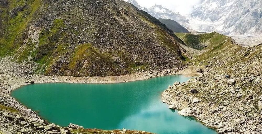
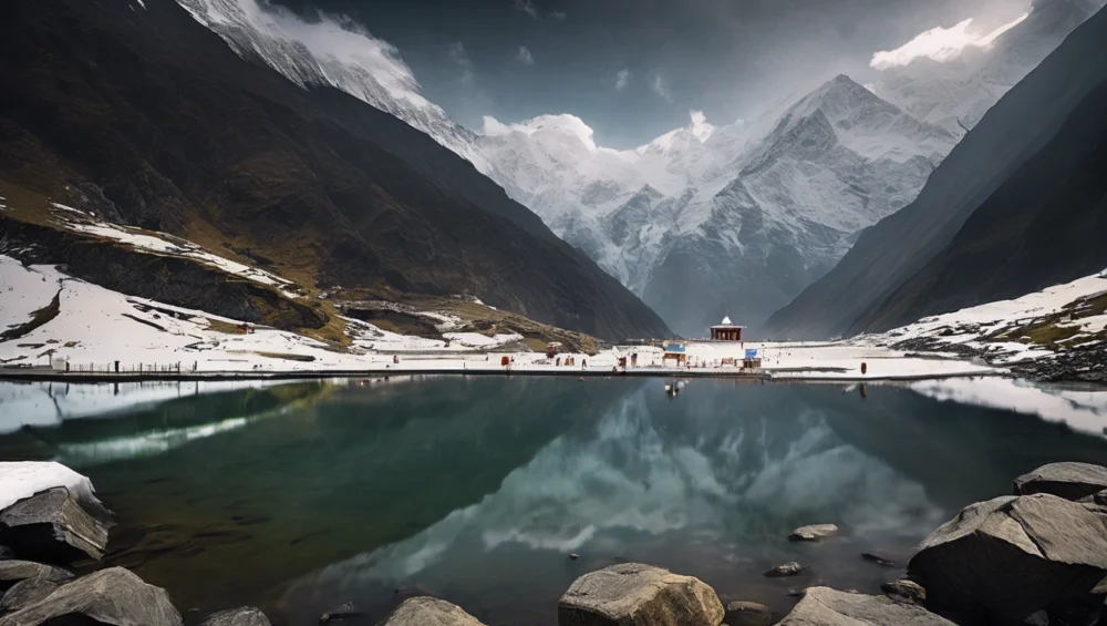
Satopanth Lake is a crystal-clear green water lake located in the Chamoli district of Uttarakhand. The trek to Satopanth Lake starts from the first Indian village Mana. This lake is situated at an elevation of 4600 meters above sea level and this beautiful lake is surrounded by snow-covered peaks.

Satopanth Tal is a high-altitude lake located in the Chamoli district of Uttarakhand, nearby Badrinath Dham. The approximate distance of the lake from Mana village is 7 km. Every year, hundreds of trekkers visit this lake, the trek is full of adventure and peace. For adventure lovers, photographers and nature lovers, Satopanth Trek and Lake is a dream destination.

Satopanth also has religious importance and it is one of the most popular treks in Uttarakhand. Satopanth glacier trek offers beautiful and majestic views of the great Himalayas.

Below are the Satopanth Lake trekking guide, trek updates and Satopanth travel tips.

It is believed that trimurtis(triple deity of divinity in Hinduism) Brahma, Vishnu and Meshwara meditated on the three corners of this holy lake.

Other facts tell us that at the end of Mahabharata, the mighty Pandavas started their journey to Swargarohini through the route of this route. The trek starts from Mana village, which is a border village nearby Badrinath.

In between the journey one by one, each Pandavas died and at Satopanth Bheema the middle brother among the Pandavas died at this holy place Satopanth.

The trek to Satopanth Lake is one of the beautiful trails in the Garhwal region of Uttarakhand. Once you cross Mana village after 3 Km you will reach Vasudhara Falls, then Sahastradhara which has more than 100 waterfalls can be spotted on the trail.

Further, you will reach Lakshami van forest and Chakratirtha meadow, which are the best locations in between the trek.

Satopanth trail Information

Satopanth tal trek journey can be completed in 4 days from Badrinath to Mana. The trail can be divided into:

Day 1:

Acclimatization day

Day 2:

Badrinath to Lakshami van via Mana village and Vasudhara falls

Day 3:

Lakshami van to Chakrateertha

Day 4:

Chakrateertha to Satopanth Lake and return

Day 5:

Chakrateertha to Badrinath back

So the journey from Badrinath to Satopanth and return is approx 4 days journey.

Best Season to visit Satopanth Tal Trek

If you want to do Satopanth trek then the best time to visit the trek is in May to mid-July and September to October.

In the month of mid-July, you get to see the beautiful green meadows, beautiful wildflowers and crystal clear Satopanth Tal.

If you are visiting Satopanth Tal after the monsoon season, you will see the aggressive form of the Alaknanda River and the graceful Vasudhara waterfalls joining the Alaknanda.

Hemkund Sahib Uttarakhand – How to Reach and Places to Visit

Hemkund Sahib Travel Guide

Shri Hemkund Sahib is an important pilgrimage destination site for Sikhs and Hindus. Hemkund Sahib is the breathtaking Lokpal Lake located at an altitude of 4329 meters above sea level. One can reach this beautiful lake through a challenging but very interesting and enjoyable trek from Ghangaria. The natural settings make this hilly region an amazing place for spending holidays.

Sikhs consider this site a sacred place where one of the famous Sikh Gurudwara is here in the heart of the region. A Hindu shrine dedicated to mythological the Lord Lakshamana is attractive for Hindu pilgrims. The temple is built on the beautiful banks of Hemkund lake.

Hemkund Sahib is nested amidst seven snow-covered peaks and marvelous snowy glaciers. The natural beauty is reflected here with all its mighty appearance in the crystal clear water of Hemkund Lake.  Hemkund lake is fed by the glaciers from the majestic peaks, which are Saptrishi peak and Hathi Parvat. A small stream which is known as Himganga originates from this imposing lake.

It is written in the holy Granth Sahib that the tenth Guru of Sikhs, Shri Guru Govind Singh meditated on the beautiful scenery banks of Hemkund in one of his earlier births. Guru Govind Singh is believed to be the Guru who founded all present characteristics of present Sikhism. The Gurudwara of Sikhs on the banks of Hemkund lake is located at the place where the Guru had meditated.

Hemkund has got mentions in Ramayana. It is believed that the younger brother of Lord Rama, Lakshmana, regained his health by meditating on the banks of Hemkund after the injuries he received from Megnath during the war. The Lakshamana temple is built at the place where Lakshmana meditated to regain his health.

Nearby Places to visit in Hemkund Sahib

Valley of flowers

Valley of flowers is a 4Km beautiful easy-grade trek from Ghangaria. The region of the Valley of flowers is rich in flora and fauna. The valley was declared a world heritage site and National park in the year 1982. The virgin beauty of this mystical valley has always lured botanists, trekkers, adventure lovers and photographers.

Ghangaria

Ghangaria is the last human habitation centre on the way to Hemkund Sahib and the Valley of flowers. It is a scenic hamlet perched at an altitude of 3,050 meters above sea level at a distance of 13 km from Govind Ghat and 4 Km before Valley of Flowers.

The trek becomes easy grade to moderate from this point if you travel towards Hemkund Sahib. The region is prone to heavy snowfall during winter, the region remains open only from May to October. A Gurudwara, GMVN rest house and a few more hotels provide accommodation facilities at Ghangaria.

How to reach Hemkund Sahib

Hemkund Sahib is well-connected to roads up to Govind Ghat, from here you have to commence a trek of 19 KMS to reach Hemkund Sahib. Govindghat is well-connected by roads with major travel destinations in Uttarakhand state. Buses to Haridwar, Rishikesh and Srinagar are available from Kashmiri Gate ISBT (Delhi). Shareable vehicles like Ertiga Mahindra Maxx and Buses to Govind Ghat are easily available from major stops of Uttarakhand like Rishikesh, Rudraprayag, Srinagar, Pauri, Ukimath, Karanprayag, Chamoli, etc. Govind Ghat is situated on the national highway NH-58 making it easy to reach the destination. Also you can reach Hemkund Sahib by Helicopter from Govindghat to Hemkund Sahib.

By Train

The nearest railway station is Rishikesh from Hemkund Sahib, but the roads are well-connected up to Govind ghat, from where you have to trek 19 KMS to reach Hemkund Sahib. Rishikesh railway station is situated at a distance of 273 Kms on NH-58. Rishikesh city, one of the well-developed cities of Uttarakhand state, is well-connected by railway networks with all the major destinations of India. Trains to Rishikesh are frequent. Govind ghat is well-connected by roads with Rishikesh. Sharable vehicles(Ertiga, Mahindra Maxx and Tata sumos) and buses are easily available from Rishikesh, Srinagar, Rudraprayag, Karanprayag, Chamoli and Joshimath.

By Flight

The nearest Airport to Hemkund Sahib is Jolly Grant Airport, Dehradun. Govindghat is situated at a distance of 292 kms from Jolly Grant Airport, Dehradun. Jolly Grant Airport is well-connected to Delhi flights. After that, you have to travel with vehicles like buses, shareable jeeps or personal vehicles to reach Hemkund.

Overview Hemkund Sahib
  • Temperature: -17 to 18 degrees Celcius(in winters) and 2 to 25(in summers)
  • Location: Chamoli, Uttarakhand
  • Famous for: Pilgrim
  • Languages are spoken in the region: Garhwali, Hindi
  • Altitude: 4200 meters
  • Pincode: 249401
  • STD code: 01372
  • Best time to visit: January to October

Activities to do in Kartik Swami – Travel Guide

Activities to do in Kartik Swami

As you all know that Kartikswami is famous for the Lord Kartikey temple but there is a lot more to do when you visit there. The following activities you can enjoy while traveling to Kartikswami.

Trekking: Kartikswami is 3 Km away from the road. We can reach easily thereby trekking the route in about an hour. There are reddish forests of Buransh all over the route, which makes the journey more beautiful. There are many scenes in between the trek to view the other far villages and the Himalayan Range.

Camping: In Kartikswami, there are many places for camping, you can enjoy camping with your family and friends. So come here once and spend some quality time in the lap of nature. The views of Chaukhamba PeakNeelkanth and Dronagiri Parvat(Peak) can be seen from Kartikswami.

Bird Watching: Kartikswami is a paradise for birdwatchers. As there are more than 150 plus bird species found here which includes Golden eagle, Steppe eagle, Black eagle, Bearded Vulture, Himalayan Snowcock and the Himalayan Monal is also seen here. There are many more species of birds found here.

Village Tourism: For village tourism, Kanakchauri is the base starting point of the Kartikswami trek, you can also enjoy it there.

Travel Tips Kartik Swami

  • The best time to visit or travel to Kartikswami is from the month of October to June. At that time the weather becomes awesome and you can enjoy the 360-degree view of snow-covered Himalayan Ranges during the months of October and November.
  • There are no many places to stay, you can stay in the Ashrams of the Kartikswami and the second option for stay is Kanakchauri Village where Mayadeep Holiday Home and 2 more residences. You can also stay in the nearest towns like Karanprayag where Krishna Palace and many more hotels are there.
  • If possible don’t miss the beautiful sunset from Kartikswami. It feels so good and peaceful.

Where to Stay in Kartik Swami

Kanakchauri is the only village near Kartikswami after the Ashrams where you can stay. Mayadeep Holiday Home is the newly build eco-lodge in Kanakchauri which is built from the bamboos. It provides Bamboo huts with all the needed facilities for the tourists who stay here. From here you can enjoy the view of Garhwal Village life and Culture.

If you stay in the Aashram, which is managed by the priests of Kartikswami, you have to carry the basic food items like flour, tea, rice, and some other items you want to carry along with you. You can also stay in the nearest town, which is Karanprayag and then Gauchar, but Karanprayag is less far from here, so we recommend staying in Karanprayag.

Famous Peaks and Mountains in Uttarakhand

Famous Peaks and Mountains in Uttarakhand

Uttarakhand, home to the majestic Himalayas. Uttarakhand has some of the highest mountains in the world. Nanda Devi, one of the highest mountains, has a height of 7,816 meters from the sea level.

It is the tallest mountain of India within the national border. Many Peaks of Uttarakhand are yet to be climbed and many are yet to be christened. These beautiful peaks and mountains of Uttarakhand offer a beautiful view to the tourists, climbers and mountaineers.

If you wants to get training in mountaineering, so you can learn from the Nehru Institute of Mountaineering, which is located in the Uttarkashi District of Uttarakhand. So you can get training from there. The training period will be of approximately 3 months.

Peaks and Mountains of Uttarakhand

Nanda Devi Peak

Situated in Chamoli district of Uttarakhand. Nanda Devi is the highest mountain peak in India(Kanchenjunga, which lies on the border of Nepal and India. It is the highest…

Abi Gramin Peak

It is also known as Lbi Gramin, a snow-covered mountain peak which is situated at a distance of 2 km northeast from the Kamet peak. It lies in the central Himalayas right at the point wherethe Zaskar range ends.

Arwa Crest Peak

Arwa crest peak is one of the 3 peaks that make the Arwa Group of the mountain. The other 2 mountains of this group are Arwa Spire and Arwa Tower.

Arwa Spires Peak

One of the challenging peaks in the Garhwal Himalayas of Uttarakhand. Arwa Spires are a series of stupendous rocky spires which offer very high demanding rock climbs.

Arwa Tower Peaks

Alwa tower, the name is given to this mountain peak by its structure. It is one of the 3 peaks that make the Alwa group of mountains. The other 2 mountains are Alwa Crest and Alwa Spire.

Avalanche Peak 1 and 2

The Avalanche peaks are the two mountain peaks situated up above the Arwa Valley to the north-west of Badrinath Dham in the Indian state of Uttarakhand.

Bamba Dhura Peak

It is situated on the north-west ridge over the end of Kalabaland Glacier in the eastern part, left of the Milam Glacier.

Bandarpunch 1 and 2

Located in Uttarkashi district of Uttarakhand. Bandarpunch is a major peak of Garhwal region of Himalayas. The meaning of peak is basically “Tail of monkey” or “Tail of Hanuman”.

Burphu Dhura Peak

It is a Himalayan mountain peak located in the Pithoragarh district of Uttarakhand state. It is situated at the end ridge of the Kalabaland glacier.

Changabang Peak

Changbang peak situated in the Chamoli district of Uttarakhand. Changabang is a part of a group of peaks that forms the north-east wall of the Nanda Devi sanctuary.

Changuch Peak

Located at the border of Pithoragarh district and Bageshwar district of Uttarakhand state. It is a Himalayan peak situated above the Pindari(Pindar) Glacier.

Chaudhara Peak

It is also situated in the Pithoragarh district. Chaudhara is a Himalayan mountain peak which is named after its four corners.

Chaukhamba Peaks 1,2,3 and 4

Lying at the head of the Gangotri Glacier. Chaukhamba is a mountain peak in the Gangotri Group of the Garhwal Himalayas of India in Uttarakhand state. Chandrashilla is the sub-peak of the Chaukhamba peak.

Chiring We Peak

Located in the eastern Kumaon region of the Pithoragarh district of Uttarakhand. Chiring we peak is a Himalayan mountain peak having an altitude of 6,559 meters.

Dunagiri Peak

It is considered that it is one of the highest peaks in Chamoli district of Uttarakhand. Dunagiri peak lies at the north-west corner of the “Sanctuary Wall”, a ring of peaks surrounding Nanda Devi and …

Gauri Parbat Peak

Situated in the Chamoli district of Uttarakhand state it is also spelt as Ghori Parbat. A mountain peak having an elevation of 6708 meters and having a height of 22, 000 feet.

Hardeol Peak

One of the major peaks of Kumaon Himalayas. Hardeol is the highest mountain peak on the northern side of the Nanda Devi.

Hathi Parbat Peak

Situated in Chamoli district of Uttarakhand. Hathi Parbat is also known as Elephant Peak a mountain having an elevation of 6,727 meters.

Kamet Peak

Located in the Chamoli district of Uttarakhand state. Kamet is the second largest mountain peak in the Garhwal region of Uttarakhand, after Nanda Devi peak.

Kedarnath Peak – Main & Dome

Located in the Uttarkashi district of Uttarakhand, India. Kedarnath(main) and its sub-peaks, Kedarnath Dome is a mountain Peak in the Gangotri group of peaks.

Kuchela Dhura Peak

Located in the Pithoragarh district of Uttarakhand state. Kunchela Dhura is a mountain peak situated on the right bank of the Lwa Glacier or the left bank of Shalang Glacier.

Meru Peak

Meru peak is a colossal mountain peak situated in the Uttarkashi district. It lies between Thalay Sagar & Shivling and has some highly challenging routes.

Nagalaphu Peak

Situated in the Pithoragarh district of Kumaon region of Uttarakhand, has an altitude of 6,410 meters above sea level. It is a part of the Himalayan mountain peaks.

Nanda Ghunti Peak

Located in Chamoli district of Uttarakhand state, Nanda Ghunti lies on the outer rim of Nanda Devi. Having an altitude of 6,309 meters.

Nanda Khat Peak

Situated in the Bageshwar district of Uttarakhand. Nanda Khat is a spectacular mountain peak, having an elevation of 6,611 meters. Nanda Khat peak is located left of the Pindari Glacier.

Nanda Kot Peak

Literally, mean Nanda’s Fortress. Nanda Kot is a mountain peak located in the Pithoragarh district of Uttarakhand state in the Kumaon Himalayas.

Nilkantha Peak

Located in the Chamoli district of Uttarakhand. Nilkanth Peak or Neelkanth Peak stands at an altitude of 6,596 meters above the Alaknanda Valley and the town of Badrinath Dham.

Om Parvat

Located in the Pithoragarh district of Kumaon region, having an altitude of 6,191 meters. It is saidto be a sacred peak or mountain by the Hindus.

Panchchuli Peaks

Located in the Pithoragarh district of Kumaon region. Panchchuli is a group of five majestic snow-covered mountain peaks having an altitude ranging from 6,334 meters to 6,904 meters.

Shivling Peak

Located in the Uttarkashi district, the majestic Shivling peak is called “Matterhorn of Himalayas” due to its resemblance to the famed Alpine peak in Swiss Alps.

Swargarohini Peak

Location – Uttarkashi district of Uttarakhand. Swargarohini is a mountain peak in the Bandarpunch range of Garhwal Himalayas. It contains four peaks…

Suitilla Peak – East and West

Suitilla is a mountain peak located in the Pithoragarh district of Uttarakhand. It is located up above the Kalabaland Peak, Sankalp and Yankchar glaciers.

Thalay Sagar Peak

Located in the Uttarkashi district, Thalay Sagar is a mountain peak that lies in the Garhwal Himalayas region. The main ridge of the peak lies south of the Gangotri Glacier.

Tirsuli and Tirsuli West Peaks

Location – Pithoragarh district(Uttarakhand). Tirsuli is a mountain peak having an altitude of 7,074 meters. The nearest peaks are Hardeol, Dunagiri and Changabang peaks.

Trisul Peak 1,2 and 3

Resembling Lord Shiva’s famed trident, Trishul(a group of three) Himalayan peaks in the Bageshwar district of Uttarakhand.

Uja Tirche Peak

Located in the Chamoli district, Uja Tirche is a peak having an elevation of 6,202 meters above sea level. It lies on the eastern flank of the Siruanch Glacier and flows in a northward direction from the north face of Tirsuli.

These were the famous mountains and peaks in Uttarakhand.

Binsar Travel Guide Uttarakhand

Binsar wildlife sanctuary is a national park in Almora district of the Kumaon region of Uttarakhand. Binsar offers one of the most beautiful scenic places in Kumaon. It is located at an elevation of 2420 meters. It offers majestic views of Himalayan peaks such as Chaukhamba, Nanda Kot, Panchachuki, Kedarnath and Nanda Devi. Binsar offers 300 Km of majestic and panoramic views of Himalayan peaks from Binsar Zero Point. Every day, hundreds of tourists visit Binsar zero point to enjoy the beautiful views of the great Himalayan ranges and famous peaks of Uttarakhand.

It is a compact hill town encircled by Binsar Wildlife Sanctuary, which is the habitat of some rare animal species. If you are an adventure lover, hiker, or camper then you are going to love this place. There is a lot to explore in Binsar wildlife sanctuary.

Binsar hills are commonly known as Jhani Dhar which offers amazing views of the nearby places like Almora and other Himalayan peaks and mountains. It is a perfect place for bird watching, jungle trekking, photography and camping.

Read our details guide on how to reach Binsar.

Binsar History

Binsar town was the summer capital of the Chand Dynasty, which ruled the Kumaon region from the 11th to 18th century A.D. There is an ancient Shiva temple which is very famous in Binsar known as Binsar Mahadev. This temple was built in the 16th century A.D. by Raja Kalyan Chand of the Chand dynasty.

It is also renowned as the location of a mythological war between the King of Binsar and Golu Devta. It is believed that Golu Devta was beheaded.

In the olden days, people came from far-flung villages via treks and paths they created by themselves to pay homage to Binsar Mahadev.

Mythology about Binsar

The name Binsar is derived from 2 words Bin and Sar which means without head. Some historians state that once there was a battle held between Golu Devta and the King of Binsar.

It is believed that Golu Devta was beheaded and his head fell at Kaparkahan and his trunk at Gairad Dana Golu.

Why visit Binsar

From beautiful hills, beautiful orchards, meadows and mesmerizing Himalayan peaks and mountains. Travelers can also visit Jageshwar Temple, which is one of the 12 Jyotirlingas located about 50 Km from Binsar town. You can see different species of birds here, it is a perfect place for bird watchers.

Binsar Wildlife Sanctuary

Binsar Wildlife Sanctuary was set up in the year 1988, the whole area is spread over 45.59 sq Km and it is rich in flora and fauna. Binsar Wildlife Sanctuary has been declared an Important Bird Area by BirdLife International. There are more than 200 species of birds in the sanctuary, including Blackbirds, Laughing Trush, Kalij Pheasant, Monal, Parakeets, Nuthatches and Forktail.

The dense forests of Binsar Wildlife Sanctuary are the home of 200 bird species and animals Barking deer, fox, musk deer, langur, porcupine, flying squirrel, chital, jungle cat, Himalayan bear, etc.

Binsar Wildlife Sanctuary Entry Ticket Price

The entry ticket price to Binsar Wildlife Sanctuary is Rs. 40 per person and Rs. 50 for cars and other vehicles. The ticket will be collected at the entry point of Binsar Sanctuary.

Staying in Binsar

Binsar is a hill station and if we compare Binsar with the other hill stations of Uttarakhand, it is a less popular and known tourist destination. So there are not so big and premium hotels and restaurants. For staying, there are a handful of accommodation options available at Binsar.

However, you can travel to Almora which is just 33 Km from Binsar where you can find a wide range of staying options.

Binsar Food Guide

There are no restaurants in Binsar you can get a few restaurants on the way to Binsar – Almora highway. You will get pahadi kumaoni food items at those resorts, and some offer Chinese food and Almora’s famous sweet Balmithai.

Binsar Travel Tips

  • Binsar can be visited any time of the year, the best time to visit Binsar is from April to June and from September to November
  • Avoid visiting Binsar during monsoon season, you can face road blockage and landslides, and the route becomes slippery.
  • If you want to witness the crystal clear Himalayan views and other peaks, then December and February months are best to visit Binsar.
  • If you travel during the peak season, then you could face problems finding accommodation and who loves crowds?

First Indian Village Mana Chamoli

Mana Village was formerly known as the last Indian village, but from May, Mana is now the first Village of India. Mana village is now the first village in the Chamoli district of Uttarakhand. It is one of the most beautiful border villages in India. Just 3 Km from the Mana Village, Badrinath Dham is located. Badrinath is one of the holy Cham Dham located in the Chamoli district of Uttarakhand.

This beautiful village is situated at an altitude of 3,200 meters above sea level, Mana is the first village on the Indian side of the Indo-Tibetan border. The village is surrounded by snow-clad Himalayan peaks and the river Saraswati and Alaknanda emerges nearby Mana village. It has historic importance and mythological stories from the Mahabharata era. Mana village is one of the popular tourist destinations nearby Badrinath Chamoli. If you are in Badrinath then you must visit this beautiful village. It is an ideal destination for village culture lovers, photographers and nature lovers. There is a 1st Indian tea shop at Mana Village and tourists take selfied at this shop. The village is developed to promote border tourism and in recent years the number of tourists is increasing day by day.

There are many other historic and famous locations nearby Mana Village you must visit. Some of the locations nearby Mana Village are discussed below in the article.

One of the most popular attractions in Mana is the Bheem Pul, which is a natural rock bridge over the Saraswati River. It is believed that Bheema, one of the Pandavas, lifted a massive rock to create a bridge over the river, and it is named after him. Visitors can also see the Ganesh Gufa, a cave where Lord Ganesha is believed to have written the epic Mahabharata as dictated by Veda Vyasa.

Another must-see attraction in Mana is the Vasudhara Falls, located about 5 km from the village. The waterfall cascades down from a height of 400 feet and is a popular trekking destination. The trek to the falls is quite challenging, but the views of the Himalayas and the surrounding landscape are worth the effort.

The village of Mana is also known for its unique culture and traditions. The locals speak a dialect of the Garhwali language and have their own set of customs and beliefs. Visitors can experience the local way of life by staying in homestays and interacting with the villagers.

In recent years, Mana Village has become a popular destination for trekkers and adventure enthusiasts. Govt. of Uttarakhand has developed this village keeping Village and Border tourism in mind, which is a good thing. The village is the starting point for several popular treks to the Himalayan peaks, and treks such as the Vasudhara trek. Vasudhara is just 3 Km away from Mana village.

Facts about Mana Village

In Hindu mythology, Mana village has a description and it is considered a holy place. It is believed that Pandavas passed through the Mana location during their journey to heaven. There is a famous stone bridge named Bheem Pul. After crossing the Bheem Pul there is a route to Vasudhara Falls, which is another best place to visit nearby Mana and Badrinath.

Mana is steeped in history and mythology, and there are many legends associated with this village. According to Hindu mythology, it is believed that the Pandavas of the Mahabharata epic passed through this village on their way to heaven. The village is also home to the revered Vyas Gufa, where the ancient sage Veda Vyasa is said to have composed the epic Mahabharata.

7 Places to visit in Mana Village

1 – Neelkanth Parvat

Neel Kanth Peak is one of the most beautiful peaks in Badrinath Dham, the height of Neelkanth Peak is 6,597 meters above sea level it is known as the “Queen of Garhwal”. The holy temple of Badri Narayan can be seen from this peak. Brahmkamal flowers can also be seen from here clearly. Neelkanth Peak is situated just above the Badrinath temple.

Neelkanth Parvat is also a sacred site for Hindus, as it is believed to be the abode of Lord Shiva. According to legends, Lord Shiva consumed poison during the churning of the ocean, which turned his throat blue, giving him the name Neelkanth. The peak is also home to several ancient temples and shrines that attract many devotees.

2 – Tapt Kund

Tupt Kund is a natural hot water spring in Badrinath Dham which is nearby Mana Village, and it is believed that the hot water comes directly from the feet of Lord Vishnu also named Shri Badri Narayana. If you are in Badrinath then you must dive into this holy Tapt Kund once. It is also believed that the Tapt Kund has medicinal value and it removes many skin diseases.

3 – Mata Murti Temple

This temple is also located near Badrinath Dham and this temple is devoted to the mother of Lord Narayana. According to legends and historians, Mata Murti requested Lord Vishnu to take birth to her son during the era. Lord Vishnu granted her this wish by taking birth in the form of twins Nar and Narayan.

4 – Vasudhara

Vasudhara is a waterfall that is approx 9 Km away from Badrinath temple and 6 Km from Mana village. It is believed that this holy place was the temporary stay point of Pandavas during their exile. The view of Vasudhara River valley gives panoramic views of the great Himalayas and other peaks and beautiful mountains.

5 – Vyas Gufa

Vyas Gufa is located just above the MANA village and it is believed that in ancient times Maharshi Ved Vyas lived here while they were composing the four Vedas. This holy cave is now converted into a temple and this cave is nearby the 1st tea shop in Mana village. There are 4 Vedas in the Hindu religion. The distinct feature of this cave is the roof of the Ved Vyas Gufa which resembles the pages from Ved Vyas’s collection of his Holy Books. There is a small temple in the cave dedicated to Maharshi Ved Vyas, and it is believed that the cave is 5000 years old.

6 – Ganesh Gufa

It is another holy place to visit in Mana Badrinath. At this holy place, Lord Ganesha dictated Mahabharata to Shri Ved Vyas. This cave is located nearby the confluence of the Saraswati and Alaknanda rivers nearby Mana village. It is believed that Lord Ganesha lived here in the ancient period of Mahabharata.

7 – Bheem Pul

Bheem Pul has a historic story, it is believed that this stone bridge was built by Bheem of Mahabharata. Basically, it is a very big piece of rock that was put by Bheem over the Saraswati River to cross the river during their yatra to heaven. It is said by historians that this rock was placed by Bheem to make the way for Draupadi to cross the river during their journey to heaven.

Conclusion

In conclusion, Mana is a hidden gem in Uttarakhand that should not be missed. With its stunning natural beauty, rich history and mythology, and unique culture, it is a destination that will leave a lasting impression on any traveler. So pack your bags and head to Mana for an unforgettable adventure!

Location of Mana Village

Mana Village has located 5 Km from Badrinath and is well-connected with the national Highway 7.

What is Mana Village famous for?

Mana village is famous for Bheem Pul, woolen garments, and materials. The woolen garments are mostly made of sheep wool, you can also buy mufflers, aashan, pankhis, shawls, caps, carpets, and other products from Mana village.

Why is Mana the last village in India?

Mana village is situated in the Chamoli district of Uttarakhand at an elevation of 3200 meters. Mana village lies on the holy riverbank of the Sarawati river and it is located 3 Km from Badrinath Dham. The Indo – Tibet Border(Tibet that was occupied by the People’s Republic of China in 1948), is just 24 Km from Mana village. That’s why it is the last village in India.

Can we go to Mana Village?

Mana Village can only be visited during summer and monsoon season, during winter the whole area gets covered with heavy snow. Mana village opens with the opening of Badrinath Yatra. The village is in a very remote location and experiences heavy snowfall during winter.

How far is China’s border from Mana village?

China border is just 24 Km from Mana village. But currently, tourists and others can visit only up to Mana village. But the Uttarakhand government is working on developing border tourism. Hope we will travel up to the Indo- China border in the near future under the border tourism scheme of govt.

Where is India’s last village?

Mana is the last Indian village which is located in the Chamoli district of Uttarakhand and it is situated at a height of 3118 meters above sea level.

Are there any restrictions for tourists in Mana Village?

Tourists are not allowed to venture beyond the village and into the restricted areas near the Indo-China border without prior permission from the authorities. It is important to respect these restrictions and follow the rules and regulations while visiting the village.

Can I buy souvenirs in Mana Village?

Yes, you can buy souvenirs such as handmade woolen clothes, shawls, and caps, as well as local handicrafts and artifacts in Mana Village. However, it is important to bargain and negotiate the prices before making a purchase.

What are the local customs and traditions of Mana Village?

Mana Village is predominantly a Hindu community, and the locals follow their traditional customs and practices. It is important to respect their religious beliefs and follow the local customs while visiting the village.

Is it safe to travel to Mana Village?

Yes, Mana Village is generally considered safe for tourists. However, it is important to follow basic safety precautions and be aware of the weather conditions and the local customs and traditions.

What are the accommodation options in Mana Village?

There are limited accommodation options in Mana Village, mainly consisting of guesthouses and homestays. It is advisable to book your accommodation in advance, especially during peak tourist season.

How do I get to Mana Village?

The nearest airport to Mana Village is Jolly Grant Airport in Dehradun, which is around 260 km away. From Dehradun, you can take a helicopter to Gauchar and then travel via road, which is the only option after that. The nearest railway station is in Rishikesh, which is about 240 km away. From there, you can take a taxi or bus to reach Mana Village.

What is the best time to visit Mana Village?

The best time to visit Mana Village is from April to June and from September to November when the weather is pleasant and the roads are accessible. However, the village remains cut off from the rest of the world during the winter months due to heavy snowfall.

What are the places to visit in Mana Village?

Mana Village is known for its natural beauty and religious significance. The village is home to the famous Vyas Gufa, which is believed to be the cave where Sage Vyas composed the Mahabharata. Other popular attractions include the Bhim Pul, Ganesh Gufa, and Vasundhara Waterfalls.