karnaprayag chamoli

Chamoli Garhwal Uttarakhand and Places to Visit

Chamoli Uttarakhand

Chamoli district is the pride of the Uttarakhand state with the major pilgrimage center of the country like Badrinath, Hemkund Sahib, and Joshimath, Snow is covered with Himalayan peaks and natural sceneries.

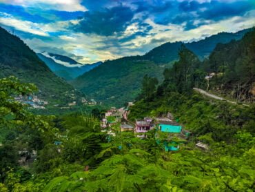
The Chamoli in Uttarakhand is said to be able to attract any visitor with its mystic charm and pristine natural beauty. The lush green hilly forests are a real paradise for trekking, mountain climbing, and hiking.

Little villages like Mana village and Niti village (the last Indian village) etc. scattered around the International border with Tibet and climatic cardinalities fulfill the journey with sweet and lovable memories.

Best Places to Visit in Chamoli

Badrinath

Badrinath, one of the Char Dhams of Uttarakhand, is an important pilgrim center of the country. It is flanked by the Nar and Narayan two mountains around, while the Neelkanth Peak forms a splendid backdrop.

Gopeshwar:

The picturesque town of Gopeshwar is famous for the Gopinath Temple, which is an ancient Shiva temple. The main attractions of Gopeshwar are Shiv temple, Vaitarni Kund(a group of temples without idols) and Oak View, Degree college, etc.

Hemkund Sahib

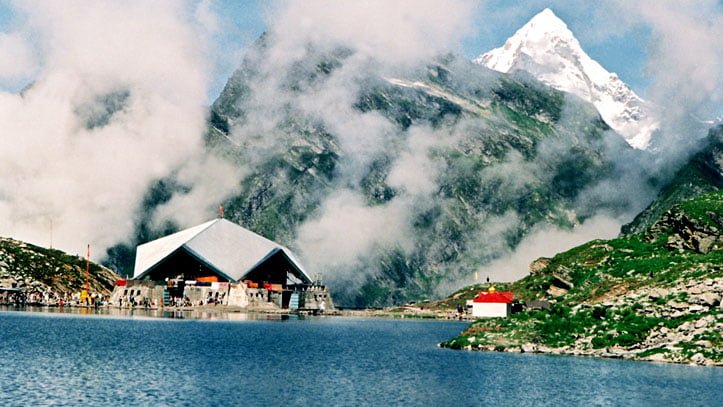
Snow Lake or the “Hemkund” are situated at a height of 4329 meters. There are seven snow-covered mountains which are collectively known as Hemkund Parvat.

Govind Ghat:

It is set on the junction of the Alaknanda River and Bhyundar or Lakshman Ganga. There is a big Gurudwara here. Govind Ghat is a small town located in the Chamoli district of Uttarakhand, India. It is situated at an elevation of 1,250 meters above sea level and is known for its religious and natural significance.

It’s best to visit Govind Ghat during the summer or spring months as the weather is pleasant, it’s easier to access the trekking routes, and also the best time to enjoy the scenic beauty and adventure sports. Bird and nature lovers are going to find this place as a heaven on earth.

Nanda Devi Raj Jat Yatra:

The internationally renowned festival is held after every 12 years and the celebration keeps on for 3 weeks. Nanda Devi Raj Jat Yatra is a 280 Km trek that starts from Nauti village(which lies in Karanprayag) to the peaks of Hemkund or Roopkund.

Nandaprayag:

It is the junction of the Alaknanda River and Mandakini, which is 21 Km far away from Karanprayag on the main road route to Badrinath. The Famous Gopalji temple is situated in Nandaprayag. The Fair is hosted here on the occasion of Baisakhi and Janmasthami.

The Panch Prayag:

“Panch Prayag ” or the 5 most sacred river junctions of the Garhwal Himalayas has religious importance. The five Prayags are Karanprayag, Nandaprayag, Vishnuprayag, Rudraprayag, and Devprayag, three of the prayags are situated in the Chamoli district.

Karnaprayag:

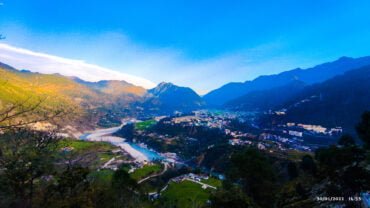
Karanprayag town is situated on the sacred junction of Alaknanda and Pindar Rivers (Pindari), a town named on behalf of Lord Karna of Mahabharat. The Karna Temple and Uma Devi Temple are located here. It is believed that Lord Surya(Sun) gifted Kavach, Kundal and Tuneer to Kartna at Karnaprayag. Karanprayag town has had its historic importance for centuries. There are some beautiful places to visit near Karanprayag you can visit like Nauti village, Simli town Benital, etc.

Auli

Famous for winter games and picnic spots, world-class winter games and skiing resort, which is 12 Km from Joshimath. The 4 km long ropeway is one of the longest ropeways in India and a 3 Km long slope ranging from a height of 2519 meters is a major attraction. There are many other locations to visit in Auli you can go to.

Joshimath:

The town lies in between the route of the sacred temple Badrinath and the base for trekkers to the famous Valley of Flowers.

Joshimath is a town located in the Chamoli district of Uttarakhand, India. It is situated at an elevation of 1,890 meters above sea level and is known for its religious and historical significance. Joshimath is the epicenter of some holy temples and knowledge from the ancient time

Best time to visit Chamoli

The best time to visit Chamoli is in winter (from November to February) to see the pure natural beauty of the mountains here when they get covered with snow. The places in Chamoli can be the perfect winter destinations for you and your loved ones.

The best time to visit Chamoli district in Uttarakhand, India depends on the activities you plan to do and the type of weather you prefer.

  1. Summer (April to June): This is the best time to visit if you want to avoid the colder weather and enjoy the natural beauty of the region. The weather is pleasant, and the snow melts, revealing a lush green landscape. This season also offers the best time to visit the temples and shrines in the district.
  2. Monsoon (July to September): This is the best time to visit if you want to see the region at its greenest, but be prepared for heavy rainfall.
  3. Winter (October to March): This is the best time to visit if you’re interested in skiing or other winter sports, as the snowfall in the region is at its heaviest during this time. However, keep in mind that the temperature can drop significantly during the night and the snow can block some of the roads.
  4. Spring (February to April): This is also a good time to visit as the weather is pleasant, the days are longer and the flowers are blooming, especially in the Valley of Flowers National Park.

Weather in the Chamoli district continuously changes in the rainy season from June to August. So you should check the weather and weather reports of Chamoli before planning a tour so that you don’t have to face any problems in between like roadblocks etc.

For what Chamoli is known?

Chamoli is a district in the Indian state of Uttarakhand, and it is known for several things:

  1. Adventure tourism: Chamoli is a popular destination for adventure tourism, with activities such as trekking, rock climbing, and river rafting.
  2. Natural beauty: The district is known for its natural beauty, including the Nanda Devi National Park, which is a UNESCO World Heritage Site, and the Valley of Flowers National Park, which is a popular destination for nature enthusiasts.
  3. Religious significance: Chamoli is also known for its religious significance, as it is home to several important Hindu temples and shrines, including the Badrinath Temple, Adibadri, Gopinath temple, Mata Anusuiya Devi temple, and many others, which are one of the most sacred shrines of Hinduism.
  4. Trekking: Chamoli district is also famous for trekking routes that take trekkers through the most picturesque landscapes of the Indian Himalayas. The most famous of them is the Valley of Flowers trek.
  5. Hydroelectric projects: The district is also home to several hydroelectric projects, including the Tehri Dam, which is the highest dam in India and one of the largest hydroelectric projects in the world.
  6. Skiing: Chamoli district is also a popular destination for skiing in India, specially Auli known as the Ski capital of India.
  7. The skiing season in Chamoli district, especially in the ski destination of Auli, typically begins in December and lasts until the end of March. This can vary slightly depending on the snowfall and weather conditions. The best time to go skiing in Auli is from January to February when the snow is at its best and the weather is the most favorable.

How to Reach Chamoli?

By Road:

Chamoli district is well-connected to all the road routes, with important cities and towns of Uttarakhand, like Delhi, Uttar – Pradesh, and Punjab State.

By Train:

The nearest railway station is located at Rishikesh(202 Km), Haridwar is another station near Rishikesh.

By Air:

The nearest airport to Chamoli is Gauchar Airport and then Jolly Grant Airport in Dehradun(221 Km), Public transport and private cabs are available from Airport to Chamoli. To avail of the heli services from Dehradun to Gauchar you have to book online at Pawan Hans official website.

Stats of Chamoli District

  • District Headquarters: Gopeshwar, Chamoli
  • The population of Chamoli district: 3,91,114
  • Languages spoken in Chamoli: Garhwali, Hindi, Kumaoni
  • Best season to visit Chamoli: Throughout the year (we will recommend visiting Chamoli in Winters to see the pure beauty of mountains here when they get snow-covered)
  • Literacy rate: 76.25%
  • Area: 7951 sq Km
  • Altitude: 1300 meters

Almora Travel Guide – Places to Visit, How to Reach

Almora

Almora district is situated in the hilly terrain of the Himalayas in the state of Uttarakhand. Almora is famous for its unforgettable natural beauty, biodiversity, historically rich monuments, delectable cuisine and handcrafts. Insider says that this picturesque place, Almora boasts the pride of being the workplace of many legends like Swami Vikekanand and the great poet Sumitranandan Pant.

History pages show that Almora was the capital of the Chand Dynasty in the olden days. This region was earlier under the reign of Katyuri king Baichaldeo, who donated this whole area to a Gujarati Brahmin Shri Chand Tiwari. In 1560 the capital of the Chand Dynasty was shifted to the Almora district (from Champawat) by the king Kalyan Chand.

This town offers beautiful views of the snowy summits of the Himalayas and it is an excellent place to enjoy a peaceful holiday. Various pilgrimage sites, ancient bazaars, an international woollen market, little quaint resorts in nearby regions and green forest peaks(perfect for adventures like trekking, mountain climbing etc) add an extra taste of happiness to the travellers’ faces.

8 Best places to visit in Almora

Here is a list of some famous locations in Almora that you should visit when planning to go there. Of all the below locations, Golu Devta temple is the most famous place to visit in Almora and you should visit there once.

1 – Chitai Golu Devta Temple:

10Km away from the main city of Almora, Chitai temple is specially dedicated to Golu Devta which is a very famous temple in the Kumaon region. An avatar of Lord Shiva, he is reputed to fulfilment of an individual’s wish if he/she prayed with a clear conscience.

2 – Nanda Devi Temple:

It is a historic temple which is placed in the centre of the town of Almora.

3 – Goddess Nanda Devi.

The fantastic feature of Nanda Devi temple is the image carved on the walls of the temple. Nanda Devi festival is held every year in the month of September.

4 – Lal Bazaar:

Almora ko Lal Bazaar. Almora is a shopper delight district like Nainital which offers a wide variety of options to buy including woollen garments, decorative items, metal utensils and Local crafts.

5 – Someshwar:

Located 35Km away from the main Almora city. Someshwar is famous for its ancient Lord Shiva Temple. This temple was constructed by Raja Som Chand from the Chand Dynasty so the name of the temple was named Someshwar after that.

6 – Deer Park Almora:

Deer park is located at a distance of 3Km outside the city. A good choice for evening walks and spending time with nature.

7 – Jageshwar:

Famous for Shiv Temple with amazing architecture style within dense forests. The temple complex has 124 shrines and hundreds of statues with outstanding craftsmanship on them.

8 – Bright End Corner:

This place located 2Km away from the main Almora city, is famous for the pleasant scenes of Sunrise and Sunset. Swami Vivekanand Memorial and Vivekanand Library is also situated there.

How to reach Almora

  • By Road: Almora district is well-connected with the other parts of the country via road route.
  • By Train: The nearest railway station is Kathgodam, which is at a distance of 90 Km from the main Almora. Public and private transport vehicles are available at Kathgodam Railway Station.
  • By Air: The nearest Airport to Almora city is Pant Nagar in Nainital, which is 127 Km away.

Stats of Almora District

  • District Headquarter: Almora
  • Languages spoken in Almora: Kumaoni, Garhwali and Hindi
  • Best season/time to visit Almora: April – June, September – November
  • Population of Almora: 6,21,972
  • Literacy Rate: 74.53%
  • Latitude: 29 degree 36′ North
  • Longitude: 79 degree 30′ East
  • Area: 3090 sq Km
  • Altitude: 1651 mtr

Famous Peaks and Mountains in Uttarakhand

Highest Mountains and Peaks in Uttarakhand

Uttarakhand, home to the majestic Himalayas. Uttarakhand has some of the highest mountains in the world. Nanda Devi one of the highest mountains has a height of 7,816 meters from the sea level.

It is the tallest mountain of India within the national border. Many Peaks of Uttarakhand are yet to be climbed and many are yet to be christened. These beautiful peaks and mountains of Uttarakhand offer a beautiful view to the tourists, climbers and mountaineers.

If you wants to get training of mountaineering so you can learn from the Nehru Institute of Mountaineering which is located in the Uttarkashi District of Uttarakhand. So you can get training from there. The training period will be of approximately 3 months.

Peaks and Mountains of Uttarakhand

Nanda Devi Peak

Situated in Chamoli district of Uttarakhand. Nanda Devi is the highest mountain peak in India(Kanchenjunga that lies on the border of Nepal and India). It is the highest…

Abi Gramin Peak

It is also known as Lbi Gramin is a snow-covered mountain peak which is situated at a distance of 2Km northeast from the Kamet peak. It lies in the central Himalayas right at the point where Zaskar range ends.

Arwa Crest Peak

Arwa crest peak is one of the 3 peaks that makes the Arwa Group of the mountain. The other 2 mountains of this group are Arwa Spire and Arwa Tower.

Arwa Spires Peak

One of the challenging peaks in the Garhwal Himalayas of Uttarakhand. Arwa Spires peaks are a series of stupendous rocky spires which offers very high demanding rock climbs.

Arwa Tower Peaks

Alwa tower the name is given to this mountain peak by its structure. It is one of the 3 peaks that makes the Alwa group of mountains. The other 2 mountains are Alwa Crest and Alwa Spire.

Avalanche Peak 1 and 2

The Avalanche peaks are the two mountain peaks situated up above the Arwa Valley to the north-west of Badrinath Dham in the Indian state of Uttarakhand.

Bamba Dhura Peak

It is situated on the north-west ridge over the end of Kalabaland Glacier in the eastern part, left of the Milam Glacier.

Bandarpunch 1 and 2

Located in Uttarkashi district of Uttarakhand. Bandarpunch is a major peak of Garhwal region of Himalayas. The meaning of peak is basically “Tail of monkey” or “Tail of Hanuman”.

Burphu Dhura Peak

It is a Himalayan mountain peak located in the Pithoragarh district of Uttarakhand state. It is situated at the end ridge of the Kalabaland glacier.

Changabang Peak

Changbang peak situated in the Chamoli district of Uttarakhand. Changabang is a part of a group of peaks that forms the north-east wall of the Nanda Devi sanctuary.

Changuch Peak

Located at the border of Pithoragarh district and Bageshwar of Uttarakhand state. It is a Himalayan peak situated above the Pindari(Pindar) Glacier.

Chaudhara Peak

It is also situated in the Pithoragarh district. Chaudhara is a Himalayan mountain peak which is named by his four corners.

Chaukhamba Peaks 1,2,3 and 4

Lying at the head of the Gangotri Glacier. Chaukhamba is a mountain peak in the Gangotri Group of the Garhwal Himalayas of India in Uttarakhand state. Chandrashilla is the sub-peak of the Chaukhamba peak.

Chiring We Peak

Located in the eastern Kumaon region of the Pithoragarh district of Uttarakhand. Chiring we peak is a Himalayan mountain peak having an altitude of 6,559 meters.

Dunagiri Peak

It is considered that it is one of the highest peaks in Chamoli district of Uttarakhand. Dunagiri peak lies at the north-west corner of the “Sanctuary Wall” a ring of peaks surrounding Nanda Devi and …

Gauri Parbat Peak

Situated in the Chamoli district of Uttarakhand state it is also spelt as Ghori Parbat. A mountain peak having an elevation of 6708 meters and having a height of 22, 000 feet.

Hardeol Peak

One of the major peaks of Kumaon Himalayas. Hardeol is the highest mountain peak on the northern side of the Nanda Devi.

Hathi Parbat Peak

Situated in Chamoli district of Uttarakhand. Hathi Parbat is also knew as Elephant Peak a mountain having an elevation of 6,727 meters.

Kamet Peak

Located in the Chamoli district of Uttarakhand state. Kamet is the second largest mountain peak in the Garhwal region of Uttarakhand, after Nanda Devi peak.

Kedarnath Peak – Main & Dome

Located in the Uttarkashi district of Uttarakhand of India. Kedarnath(main) and its sub-peaks Kedarnath Dome is a mountain Peak in the Gangotri group of peaks.

Kuchela Dhura Peak

Located in the Pithoragarh district of Uttarakhand state. Kunchela Dhura is a mountain peak situated on the right bank of the Lwa Glacier or the left bank of Shalang Glacier.

Meru Peak

Meru peak is a colossal mountain peak situated in the Uttarkashi district. It lies between Thalay Sagar & Shivling and has some highly challenging routes.

Nagalaphu Peak

Situated in the Pithoragarh district of Kumaon region of Uttarakhand, has an altitude of 6,410 meters above sea level. It is a part of Himalayan mountain peaks.

Nanda Ghunti Peak

Located in Chamoli district of Uttarakhand state, Nanda Ghunti lies on the outer rim of Nanda Devi. Having an altitude of 6,309 meters.

Nanda Khat Peak

Situated in the Bageshwar district of Uttarakhand. Nanda Khat is a spectacular mountain peak, having an elevation of 6,611 meters. Nanda Khat peak is located left of the Pindari Glacier.

Nanda Kot Peak

Literally, mean Nanda’s Fortress. Nanda Kot is a mountain peak located in the Pithoragarh district of Uttarakhand state in the Kumaon Himalayas.

Nilkantha Peak

Located in the Chamoli district of Uttarakhand. Nilkanth Peak or Neelkanth Peak stands at an altitude of 6,596 meters above the Alaknanda Valley and the town of Badrinath Dham.

Om Parvat

Located in the Pithoragarh district of Kumaon region having an altitude of 6,191 meters. It is said sacred peak or mountain by the Hindus.

Panchchuli Peaks

Located in the Pithoragarh district of Kumaon region. Panchchuli is a group of five majestic snow-covered mountain peaks having an altitude ranging from 6,334 meters to 6,904 meters.

Shivling Peak

Located in the Utt district, the majestic Shivling peak is called “Matterhorn of Himalayas” due to its resemblance to the famed Alpine peak in Swiss Alps.

Swargarohini Peak

Location – Uttarkashi district of Uttarakhand. Swargarohini is a mountain peak in the Bandarpunch range of Garhwal Himalayas. It contains four peaks…

Suitilla Peak – East and West

Suitilla is a mountain peak located in the Pithoragarh district of Uttarakhand. It is located up above the Kalabaland Peak, Sankalp and Yankchar glaciers.

Thalay Sagar Peak

Located in the Uttarkashi district, Thalay Sagar is a mountain peak that lies in the Garhwal Himalayas region. The main ridge of the peak lies south of the Gangotri Glacier.

Tirsuli and Tirsuli West Peaks

Location – Pithoragarh district(Uttarakhand). Tirsuli is a mountain peak having an altitude of 7,074 meters. The nearest peaks are Hardeol, Dunagiri and Changabang peaks.

Trisul Peak 1,2 and 3

Resembling Lord Shiva’s famed trident, Trishul(a group of three) Himalayan peaks in the Bageshwar district of Uttarakhand.

Uja Tirche Peak

Located in the Chamoli district, Uja Tirche is a peak having an elevation of 6,202 meters above sea level. Lies on the eastern flank of the Siruanch Glacier which flows in northwards direction from the north face of Tirsuli.

These were the famous mountains and peaks in Uttarakhand.

Activities to do in Kartik Swami – Travel Guide

Activities to do in Kartik Swami

As you all know that Kartikswami is famous for the Lord Kartikey temple but there is a lot more to do when you visit there. The following activities you can enjoy while traveling to Kartikswami.

Trekking: Kartikswami is 3 Km far away from the road. We can reach easily thereby trekking the route in about an hour. There are reddish forests of Buransh all over the route, which makes the journey more beautiful. There are many scenes in between the trek to view the other far villages and the Himalayan Range.

trekking in kartikswami


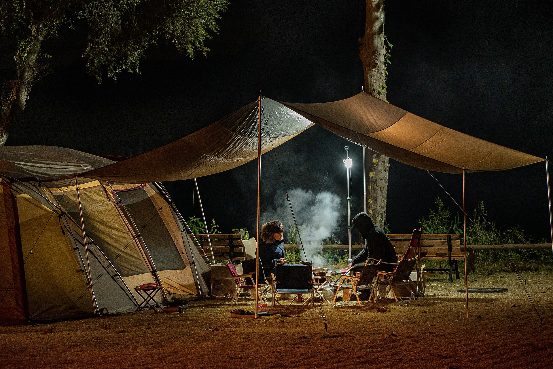
Camping: In Kartikswami there are many places for camping, you can enjoy camping with your family and friends. So come here once and spend some quality time in the lap of nature. The views of Chaukhamba Peak, Neelkanth and Dronagiri Parvat(Peak) can be seen from Kartikswami.

camping in kartikswami


Bird Watching: Kartikswami is a paradise for birdwatchers. As there are more than 150 plus bird species found here which includes Golden eagle, Steppe eagle, Black eagle, Bearded Vulture, Himalayan Snowcock and the Himalayan Monal is also seen here. There are many more species of birds found here.

Village Tourism: For village tourism, Kanakchauri is the base starting point of the Kartikswami trek you can also enjoy there.


Travel Tips Kartik Swami

  • The best time to visit or travel to Kartikswami is from the month of October to June. At that time the weather becomes awesome and you can enjoy the 360-degree view of snow-covered Himalayan Ranges during the months of October and November.

  • There are no many places to stay, you can stay in the Ashrams of the Kartikswami and the second option for stay is Kanakchauri Village where Mayadeep Holiday Home and 2 more residences. You can also stay in the nearest towns like Karanprayag where Krishna Palace and many more hotels are there.

  • If possible don’t miss the beautiful sunset from Kartikswami. It feels so good and peaceful.

Where to Stay in Kartik Swami

Kanakchauri is the only village near Kartikswami after the Ashrams where you can stay. Mayadeep Holiday Home is the newly build eco-lodge in Kanakchauri which is built from the bamboos. It provides Bamboo huts with all the needed facilities for the tourists who stay here. From here you can enjoy the view of Garhwal Village life and Culture.

If you stay in the Aashram which is managed by the priests of Kartikswami, you have to carry the basic food items like flour, tea, rice, and some other you want to carry along with you. You can also stay in the nearest town which is Karanprayag and then Gauchar but Karanprayag is less far from here so we recommend staying in Karanprayag.

Dams of Uttarakhand – Hydroelectric Projects in Uttarakhand

Hydroelectric Dams in Uttarakhand

Uttarakhand is a self-reliant state which generates great hydroelectric power. There are many big dams which generate a lot of electrical energy. There are many Dams in Uttarakhand which generate a huge amount of electrical energy which is supplied all over the state and also in the other states. The water from natural sources like glaciers and rainwater is collected in the dams.

These dams then act as large water storage sources which are used for harvesting energy. The power from these hydroelectric dams is used to generate power which is used for irrigation, factory or industrial use etc. Uttarakhand not only supplies electricity in the entire state, but also serves other states. Uttarakhand is one of the largest Hydroelectric energy generator states in India, having the largest dam, which is Tehri Dam in Tehri District.

List of Dams in Uttarakhand State

Tehri Dam

One of the tallest dams in India is the remarkable Tehri Dam or Tehri dam reservoir. Tehri Dam is the largest dam of Uttarakhand which provides electricity to the different districts of Uttarakhand as well as the electricity is also supplied to Uttar Pradesh state of India.

Srinagar Hydro Electric Project

The Srinagar hydro electric project dam is built on Alaknanda River. It is situated at Srinagar which lies in Pauri Garhwal district of Uttarakhand.

Tumaria Dam

The dam has a height of 15.9 meters and a length of 10,000 meters which is built on the Phika river.

Ramganga Dam(Kalagarh Dam)

Ramganga Dam is also known as Kalagarh Dam is an earth and rockfill embankment dam built on Ramganga river about 3Km upstream of Kalagarh in Pauri Garhwal district.

Nanak Sagar Dam

Nanak Sagar Dam is situated in Udham Singh Nagar of Uttarakhand state. It has a height of 16.5 meters and a length of 19,200 meters.

Koteshwar Dam

It is built on the Bhagirathi river in Tehri Garhwal of Uttarakhand. It is a run of the river type Dam which has a height(tall) of 97.5 meters and a length of 300.5 meters.

Maneri Dam – Maneri Bhali Hydroelectric Project

It is a concrete gravity dam built on the Bhagirathi river located at Maneri which is about 8.5 Km east of Uttarkashi district in Uttarakhand. It is also a run of the river type dam.

Lchari Dam

The Lchari Dam is also a concrete gravity dam which is built on the Tons river located about 13 Km north of Dakpathar in Dehradun District.

Haripura Dam

An earthen embankment dam built on the Bhakra river in Udham Singh Nagar(a Kumaon district) of Uttarakhand. River Ganga is the basin of the Haripura Dam.

Dhora Dam

The Dhora Dam is situaed in Udham Singh Nagar of Uttarakhand state. This type of dam was built on the Kichha river. The basin area of this dam is Ganga river.

Bhimtal Dam

The Bhimtal Dam is situated 20 Km away downhill from Nainital district, located near an ancient 17th century old temple.

Dhauliganga Dam

It is a concrete face and earth fill embankment dam which is built on Dhauliganga river near Dharchula in Pithoragarh district of Uttarakhand.

Baur Dam

The Baur Dam is situated in Bajpur of Udham Singh Nagar district of Uttarakhand. It is a TE type Dam which has a height of 17.9 meters and a length of 9500 meters.

Baigul Dam

The astounding Baigul Dam is located in Udham Singh Nagar of Uttarakhand state. The dam is built on Baigul river and Sukhli river and the basin of the dam is Ganga river.

Popular Glaciers of Uttarakhand

Famous Glaciers in Uttarakhand

Uttarakhand lies in the lap of Himalaya and has a vivid topography. Including the arduous terrains, the lush green meadows to the gigantic glaciers, every little drop of natural beauty is a sight to behold.

The mighty glaciers of Uttarakhand serve an important role in providing fresh sweet water to the state. These glaciers are also the source of some important river bodies in India. The snow-covered glaciers of “Dev Bhoomi” in Uttarakhand not only feed the perennial rivers, but they are also a popular tourist attraction.

The adventure enthusiasts hikes on the summits of the glaciers of Uttarakhand, which offers a surreal view of the enchanting lands. While some of these glaciers are considered holy and some of them are admired for their magnificence.

Here is the list of some popular glaciers of Uttarakhand

Glaciers in Garhwal

  • Bandarpunch Glacier
  • Chorabari Bamak Glacier
  • Dokriani Glacier
  • Doonagiri Glacier
  • Nanda Devi Group of Glaciers
  • Tipra Bamak Glacier
  • Gangotri Glacier
  • Khatling Glacier
  • Satopanth glacier and Bhagirathi – Khark Glacier

Glaciers in Kumaon

  • Milam Glacier
  • Maiktoli Glacier
  • Namik Glacier
  • Ralam Glacier
  • Pindari Glacier
  • Kaphini Glacier
  • Sunderdhunga Glacier

Rivers in Uttarakhand – Tributes of Ganga and other Rivers

Rivers of Uttarakhand

“Uttarakhand” is a state which is known for its hundreds and thousands of small and big rivers, sacred temples, and holy places, situated on the banks of the holy rivers. Some rivers have relevance in Hindu mythology and these rivers have religious significance in India. The Source of these rivers is the glaciers of the Himalayas (western Himalayas) situated within India, Nepal, and Tibet borders. These rivers play a very important role in economical, social, cultural, and environmental issues in India.

The important dams in Uttarakhand on these rivers are providing electricity to thousands of homes in India. These rivers are the backbone of the Indian economy because of their huge usage in farming, drinking water, fishing, trading, electricity, etc. In some parts of Uttarakhand rivers like Tons, Ganga (rafting in Rishikesh), Yamuna and Kali are very famous for a wide variety of water sports. These rivers are clean and less polluted till they enter the plains (Tarai region).

Some Major Rivers of Uttarakhand

Alaknanda River

The River Alaknanda flowing in Uttarakhand is one of the two headstreams of the holy river Ganga. The origin or source of the Alaknanda River is in the Badrinath region.

Ganga River

The holy River Ganga also referred to as the Ganges emerges from Devprayag and exists at…

Gaula River

River Gaula is a Himalayan river which flows in India. The origin or source of the river is Paharpani and the destination point is Kichchha. The length of the river is approx 103 Km. The River Gaula emerges from …

Dhauli Ganga River – Kumaon

It is situated in the Kumaon division of Uttarakhand. The River Dhauli Ganga originates from Govan Khana Himani and exists at Tawadhar.

Dhauli Ganga River – Garhwal

Dhauli Ganga also known as River Dhauli is one of the six source streams of the holy river Ganga.

Bhagirathi River

River Bhagirathi is a Himalayan river which flows in Uttarakhand state. It is one of the two headstreams of the…

Bhilangana River

River Bhilangana in Uttarakhand, India is a major tributary of the Bhagirathi river…

Gori Ganga River

Gori Ganga ruver also known as Ghori Ganga and Gori Gad is a river in Munsyari tehsil…

Kali River

Kali River also known as “Sharda River” and “Kali Ganga” or “Mahakali River” is also a Himalayan river which flows in Uttarakhand.

Kosi River

Kosi River is also a Himalayan river which originates from Dharpani Dhar in the Baramandal region of the Almora district in Kumaon mandal…

Mandakini River

River Mandakini emerges from Chorabari glacier near Kedarnath temple.

Nandakini River

River Nandakini is one of the five tributaries of the holy Ganga River. The holy river originated from Nanda Ghunghati and exists in…

Nayar River – Eastern

Nayar River is a tributary of the holy River Ganga, it originates from the Dudhatoli ranges of Garhwal.

Nayar River – Western

Like as eastern Nayar river, the western Nayar River also originates from the Dudhatoli ranges of the Garhwal region.

Pinder River

Pinder river also known as the Pindari river is also a Himalayan river which emerges from the Pindari Glacier and meets with Alaknanda river at Karnaprayag Sangam.

Ramganga River – Eastern

Ramganga is a tributary of the river Ganges, originating in Uttarakhand state, India.

Ramganga River – Western

Ramganga(west) river emerges from Dudhatoli ranges of Pauri district of Uttarakhand. The length of the river is approx 155 Km, read more.

Saryu River

Saryu or Sarju is a Himalayan river which flows in the Kumaon region of Uttarakhand. The source of Saryu River is Sarmool and the destination point is Pancheshwar.

Tons River

Tons river is a major Himalayan river which flows through Garhwal division of Uttarakhand and touches Himanchal Pradesh state.

Yamuna River

The River Yamuna is a sacred river of India according to Hindu mythology. It is also known as Jamuna river which originates from Yamunotri Glacier.

Frequently Asked Questions About Rivers In Uttarakhand

Which is the longest river in Uttarakhand?

The Alaknanda river is the longest river in Uttarakhand, which is also the major source of river Ganges.

Which dams are situated in Uttarakhand?

The Haripura dam, Srinagar Hydroelectric project and Tehri Dam are situated in Uttarakhand which is an earthen embankment built on the Bhakra river in Udham Singh Nagar, Alaknanda River and on Bhagirathi river.

In which state Ramganga river is situated?

The Ramganga is situated in Uttarakhand, which originates from Doodhatoli ranges in the district of Pauri Garhwal.

gauchar

Gauchar – Valley of Flat Lands

Gauchar Chamoli

Gauchar is a small town located in Chamoli district on the riverbank of the Alaknanda River, which is about 800 fairs above sea level. Gauchar is famous for its flat land and historic trade fair, which is also known as Gauchar Mela. Gauchar is surrounded by mountains all around it. Basically, Gauchar is a beautiful valley of flatlands. Gauchar is located in the Chamoli district of Karanprayag Tehsil of Uttarakhand. Gauchar town is located on the left riverbank of the Alaknanda River.

Gauchar lies on NH 7 (which was formerly known as NH 58) and it serves as the halt for the tourists on the way to Badrinath Temple, Auli, Hemkund Sahib, and many other tourist places. Gauchar Airport played a big role at the time of the Kedarnath Flood in 2013 many people’s lives were saved through the rescue operation.

You can reach Gauchar from Dehradun via Helicopter also

Culture of Gauchar and Importance of Gauchar

Gauchar Mela Ground is very famous in the Garhwal region, where the Gauchar Fair(Mela) starts in the month of November. Gauchar Mela is one of the largest fairs in Garhwal and Uttarakhand. Gauchar Mela has been hosted for many years. In 1943, it got the largest trade fair of the Garhwal and Uttarakhand, which was hosted first by the Bhotias of Chamoli District of Uttarakhand. Bhotias mainly live in the Mana Village, which is 3 Km from the Badrinath Temple. 70 Km far from the Mana Village, China Border is situated there.

About Gauchar Mela

Gauchar Mela(Fair) is held every year in the month of November, which starts on 14 November and lasts for 7 days. Gauchar Mela is a great attraction for traders, the local peoples of Gauchar, and the peoples of Garhwal. Cultural programs are also taken there until the 6 nights of the Fair. Garhwali and Kumaoni singers and actors come there and entertain the people with their performances. Local dances and songs are also performed by the students of different Schools.

Activities to do in Gauchar

There are not many more places to visit in Gauchar, only you can visit Gauchar Airport, Gauchar Mela Ground, Riverbank of Gauchar near Bhatnagar Village. Like Nainital or Mussoorie which are the tourist hubs of Uttarakhand. Gauchar is basically a hilly town covered with mountains all around it.

Gauchar is a small town near Alaknanda River lies between Badrinath Route NH 7. 

Places to Visit in Gauchar: There are some famous temples in Gauchar like Kalinka Devi, Rawal Devta, Panneshwar Mahadev temple in Panai village of Gauchar, and Gauchar Airport.

For what Gauchar is famous for?

Gauchar, a valley town, is so famous for the historical Gauchar Mela which is held in the month of November (14 to 20) every year and also for the Gauchar airport.

Places to visit near Gauchar

  • Bhattnagar Village
  • Sidoli Road
  • Duwa Kanda Road
  • Sari Village
  • Rano Village
  • Haryali Devi temple
  • Karnaprayag

and many other few locations are there to visit in Gauchar.

Nature Visits

Gauchar is surrounded by green forests and hills and small rivers known as Gadhera in the local Garhwali language.

Shopping Area

There are many shops and stores in Gauchar. Wine shops, fashion stores, shoe stores and grocery stores have all the necessary things available there.

Accommodation in Gauchar Chamoli

Gauchar is a small town in the Chamoli district of Uttarakhand. As a result, there are many options for staying here like GMVN Lodge near Gref Chok Gauchar which is a 1-star hotel and restaurant. There are other restaurants and hotels like Hotel Taj Palace near the New bus stand Gaucher, Wooden Umbrella Restaurant Gauchar, Hotel Arjuna and Restaurant, Hotel Sahara (Sahara Lodge), Hotel Mohini, Kolonel Cottages, etc are the best options for staying in Gauchar.

Food Guide for Gauchar

Being a small town, there are not many big restaurants for luxury food items, but there are some hotels where you can enjoy Chinese and Indian foods at budget prices. Some popular restaurants in Gaucher are Kanak Restaurant, Om Ji, Hunger point gauchar, Prem Chowmein Center, etc.

How to reach Gauchar

Via road – Gauchar town lies on NH58 buses, taxis are available from Rishikesh directly.

Via Air – You can reach Gauchar via helicopter from Dehradun directly. Read the complete guide and information about the route, ticket pricing, and schedule.

haridwar uttarakhand

Haridwar Uttarakhand – Places to Visit and Things to Do

Haridwar – Dharmnagri Gateway to the Land of Gods

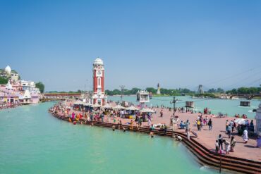
As you enter the Dharmnagri Haridwar you will be welcomed with the sound of temple bells. Haridwar city has religious importance as the River Ganga enters the plains of Northern India for the first time in Haridwar. It is also known by the former name “Gangadwara ”. There are plenty of ancient and holy places nearby Haridwar within 50 Km you can also visit during your Haridwar tour.

Haridwar is one of the seven holiest places in India, it is also known by the name Hardwar or Hari-Dwar.

Importance and History of Haridwar

Haridwar is made up of two words Hari (means Lord Vishnu) and Dwara (meaning gate) so Haridwar stands for “The Gateway to Lord Vishnu”. It is also an entry point to Char Dham which are Badrinath, Kedarnath, Gangotri and Yamunotri. With Nasik, Ujjain, Allahabad, Haridwar is the fourth important pilgrimage centre of India, where Kumbh Mela is celebrated every 3 years. Maha Kumbh Mela will be held in Haridwar in 2022. Haridwar is also known by the Gangadwara, Mayapuri and Mokshadwar in ancient writings.

According to Hindu mythology, during the Samudra Manthan the precious drops of Amrit were accidentally spilt at four places i.e. Ujjain, Nasik, Allahabad and Haridwar. To commemorate this event, Maha Kumbh Mela and Kumbh Mela are celebrated once every 12 years and in 3 years at one of the four holy places respectively. Brahma Kund is believed to be the place in Haridwar where the drops of elixir fell.

Haridwar Business Hub and Industrial Town of Uttarakhand

Haridwar is an ancient city and is one of the 13 districts of Uttarakhand. It is the largest city of Haridwar district. This holy place is developing in industrial estate as the State Industrial Development of Uttarakhand(SIDCUL), BHEL(Bharat Heavy Electricals Limited), Patanjali Ayurved and many other companies and industries are here.

Travel Tips and Guide to Haridwar

  • Ganga Aarti takes place every evening at the bank of the holy river Ganga in Har Ki Paudi one shouldn’t miss this.
  • Photography is prohibited somewhere inside the temples but is allowed outside everywhere, so please follow the guidelines.
  • Please don’t carry non-vegetarian and alcoholic beverages together. There are no liquor shops in Haridwar in case you are wondering.

For what Haridwar is famous for?

  • Haridwar is famous for Dharmnagri, Pilgrimage.
  • It is recommended as a destination for Kids and Family, Couples, Solo and all.
  • Haridwar is a popular destination for the following activities: Dharmnagri, Mayapuri, Char Dham Route, Business Hub, Kumbh Mela, Temples etc.

Overview Haridwar

  • Temperature: 27 (Max) and 13 (Min) in March
  • Location: Haridwar, Garhwal
  • Stay (Recommended): 2 or 3 Days
  • Nearest Railway Station: Haridwar
  • Nearest Airport: Jolly Grant Airport, Dehradun (36 Km)
  • Famous for: Dharm Nagri, Temples, Mansa Devi, Pilgrimage
  • Best times to visit: February, March, April, May, June, September, October, November and December