How to reach Binsar

How to reach Binsar

Binsar Hill station is well-connected with all the important towns and districts of Uttarakhand. If you are planning to visit Binsar wildlife sanctuary then in this article we are going to discuss how to reach Binsar by road, train, or flight. Binsar is not a popular tourist destination but yes a decent number of tourists visit Binsar wildlife sanctuary.

Location of Binsar

Binsar is located in the Almora district of Uttarakhand at a distance of 380 Km from Delhi and 95 Km from Nainital district.

How to reach Binsar

By Road

The easiest and most cost-effective way to reach Binsar is via road. Binsar is well-connected by roads with all the major cities and towns of the Kumaon region, as well as the Garhwal region of Uttarakhand. You can get a bus from ISBT Anand Vihar to Haldwani, Nainital and Almora directly. From Almora, you can take local sharable vehicles to reach Binsar Wildlife Sanctuary, or you can travel directly in your personal vehicle. If you are traveling by your own vehicle, then you will have to pay Rs. 50 as an entry ticket. The road conditions in the Kumaon region is very good, but as Almora is a hilly district, so you may face landslide and roadblock problem during the monsoon season.

By Train

Kathgodam is the nearest railway station to Binsar which is located at a distance of 119 Km away. Kathgodam city is well-connected with the major railway stations of India like Lucknow, Kolkata, Delhi, etc. There are 2 trains that run daily between Delhi and Kathgodam. Trains are frequent to Kathgodam because it is the gateway to the Kumaon region. Buses and cabs are easily available from Kathgodam to Binsar.

By Air

The nearest airport to Binsar is at Pantnagar which is located at a distance of 152 Km. Taxis and buses are easily available from Pantnagar Airport to Binsar. Daily flights are available from Delhi to Pantnagar and vice versa. Pant Nagar airport is well-connected with motorable roads with Mukteshwar and other famous places of the Kumaon region.

Binsar Distance Chart

The distance and travel time to Binsar/ from Binsar to different cities of Uttarakhand or outside the state – Binsar Distance Chart

You can also hire or rent a Cab to Binsar. For more details and pricing visit Garhwali Traveller Uttarakhand Cab Rentals.

How to reach Madmaheshwar

How to reach Madmaheshwar by Road, Train or Air

Brief overview of Madmaheshwar

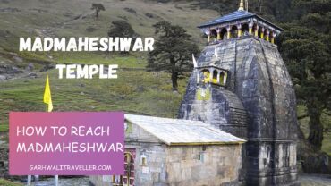
Madmaheshwar is one of the panch kedar in Uttarakhand. This temple is dedicated to lord shiva and every year hundreds of pilgrims visit this holy temple in the Rudraprayag district of Uttarakhand. This temple is located in a remote area. But the nearest village which is Ranshi village is well-connected with the important towns and cities of Uttarakhand. Below is the complete guide and detailed information about how to reach Madmaheshwar by Road, Train, or Flight.

Madhmaheshwar is one of the Panch Kedar, a group of five sacred Hindu temples dedicated to Lord Shiva, which exudes an aura of divine tranquility. It is situated at an altitude of 3497 meters above sea level. Every year, hundreds of pilgrims visit this holy temple.

The journey to Madhmaheshwar is an adventure in itself, requiring a trek through rugged terrain and pristine forests. The trek is hard in some locations. As travelers traverse the winding paths, they are treated to breathtaking vistas of snow-capped peaks, lush valleys, and glistening streams, each step bringing them closer to the heart of this mystical destination.

Beyond its religious significance, Madhmaheshwar also beckons adventurers with its myriad trekking routes and opportunities for exploration. Whether scaling the nearby peaks, traversing remote trails, or simply communing with nature, visitors are sure to find solace and inspiration in the untamed wilderness of this sacred land.

As the sun sets behind the towering summits, casting a golden glow over the landscape, one cannot help but feel a sense of awe and reverence for the timeless beauty of Madhmaheshwar. Whether seeking spiritual enlightenment, embarking on a journey of self-discovery, or simply escaping the chaos of everyday life, this hidden gem of the Himalayas promises an unforgettable experience for all who venture within its embrace.

Importance of Madmaheshwar in Hindu Mythology

At the heart of Madhmaheshwar lies the ancient temple of Madhmaheshwar, where devotees pay homage to Lord Shiva in his fierce form as the destroyer of evil. The temple, constructed in classic Himalayan style with stone and wood, stands as a testament to centuries of reverence and devotion. Surrounded by majestic mountains and enveloped in an atmosphere of profound spirituality, it offers pilgrims a place for prayer, meditation, and reflection.

Location of Madmaheshwar

Madmaheshwar temple is located in Rudraprayag district of Uttarakhand. Ransi village is the last village that is connected with the road, from here you have to complete a trek of 16 Km to reach Madhyamaheshwar. The trek to Madmaheshwar is not so hard, but at some points the trek is hard. The trek to Bantoli village is easy, but from Bantoli to Madmaheshwar the trek is steep. So before travelling to Madmaheshwar stay physically fit for a tough trek journey.

Safety precautions during the trek

It is necessary to put some necessary things together when you are on a trek. Like a torch, rope, first aid kit, and water bottle. Never choose any shortcut you may lose the original route and get lost in the terrain. So always follow the instructions from your trek guide.

Leaving no trace: practicing responsible tourism

Whatever you carry with you like water bottles, plastic bags to carry foodstuff or any kind of plastic you see in between the trek. It is requested to carry all the plastic things with you back to the Ransi and put them into the dustbins there. We must keep nature clean and save Mother Earth.

How to reach Madmaheshwar Temple?

You can reach Madmaheshwar by completing a trek of 16 Km which starts from Ransi village. The trek to Madmaheshwar is easy to grade up to Bantoli village, but from Bantoli the trek becomes steep up to the temple and it is the hardest portion of the trek.

Bantoli is the location where Madhyamaheshwar Ganga and Martyenda Ganga meet. The trail continues to Khatara, Nanu and then Madmaheshwar.

Gaundhar and Kalimath are two important places on the route to Madmaheshwar temple. The trek is so tough, but the beauty of nature will make your journey easy and your mind will be refreshed. For photographers, nature lovers and content creators, it’s like heaven.

By road

You can take a direct bus from Kashmiri Gate Delhi(Haridwar, Rishikesh, Dehradun) to Ukhimath. From here you can take a cab to Ransi village. Ukhimath town is well-connected with all the major cities and towns of Uttarakhand such as Rishikesh, Pauri, Uttarkashi, Rudraprayag, Gaurikund, Srinagar Garhwal, Gopeshwar, Gauchar, Karnaprayag, etc.

Ukhimath town is situated on the road that connects Guptkashi with Gopeshwar. Ukhimath temple is also famous for an ancient Shiva temple – Omkareshwar Temple.

You can book a cab from Haridwar / Rishikesh / Dehradun to Ukhimath or directly to Ransi village. Garhwali Traveller cab service is available for any tourist destination in Uttarakhand from the major towns and cities.

Road route from Delhi to Ransi Village

Delhi – Meerut – HaridwarRishikesh – Devprayag – Srinagar – Rudraprayag – Ukhimath – Uniana – Ransi Village – Trekking (16 Km) – Madmaheshwar

By air

The nearest airport to Madmaheshwar is Jolly Grant Airport, which is located in Dehradun at a distance of approx 235 km. But now you can reach Phata via helicopter, which is a nearby town to Ukhimath. It is the easiest but most expensive way to reach Madmaheshwar. But for the rest of the journey to Madhyamaheshwar, you will have to complete via trekking, there is no choice to skip the trek.

By train

The nearest railway station to Ukhimath is Rishikesh railway station, which is connected with all the major cities of different states of India. You can reach Rishikesh via train from Prayagraj, Delhi, Mumbai, Kolkata, etc. From Rishikesh, you can book a cab to Ransi village and then the rest of the journey is trekking. We recommend you take the train to Haridwar because Haridwar is connected to major railway stations in India by the Indian rail network. From Haridwar, you can take a bus to Ukhimath or book a cab directly to Ransi village.

Madmaheshwar Distance Chart

Road distances and travel time to Madmaheshwar from various cities of Uttarakhand and other cities of India.

Madmaheshwar Distance Chart

1. What is Madmaheshwar?

Madmaheshwar is a sacred Hindu pilgrimage site located in the Rudraprayag district of Uttarakhand, India. It is one of the Panch Kedar temples dedicated to Lord Shiva and holds great religious significance for devotees.

2. How do I reach Madmaheshwar?

To reach Madmaheshwar, one has to trek from the town of Ransi, which is about 25 kilometers from Ukhimath. The trek is moderately difficult and takes approximately 8 – 10 hours to complete, depending on your pace and weather conditions. It offers breathtaking views of the surrounding Himalayan mountains and lush green valleys.

3. When is the best time to visit Madmaheshwar?

The best time to visit Madmaheshwar is during the summer months, from May to June, and the early autumn months of September to October. During these periods, the weather is generally pleasant and suitable for trekking. The temple remains open for devotees from late April to early November.

4. What is the significance of Madmaheshwar in Hindu mythology?

According to Hindu mythology, Madmaheshwar is believed to be the place where the Pandavas, from the great Indian epic Mahabharata, sought the blessings of Lord Shiva to seek forgiveness for their actions in the war. The temple is also associated with the navel (nabhi) of the bull form of Lord Shiva.

5. Are there any accommodation facilities near Madmaheshwar?

While trekking to Madmaheshwar, accommodation options are limited. There are some basic guesthouses and small lodges available in Ransi and other nearby villages. However, it is advisable to carry your own sleeping bags and camping equipment for a more comfortable stay during the trek.

6. What should I carry while trekking to Madmaheshwar?

Trekking to Madmaheshwar requires proper planning and preparation. Some essential items to carry include sturdy trekking shoes, warm clothing, rain gear, a first-aid kit, a torch, water bottles, energy snacks, and personal medications. It’s crucial to pack light yet adequately for a smooth trekking experience.

7. Is Madmaheshwar accessible during the winter months?

No, the Madmaheshwar temple remains closed during the winter months due to heavy snowfall and harsh weather conditions. The region becomes inaccessible, and the idol of Lord Shiva is shifted to Ukhimath’s Omkareshwar temple, where it is worshipped during winter.

8. Are there any other attractions near Madmaheshwar?

Yes, the trek to Madmaheshwar takes you through beautiful landscapes and picturesque villages. During the journey, you can visit other sacred places like Kalimath, where Goddess Kali is worshipped, and Gaundar, known for its lush green meadows and breathtaking views.

9. Is photography allowed inside the Madmaheshwar temple?

Photography is generally not allowed inside the temple premises to maintain the sanctity and respect the religious sentiments of the pilgrims. It’s best to inquire about the specific rules and guidelines at the temple entrance.

10. Is there any specific dress code to be followed while visiting Madmaheshwar?

While there is no strict dress code, it is advisable to dress modestly and respect the religious significance of the place. Avoid wearing revealing or inappropriate clothing inside the temple premises to maintain the sanctity of the holy site.

How to reach Gangotri

How to reach Gangotri

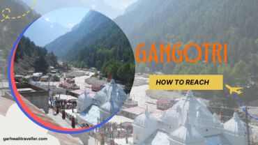
Gangotri Dham is one of the four holy pilgrimage sites (Char Dham) in the Indian state of Uttarakhand. It is located in the Garhwal Himalayas, at an altitude of about 3,048 meters (10,000 feet). The Gangotri glacier, the source of the Ganges River, is located about 19 kilometers (12 miles) from Gangotri Dham. It is one of the holy temple and Char Dham pilgrimage sites in the Uttarkashi district of Uttarakhand. If you are planning to visit Gangotri then you must read this article to get detailed information about how to reach Gangotri temple.

Gangotri Dham is a popular pilgrimage site for Hindus, who believe that the Ganges River is a sacred river that can cleanse sins and bring good fortune. The temple at Gangotri Dham is dedicated to the goddess Ganga, who is believed to have descended from heaven to earth at this spot.

Gangotri – How to reach

By Air

The nearest airport to Gangotri is Jolly Grant Airport in Dehradun, which is about 250 kilometers away. There are regular flights from Delhi and other major cities to Jolly Grant Airport. From there, you can take a taxi or bus to Gangotri. The journey will take about 6-7 hours. You can take a helicopter to Gangotri from Dehradun directly.

By Rail

The nearest railway station to Gangotri is Rishikesh, which is about 234 kilometers away. There are frequent trains from Delhi and other major cities to Rishikesh. From Rishikesh, you can take a taxi or bus to Gangotri. The journey will take about 4-5 hours.

By Road

Gangotri is well connected by road to major cities in Uttarakhand. You can take a bus or car from Delhi, Haridwar, Rishikesh, or Dehradun to Gangotri. The journey will take about 6–8 hours from Delhi, 4–5 hours from Haridwar, 3–4 hours from Rishikesh, and 2–3 hours from Dehradun.

By Helicopter

If you are short on time or want to avoid the long journey by road, you can also take a helicopter to Gangotri from Dehradun. The helicopter ride will take about 45 minutes. It is the easiest and most time-saving way to reach Gangotri.

Here are some tips for reaching Gangotri:

  • The best time to visit Gangotri is during the summer (May-June) or autumn (September-October) when the weather is pleasant.
  • Make sure to carry warm clothes as the weather at Gangotri can be cold even during the summer.
  • Be prepared for the long journey, especially if you are traveling by road.
  • Allow plenty of time for your journey, as traffic can be heavy, especially during the peak tourist season.
  • If you are traveling by car, make sure that your vehicle is in good condition and has enough fuel.
  • Pack plenty of snacks and drinks, as there are limited options available en route.
  • Be respectful of the local culture and religious beliefs.

I hope this guide helps you plan your trip to Gangotri! Happy journey. If you need a travel agent that can help you explore the Gangotri Dham and other places nearby Gangotri.

How to reach Nainital Uttarakhand

How to reach Nainital Uttarakhand

Nainital also known as the city of lakes is one of the most famous hill stations of Uttarakhand. This is an ancient city developed by the Britishers when India was a colony of Britain. If you are looking for a perfect summer destination or want to enjoy the beautiful snowfall during the winter, then it is the best winter destination. Nainital is also a popular honeymoon destination.

Are you planning to visit Nainital and don’t know how to reach Nainital? Don’t worry, below is the detailed travel guide to Nainital. This city is well-connected with all the major towns and cities of India, so you won’t face any problem reaching here. So let’s see the detailed information:

Location of Nainital

Nainital is a town located in the Nainital district of Uttarakhand. This hill station is surrounded by beautiful mountains, and fulfilled with a pear-shaped lake that is approximately two miles in circumference. The nearest railway station is at Kathgodam and the nearest airport is at Pantnagar. The main attraction of this city is the Naini Lake (commonly known as Nainital Lake). So let’s discuss in detail about different modes to reach Nainital.

Nainital – How to reach here

By Air

The nearest Airport to Nainital is Pant Nagar Airport. It is located at a distance of 72 Km from Nainital, and this airport is well-connected by motorable state and national highways. You can take a taxi from the airport to Nainital, which is available very easily.

By Train

The nearest railway station is at Kathgodam which is situated at a distance of 41 km. Kathgodam railway station is well-connected by railway networks with the major railway stations of India, such as Prayagraj (formerly known as Lucknow), New Delhi railway station and Kolkata. You can get a direct train to Kathgodam Uttarakhand from these stations. Buses and cabs are easily available from here to Nainital city.

By road

Nainital City is well-connected with the major state and National highways of Uttarakhand, India. You can easily reach here via your personal vehicle or via Govt. Buses or book a cab to Nainital. If you are traveling via train and reached Kathgodam, Nainital city is just a 1-hour drive from Kathgodam railway station. Buses and cabs are frequently available

Nainital Quick Information

Attractions – Natural Beauty, Naini Lake, Boating

Altitude – 2084 m

STD Code – 05942

Best time to visit – Summers March to June, Winters December to February

State code – Nainital (263001, 263002)

Languages – Hindi, Garhwali and Kumauni

Nainital Distance Chart

Here is the distance chart of Nainital and travels time from/ to Nainital from various cities of Uttarakhand and India. – Nainital Distance Chart

You can also hire or rent a cab to Nainital. For more information, contact Garhwali Traveller Cab Service for Nainital Cab rentals.

Kartik_swami_temple_Rudraprayag

How to reach Kartik Swami Temple

Kartik Swami temple is the one and only temple of Lord Kartikey elder son of Lord Shiva in the Rudraprayag district of Uttarakhand. If you are planning to visit Kartik Swami temple, then you have landed on the right page. In this article, we will guide you on how to reach Kartik Swami. Kartik Swami Temple is well-connected with most of the important towns and cities of Uttarakhand, tourists can reach Kartik Swami temple very easily. Kartikswami temple is one of the popular tourist destinations in Rudraprayag Uttarakhand.

So let’s see the detailed information about how to reach Kartik Swami by road, train, or flight.

Location of Kartikswami

The total trek distance to Kartikswami is approx 3 km from Kanakchauri village. This village is on the Rudraprayag – Pokhari route, which is 40 Km from Rudraprayag.

You can start your trek to Kartikswami from Kanakchauri village. The trek is not so hard, beginner trekkers can easily complete it without any problem.

The views between Rudraprayag to Kanakchauri are so pleasing and it’s like heaven for nature lovers and photographers also. It takes approx 1.5 hours to reach Kanakchauri from Rudraprayag.

How to reach Kartik Swami

Firsly take a shared Taxi from Rudraprayag to Kanakchauri or you can go with your personal vehicle. Shared cabs take around Rs. 50 from Rudraprayag to Kanakchauri village. There are some bus services available, but we recommend you take shared cabs, it will save you time as compared to buses. The timings of buses are also odd.

By road:

Kartik swami temple can be reached by shared cab, bus or through personal vehicle from Rishikesh. It takes approx 5 hours to reach Kartik swami from Rishikesh.

By Train:

The nearest railway station to Kartik Swami is Rishikesh. But after few years when Rishikesh – Karnaprayag railway line project will get completed it will be easier to travel via train.

By Air:

The nearest airport is Jolly Grant Dehradun. From Dehradun, you will have to travel via road.

Activities to do in Kartik Swami

Kartik swami is not only a pilgrimage site, there are many other options you can explore. Some activities are:

Trekking
Village tourism
Photography
Bird watching

Best time to visit Kartik Swami Temple

The temple remains open throughout the year. We recommend you visit the temple from October to June. Also, you can visit in monsoon season to see the beauty of the majestic Himalayas and clouds circulating around the temple.  Many devotees visit the temple during Kartik Purnima, which is usually celebrated between October and November. You can also plan a visit during the Kalash Yatra in June.

Hope this article was useful for you and this will help you to reach Kartik Swami Temple.

If you are searching for cab booking in Rudraprayag then you can contact Garhwali Traveller Cab Service for any trip in Uttarakhand for any destination at very affordable pricing.

Chakrata Hill Station

How to Reach Chakrata by Road, Air and Train

We all know that there are a few hill stations nearby Dehradun. One of the popular hill stations is Mussoorie and the other one is Chakrata. Every year, thousands of tourists visit these hill stations. If you are in Dehradun then you must consider visiting these hill stations for sure. The surroundings are so beautiful and you can see the beautiful bird eye view of Dehradun city from Chakrata. But the question is how to reach Chakrata, because the locals know the routes and procedures of reaching Chakrata, but other people don’t know. In this article, we will guide you on how you can reach Chakrata via different modes of transport.

But before getting started, let’s talk about the overview of Chakrata before visiting there.

Chakrata is a hill station in the Dehradun district of Uttarakhand, India. It is located at an altitude of 7,000 feet above sea level and is surrounded by the Garhwal Himalayas. Chakrata is a popular tourist destination, especially during the summer months. If you are searching for a perfect hill station or tourist destination nearby Dehradun, then Chakrata is the only hill station after Mussoorie. This place is so calm and the views from Chakrata are so amazing, you are going to love the beautiful view of nature. It is a perfect summer destination as well as a winter destination in Uttarakhand.

In this article, we will read how to reach Chakrata from Dehradun and what are the different routes to reach Chakarata and other necessary information.

By Air

The nearest airport to Chakrata is the Jolly Grant Airport in Dehradun. There are regular flights from Delhi and other major cities to Jolly Grant Airport. From the airport, you can take a taxi or bus to Chakrata.

By Train

The nearest railway station to Chakrata is the Dehradun railway station. There are regular trains from Delhi and other major cities to Dehradun railway station. From the railway station, you can take a taxi or bus to Chakrata.

By Road

Chakrata is well-connected by road to major cities in Uttarakhand and neighboring states. You can take a bus or a taxi to Chakrata from Dehradun, Mussoorie, Haridwar, and other nearby cities.

Now let’s see the different routes to reach Chakrata from Dehradun:

The following are the two main routes to reach Chakrata by road:

Route 1: Dehradun – Mussoorie – Vikasnagar – Chakrata

Route 2: Dehradun – Herbertpur – Kalsi – Chakrata

The distance from Dehradun to Chakrata is approximately 100 kilometers. The journey time by road is about 4 hours.

Here are some tips for reaching Chakrata:

  • If you are traveling by air or train, book your tickets in advance, especially during the peak season.
  • If you are traveling by road, make sure that your vehicle is in good condition. The roads to Chakrata can be narrow and winding, so it is important to be prepared for a bit of a bumpy ride.
  • If you are traveling during the summer months, be sure to carry plenty of water and sunscreen. The weather in Chakrata can be hot and sunny, especially during the day.

Hope this travel guide to Chakrata will help you to reach Chakarata very easily. We discussed all the routes and different modes of transport to reach Chakrata. Do share this article with your friends who are planning to visit Chakrata. It is one of the favorite weekend destinations for the people of Dehradun.

Frequently asked questions:

Q: Where is Chakrata located?

A: Chakrata is a small town located in the Dehradun district of Uttarakhand state in India. It is situated at an elevation of around 2,118 meters (6,949 feet) above sea level.

Q: How can I reach Chakrata?

A: The nearest major airport to Chakrata is the Jolly Grant Airport in Dehradun, which is approximately 100 kilometers away. From the airport, you can hire a taxi or take a bus to reach Chakrata. Chakrata is also well-connected by road, and you can reach there by hiring a taxi or taking a bus from Dehradun or other nearby cities.

Q: What is the best time to visit Chakrata?

A: The best time to visit Chakrata is during the summer months of April to June when the weather is pleasant and the temperatures range from 10 to 25 degrees Celsius (50 to 77 degrees Fahrenheit). It is also a popular destination during the winter months for snow enthusiasts, but road conditions can be challenging.

Q: What are the popular tourist attractions in Chakrata?

A: Chakrata is known for its natural beauty and offers several attractions for tourists. Some popular places to visit include Tiger Falls, Budher Caves, Deoban, Chilmiri Neck, Ram Tal Horticultural Garden, and the Kanasar Forest.

Q: Are there accommodation options available in Chakrata?

A: Yes, Chakrata offers a range of accommodation options to suit different budgets. There are hotels, resorts, guesthouses, and homestays available for visitors.

Q: What activities can I do in Chakrata?

A: Chakrata is a paradise for nature lovers and adventure enthusiasts. You can indulge in activities such as trekking, hiking, camping, bird watching, and nature walks. The region also offers opportunities for rock climbing and rappelling.

Q: Is Chakrata safe for tourists?

A: Chakrata is generally considered safe for tourists. However, like any other travel destination, it is advisable to take necessary precautions and follow safety guidelines. It’s always recommended to be aware of your surroundings and avoid venturing into isolated areas alone, especially at night.

Q: Are there any medical facilities and ATMs available in Chakrata?

A: Chakrata has limited medical facilities and ATMs. It is advisable to carry sufficient cash and essential medications with you. But these days because of online transactions Gpay, Amazon Pay, PhonePe, and UPI are accepted almost everywhere. For comprehensive medical facilities and a wider range of banking services, it is best to visit Dehradun or other nearby towns.

Q: Can I visit Chakrata on a day trip from Dehradun?

A: Yes, Chakrata can be visited as a day trip from Dehradun. However, to explore the area thoroughly and enjoy its natural beauty, it is recommended to spend at least 1 day in Chakrata.

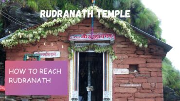
Rudranath Temple

How to reach Rudranath – Trekking Guide

Rudranath is one of the holy temples dedicated to Lord Shiva. It is one of the Panch Kedars located in the Chamoli district of Uttarakhand. Rudranath trek is one of the hardest treks of Uttarakhand, so you must be physically fit to complete this trek. If you are planning to visit Rudranath this season and don’t know how to reach Rudranath, then in this article we will guide you on how to reach Rudranath temple.

Here is a detailed information guide about how to reach Rudranath by Road, Train, and Air.

Location of Rudranath Temple

Rudranath temple is located in the Chamoli district of Uttarakhand at an elevation of 2286 meters above sea level. It comes under the Panch Kedar temples of Uttarakhand. The Panch Kedar temples are – Kedarnath, Tungnath, Kalpeshwar, Madhyamaheshwar and Rudranath.

The trek to Rudranath passes through dense forests and meadows which are rich in flora and fauna. The trek is hard to climb and the total length of the trek to Rudranath is approx 21 Km and it takes 5 to 6 hours to complete the trek. So be mentally and physically prepared to trek Rudranath.

How to reach Rudranath

Rudranath temple trek is one of the hardest treks in Uttarakhand. The total trek distance is 21 Km, which starts from Sagar village. The trek is so beautiful and full of adventure, rich flora and fauna forests, alpine meadows and deep gorges. For nature lovers and photogrphers trek to Rudranath is so amazing.

By Road

The road route is the cheapest way to reach Rudranath. The nearest interstate bus Station is ISBT take a bus from ISBT Kashmiri Gate, New Delhi to Gopeshwar directly. From there take a sharable taxi to Sagar village and you can start your trekking journey from there.

By Train

The nearest railway station to Rudranath is in Rishikesh. You can take train from Delhi to Rishikesh or Haridwar from there you will have to travel via road. Which is the only option. Or you can travel to Dehradun via flight or train and then reach to Gauchar via helicopter and further journey will be travelled via road.

By Air

Take flight from Delhi to Dehradun or from any other city. Then reach Gauchar via helicopter and then rest of the journey will be travelled via road, which is the only option.

Road route from Delhi to Sagar Village

Delhi – Meerut – HaridwarRishikesh – Devprayag – Srinagar Garhwal – Rudraprayag – Gopeshwar – Sagar Village – Trek (19 to 21 Km) – Rudranath

So this was the complete guide on how to reach Rudranath, hope you find this article informative and useful. This article will help you to complete your Rudranath journey easily and successfully.

What is Rudranath?

Rudranath is one of the Panch Kedar temples, dedicated to Lord Shiva, located in the Garhwal region of Uttarakhand, India. It is situated at an altitude of approximately 3,600 meters (11,800 feet) above sea level.

How do I reach Rudranath?

To reach Rudranath, you can follow the traditional pilgrimage route. Here’s a step-by-step guide:
a. Start your journey from Haridwar, which is well-connected by road and rail.
b. From Haridwar, travel to Ukhimath, which is approximately a 7-hour drive.
c. From Ukhimath, reach the village of Sagar, which is about a 1-hour drive.
d. From Sagar, you have to trek approximately 20 kilometers to reach Panar, which takes around 8-10 hours.
e. From Panar, continue the trek for another 4 kilometers to reach Rudranath.

How difficult is the trek to Rudranath?

The trek to Rudranath is considered moderately difficult. It involves steep uphill and downhill sections, as well as rugged terrain. It is recommended for experienced trekkers or individuals with a good level of physical fitness. Altitude sickness can also be a concern, so it’s important to acclimatize properly and carry necessary medications.

What is the best time to visit Rudranath?

The best time to visit Rudranath is during the summer months from May to June and the autumn months from September to October. The weather during these periods is generally favorable, with pleasant temperatures and clear skies. The temple remains closed during the winter months due to heavy snowfall.

Are there any accommodation options available near Rudranath?

There are limited accommodation options near Rudranath. You can find basic guesthouses and ashrams in Panar, which is the last village before the temple. It is advisable to carry your own sleeping bags and basic amenities, as facilities may be limited.

Are there any medical facilities available during the trek?

Medical facilities are scarce along the trekking route to Rudranath. It is important to carry a basic first aid kit and any necessary medications with you. It is also advisable to consult a doctor before undertaking the trek, especially if you have any pre-existing medical conditions.

Is it possible to visit Rudranath in a single day?

Visiting Rudranath in a single day is not recommended due to the long trek and challenging terrain. It is advisable to plan for at least a two-day trek, including overnight stay in Panar, to comfortably complete the pilgrimage and enjoy the spiritual experience.

Are there any restrictions or guidelines for visiting Rudranath?

It is important to respect the religious significance of Rudranath and follow certain guidelines:
a. Dress modestly and appropriately, preferably in traditional attire.
b. Seek permission before entering the temple premises.
c. Photography may be restricted inside the temple.
d. Carry back any waste or garbage to maintain cleanliness.

How to reach Kedarnath

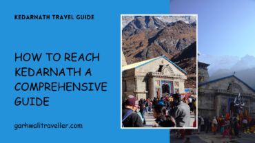
How to Reach Kedarnath: A Comprehensive Guide

Kedarnath is one of the holy temples of Lord Shiva located in the Uttarakhand state of India. Where every year thousands and lacks of tourists visit Kedarnath temple during the Char Dham Yatra. If you are planning to visit Kedarnath this Char Dham Yatra season and don’t know where to start the journey. Then don’t worry, in this article we explained everything about how to reach Kedarnath via different modes of transport and all the other important details about the Kedarnath Yatra for your comfortable journey.

This guide will provide you with all the necessary information on how to reach Kedarnath via different modes of transport so that you can plan your journey in the most convenient and comfortable way possible. From air travel to road trips, we’ve got you covered.

Read this guide also if you are planning to visit Kedarnath from Haridwar – How to reach Kedarnath from Haridwar

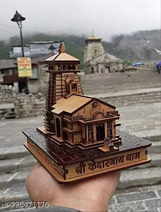
Located in the northern state of Uttarakhand in India, Kedarnath is a popular pilgrimage destination for Hindus. It is famous for its ancient Kedarnath Temple, which is dedicated to Lord Shiva and is one of the four Char Dham sites. Kedarnath is also a trekking hub and a great place for adventure enthusiasts.

By Air

The nearest airport to Kedarnath is the Jolly Grant Airport in Dehradun, which is around 238 km away. From there, you can take a taxi or bus to reach Kedarnath. Helicopter service to Kedarnath is available from Phata and Ukhimath helipads and as per the latest news govt. is also planning to allow helicopter service directly from Dehradun to Kedarnath. Let’s see when this service begins.

By Train

The nearest railway station to Kedarnath is in Rishikesh, which is around 216 km away. From there, you can take a taxi or bus to reach Kedarnath.

By Road

Kedarnath is well-connected to major cities in Uttarakhand by road. You can hire a taxi or take a bus from major cities like Dehradun, Haridwar, Rishikesh, and Delhi to reach Kedarnath.

Trekking

Trekking is one of the most popular ways to reach Kedarnath. The trek starts from Gaurikund, which is around 16 km from Kedarnath. The trek is moderate to difficult, and it takes around 6-8 hours to reach Kedarnath.

Best Time to Visit Kedarnath

The best time to visit Kedarnath is from May to June and from September to October. The weather during these months is pleasant and ideal for trekking and sightseeing. And during these months you will not face so much crowd at Kedarnath and you can visit the temple properly.

Where to Stay in Kedarnath

There are several accommodation options available in Kedarnath, ranging from budget to luxury. You can find hotels, guest houses, and Dharamshala (rest houses) in the town. It is recommended to book your accommodation in advance, especially during peak season. We recommend you search for space in Dharamshalas it will save you money.

What to See in Kedarnath

Apart from the Kedarnath Temple, there are several other places to see in and around Kedarnath. These include:

  • Bhairavnath Temple
  • Gandhi Sarovar
  • Vasuki Tal
  • Shankaracharya Samadhi

Things to Do

Kedarnath is a great place for adventure enthusiasts. Some of the activities you can indulge in include:

Essential Tips

Here are some essential tips that will help you plan your trip to Kedarnath:

  • Carry warm clothes, as the weather can get chilly, especially at night.
  • Wear comfortable and sturdy shoes, as you will have to do a lot of walking and trekking.
  • Carry a first-aid kit and essential medicines.
  • Carry enough cash, as there are no ATMs in Kedarnath.
  • Because of digital payments now, many shops and resorts accept PayTm, G-Pay, Amazon Pay, etc
  • Carry a first-aid kit and essential medicines.
  • Carry enough cash, as there are no ATMs in Kedarnath.
  • Respect the local culture and traditions.

hemkund sahib uttrakhand

How to reach Hemkund Sahib

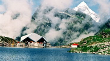
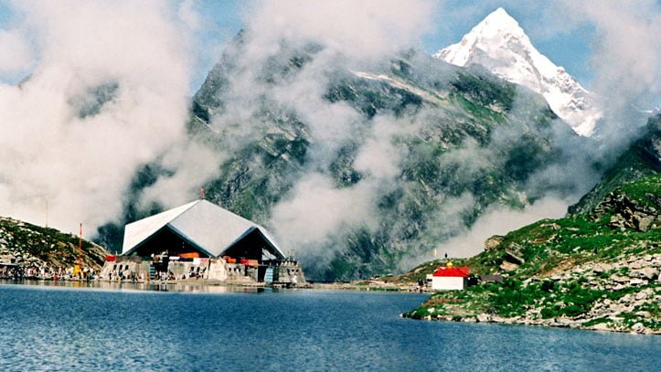
Hemkund Sahib, also known as Gurudwara Sri Hemkund Sahib, is a holy Sikh shrine located in the Chamoli district of Uttarakhand. Hemkund Sahib Gurudwara is situated at an altitude of 4,632 meters above sea level, and is surrounded by picturesque snow-clad mountains and lush green valleys. If you are planning to visit Hemkund Sahib and don’t know how to reach and what are the modes to reach Hemkund Sahib. In this article we discussed on different ways to reach Hemkund Sahib.

The significance of Hemkund Sahib lies in its spiritual and historical importance. According to Sikh tradition, the tenth Sikh Guru, Guru Gobind Singh Ji, meditated at this site for years. It is also believed that Sage Rishi Medhasa worshipped gods at this holy place.

Reaching Hemkund Sahib can be challenging, but it is definitely worth the effort. The nearest town to Hemkund Sahib is Govindghat, which is well-connected by road to major cities like Rishikesh and Dehradun. From Govindghat, the trek to Hemkund Sahib is approx 16 Km long and it will take approx 8 to 10 hours to complete the trek.

The trek to Hemkund Sahib is a steep and arduous one, and it is advisable to be physically fit and acclimatized to high altitudes before attempting it. The trek takes one through picturesque landscapes of pine forests, gushing streams, and cascading waterfalls.

Once you reached Hemkund Sahib, you will see the beautiful pristine lake and snow covered mountains and green forests around the site. The crystal-clear waters of the lake surrounding the shrine are believed to possess healing powers, and visitors can take a dip in the holy water before entering the Gurudwara.

Overall, a visit to Hemkund Sahib is a spiritually enriching and awe-inspiring experience, and is definitely worth the effort for those willing to undertake the challenging trek.

In this guide, we will provide you with detailed information on how to reach Hemkund Sahib from various locations, the best time to visit, and other important details that will make your journey to this holy site an unforgettable experience.

You can reach Hemkund Sahib via helicopter from Gauchar, Badrinath and Govindghat.

Book a helicopter ticket for Hemkund Sahib online.

How to Reach Hemkund Sahib

To reach Hemkund Sahib the trek starts from Govind Ghat which is the nearest town to Hemkund Sahib Gurudwara. Govind Ghat is well-connected to the roads. If you are not physicially fit then we recommend you to prepare yourself 1 month before the trip to complete the trek easily, otherwise, you will face problems.

By Air

The nearest airport to Hemkund Sahib is in Gauchar. You can get helicopter from Dehradun to Gauchar and then rest of the journey to Hemkund Sahib will be done via road and foot trek. You can book taxi to Hemkund sahib from Rishikesh, Dehradun or Gauchar at very best rates.

If you want to save your time, we recommend you to book helicopter from Dehradun to Gauchar and then travel through cab to Govind Ghat.

By Road

The easiest and cheapest way to reach Hemkund Sahib is via road. Hemkund sahib is not properly connected with roads, so you can drive only upto Govind Ghat only from here you will have to complete a trek of 19 Km to reach Hemkund Sahib. The trek is little difficult so if you are not physically fit prepare yourself for the trek. Buses, cabs are easily available from Punjab, Delhi, Rishikesh and Dehradun.

By Train

The nearest railway station to Hemkund Sahib is in Rishikesh. From Rishikesh, Govind Ghat is approx 273 Km and easily accessible via road. From Govindghat there is a 16 km trek to reach Hemkund Sahib.

Frequently Asked Questions about Hemkund Sahib

What is Hemkund Sahib and why is it important?

Hemkund Sahib is a Sikh pilgrimage site located in the Chamoli district of Uttarakhand, India. It is a high-altitude lake surrounded by seven mountain peaks and is considered a holy site by Sikhs. It is believed to be the place where Guru Gobind Singh, the tenth Sikh guru, meditated and achieved enlightenment in the ancient times.

What is the best time to visit Hemkund Sahib?

The best time to visit Hemkund Sahib is from May to October, when the weather is mild and the roads are open. The site is closed during the winter months due to heavy snowfall.

How do I reach Hemkund Sahib?

To reach Hemkund Sahib, you need to trek from Govindghat, which is the base camp. It is a steep and challenging trek that takes about 6-7 hours. Alternatively, you can hire a mule or helicopter services to reach the site.

What should I wear and carry while trekking to Hemkund Sahib?

While trekking to Hemkund Sahib, it is recommended to wear comfortable clothes and sturdy shoes with good grip. Carry a backpack with essentials like water, snacks, sunscreen, sunglasses, and warm clothes. It is also advised to carry a first aid kit and a walking stick.

Is there any accommodation available near Hemkund Sahib?

Yes, there are several options for accommodation near Hemkund Sahib, including guest houses and lodges. However, due to its remote location, it is recommended to book your accommodation in advance. Camping is also allowed at certain designated areas with permission from the authorities.