10 Best Honeymoon Places in Uttarakhand for Couples

Famous Romantic Destinations in Uttarakhand for Couples

The beautiful and mesmerizing weather of the hilly regions of Uttarakhand is very ideal for a romantic trip with your partner. The cosy hill stations in Uttarakhand are the most popular honeymoon destinations for couples and newly married couples, where they can spend memorable and valuable time with each other. You will fall in love with these beautiful places in Uttarakhand.

If you are a newly married couple, then you must visit these destinations if you are planning to visit Uttarakhand. There is no doubt that Uttarakhand is the best state, which is ranked among the best honeymoon destinations in India.

So let’s see those honeymoon destinations in Uttarakhand where you must go.

Best Honeymoon Destinations in Uttarakhand

During the peak season, some destinations such as Auli, Nainital, and Mussoorie in Uttarakhand can be crowded with newly wedded romantic couples. The pleasant weather of the lush green forests surrounds you with the slowly moving wind, which creates more excitement and romance between the couples.

Some destinations in Uttarakhand, which are lesser-known, are beautiful and enjoyable as others are, but few people visit those destinations. That’s why they are less popular.

But we recommend that you visit those lesser-known destinations if you are a travel enthusiast and nature lover. You will fall in love with those places, for sure.

Some of the most beautiful hill stations of Uttarakhand are the best honeymoon places in India for couples.

1 – Auli

Auli is one of the best tourist places to visit in Uttarakhand. Especially during winter, the area of Auli and Joshimath gets covered with snow and it is the perfect honeymoon destination in Chamoli, Uttarakhand. Auli remains open throughout the year, but we recommend you visit Auli during winter. If you are a newly married couple, then you must consider Auli for your honeymoon destination.

2 – Mussoorie

Mussoorie is also known as the queen of hills. It is one of the beautiful tourist honeymoon destinations of Uttarakhand. Every year, hundreds and thousands of tourists and couples visit Mussoorie during the winter and summer seasons to enjoy their holidays. There are plenty of other tourist places nearby Mussoorie where you can visit and enjoy the beauty of nature and the whole Himalayan range. If you are in Dehradun or planning to visit Dehradun, then you must consider visiting Mussoorie on your travel list.

3 – Chakrata

Chakrata is another popular hill station near Dehradun. It is the most visited hill station in the Dehradun district after Mussoorie. You can see the whole Himalayan range from Chakrata, and it is an ideal location to enjoy your honeymoon and summer vacations as well. During winter, snowfall can be seen here. If you are searching for places to visit near Dehradun within a 100 Km range, then you must consider adding Chakrata to your travel bucket list.

4 – Chopta

Chopta is another best tourist and winter honeymoon destination of Uttarakhand. Every year, hundreds and thousands of newly married couples visit the Chopta Hill station. You are going to love the Chopta Valley and which is also known as the mini Switzerland of India. If you are a driving enthusiast, then you are going to love the roads and the green, lush trees following the roads on both sides. You can also add Chopta hill station to your honeymoon destination list.

Nainital Uttarakhand and Travel Guide, Uttarakhand

Nainital is one of the most popular hill stations in the Kumaon region of Uttarakhand. It is a very famous travel destination in India. The town not only attracts domestic travelers but also foreign tourists. It is surrounded by beautiful Himalayan mountains and lakes.

Nainital is a paradise for nature lovers. The most beautiful aspect of Nainital is the hilly region and the Nainital Lake. “Naini Lake” offers an amazing experience to tourists and is also known as the Queen of Lakes.

What is Nainital famous?

Nainital is famous for the “Naini Lake”, awesome views and pleasant weather. There are some other tourist places like the Mall Road and other malls, which are presently known as Govind Ballabh Pant Marg. Nainital Zoo is also a good visiting point where you can see the rare species of Snow Leopard, Steppe Eagle, and the Himalayan Black bear. The Raj Bhawan’s Governor house is one of the few Raj Bhawans for public visits and viewing. Nainital’s latest attraction is Eco-Cave Garden, where children can learn about the ecosphere.

Activities to do in Nainital?

There are several types of activities you can do in Nainital, like Boating, trekking, picnic spots, Shopping, Sightseeing, Ropeways and many more. Nainital is also the best destination for honeymoons for newly married couples. Tourists from all around India and from other countries come here.

Boating in Nainital: Naini Lake is the main attraction of Nainital and Boating is one of the most popular activities done by tourists and honeymoon couples. Yachting is another form of boating that is also gaining more attention and popularity in Nainital.

Trekking and Hiking: There are many hiking and trekking spots in and around Nainital where adventure lovers can hike and camp to explore the beauty of nature. Nainital – Betalghat, Nainital – Kilbury Trek, Nainital  Kainchi and Snow view trek are some famous hiking trails in Nainital.

Shopping: There are some local markets in Nainital like Tibetan Market, Bara Bazaar and Mall Road market from where you can shop for handicrafts, artifacts, apparel and souvenirs. The markets of Nainital are known for keychains, scented candles, books and artificial jewelry.

Picnic spots & Ropeway: Nainital has an aerial ropeway that connects the town with the snow viewpoint, which offers an amazing view of Naini Lake as well as the surrounding places like a Tiffin Top, Snow view point and China Peak.

There are many more exciting places to visit in Nainital and it is like heaven, the blue lake and you are boating in the lake with your loved ones. Imagine how the best feeling will be. Every year, hundreds of visitors from European countries, Gulf countries like Dubai, Saudi Arabia, etc and other different parts and countries of the world visit Nainital every year.

Travel Tips Nainital

  • Nainital is a perfect weekend getaway from New Delhi. You will reach Nainital within 6 to 8 hours from Delhi.
  • There are some more beautiful places around Nainital like Haldwani, Bhowali, Snow view point Nainital, Ramnagar, Mukteshwar, Ghorakhal, Ramgarh, Betalghat, Sat-Taal and Bhimtal.
  • During the peak season, there is a high rush of people, so it is better to book your rooms in advance. Otherwise, you can face problems with accommodation in Nainital.

Overview Nainital

  • Temperature: 15 (Max) and 6 (Min)
  • Location: Kumaon
  • Stay (Recommended): 2 days (Min)
  • Nearest Railway Station: Kathgodam(41 Km)
  • Nearest Airport: Pantnagar (72 Km)
  • Famous for: Hill Station, Naini Lake, Picnic Spots, Himalayan views
  • Best times to visit Nainital: March, May, June, September, October, November, December

Rudranath Trek- Travel Guide and How to Reach

Rudranath – The Toughest Panch Kedar

Rudranath, the highly revered temple of Lord Shiva situated peacefully in the Garhwal Himalayas. It is situated at a height of 3400 meters from sea level.  It is the fourth time the Panch Kedar Pilgrimage has visited. The temple is located inside the rhododendron forests and the alpine meadows.

The adventurous trek to Rudranath can be started from Helang, Urgam Village and Sagar Village. Rudranath trek is the toughest one in comparison to other Panch Kedars. The Himalayan peaks adding luster to Rudranath are Nanda Devi, Trishul and Nanda Ghunti.

Why visit Rudranath Trek?

The trekking route to Rudranath offers the awesome beauty of nature, inspiring views and the deep gorges that make the way to Rudranath more interesting and enjoyable. Rudranath temple is one of the toughest temples in comparison to other Panch Kedars, but it is worth the pain as one can see the glorious Trishul, Nanda Devi and Nanda Ghunti peaks. The route passes through the wild grassy Bugyals(Meadows), thick woodlands and the awesome inspiring beautiful views of the Himalayas.

You can include in the morning aarti that takes place at 8 AM and the evening aarti that takes place at 6.30 PM every day. Sit beside the Vaitrani River, also known as the Water of Salvation(मोक्ष) and feel the music of the flowing water of the river.

There are three different routes to reach Rudranath and every trek offers different landscapes and the beauty of the Himalayas and nature. There is a very famous statement about the Rudranath trek by the local people, “Rudranath ki Chadai” or “Germany ki Ladai”.

Activities to do in Rudranath

First, the Rudranath trek is an approximate 18 Km route, so the first activity for the visitors is a long Yatra. While trekking, explore the beautiful region of the Punar Bugyal and Lyuti Bugyal. Rudranath temple is surrounded by small pools named Surya Kund, Tara Kund, Chandra Kund and Manas Kund.

Travel Guide and Tips for Rudranath Trek

Due to heavy snowfall, the temple remains closed from November to April.

The morning aarti in Rudranath temple starts at 8 AM and the evening aarti starts at 6.30 PM every day.

The trek leading to Rudranath is risky, challenging and tough, and rewarding.

It is advised to have an experienced guide who will have a good knowledge of the routes and you won’t lose your way

It is advised to check the routes and the weather conditions before starting your journey.

Trekking Routes for Rudranath Trek

There are three different routes to reach Rudranath, here they are:

Route 1: Helang- Urgam- Kalpeshwar – Dumak – Bansi Narayan – Panar – Rudranath

Route 2: Sagar Village – Liti Bugyal – Panar Bugyal – Pitradhar –  Rudranath

Route 3: Mandal village – Aanasuya Devi Temple – Hansa Bugyal – Naola Pass – Rudranath

Accommodation in Rudranath

As Rudranath is situated at a higher altitude, so there are no hotels and restaurants, but there are ashrams maintained by the temple committee. Tourists can also carry their own camping equipment like tents etc, they can camp near the temple under the clear night sky. Accommodation options are available at Punar Bugyal, Sagar Village, Lyuti Bugyal and Urgam.

Food Guide Rudranath

Rudranath is at a height of 2200 meters, so there are no hotels or restaurants. The only option for food items and meals is to carry them with you. You can carry snacks and packaged food.

But remember, don’t throw the poly bags and other stuff here and there. Please bring them with you.

For what is Rudranath famous?

Rudranath is famous for the Shiv Temple, Panch Kedar, Trekking and Meadows.

Rudranath is a recommended destination for Solo, Couples, Friend groups and for all.

Rudranath is popular for the following activities: Panch Kedars, Pilgrimage, Shiva Temple, Trekking, Yoga and Meditation, Religion and National monuments.

How to reach Rudranath – Trekking Guide

Rudranath is one of the holy temples dedicated to Lord Shiva. It is one of the Panch Kedars located in the Chamoli district of Uttarakhand. Rudranath trek is one of the hardest treks of Uttarakhand, so you must be physically fit to complete this trek. If you are planning to visit Rudranath this season and don’t know how to reach Rudranath, then in this article, we will guide you on how to reach Rudranath temple.

Here is a detailed information guide about how to reach Rudranath by Road, Train, and Air.

Location of Rudranath Temple

Rudranath temple is located in the Chamoli district of Uttarakhand at an elevation of 2286 meters above sea level. It comes under the Panch Kedar temples of Uttarakhand. The Panch Kedar temples are – KedarnathTungnathKalpeshwar, Madhyamaheshwar and Rudranath.

The trek to Rudranath passes through dense forests and meadows which are rich in flora and fauna. The trek is hard to climb and the total length of the trek to Rudranath is approx 21 Km and it takes 5 to 6 hours to complete the trek. So be mentally and physically prepared to trek Rudranath.

How to reach Rudranath

Rudranath temple trek is one of the hardest treks in Uttarakhand. The total trek distance is 21 Km, which starts from Sagar village. The trek is so beautiful and full of adventure, rich flora and fauna forests, alpine meadows and deep gorges. For nature lovers and photographers, a trek to Rudranath is so amazing.

By Road

The road route is the cheapest way to reach Rudranath. The nearest interstate bus Station is ISBT, take a bus from ISBT Kashmiri Gate, New Delhi to Gopeshwar directly. From there, take a shared taxi to Sagar village and you can start your trekking journey from there.

By Train

The nearest railway station to Rudranath is in Rishikesh. You can take the train from Delhi to Rishikesh or Haridwar, from there you will have to travel via road. Which is the only option. Or you can travel to Dehradun via flight or train and then reach Gauchar via helicopter and the further journey will be by road.

By Air

Take flight from Delhi to Dehradun or from any other city. Then reach Gauchar via helicopter and then the rest of the journey will be travelled via road, which is the only option.

Road route from Delhi to Sagar Village

Delhi – Meerut – Haridwar – Rishikesh – Devprayag – Srinagar Garhwal – Rudraprayag – Gopeshwar – Sagar Village – Trek (19 to 21 Km) – Rudranath

So this was the complete guide on how to reach Rudranath, hope you find this article informative and useful. This article will help you to complete your Rudranath journey easily and successfully.

What is Rudranath?

Rudranath is one of the Panch Kedar temples, dedicated to Lord Shiva, located in the Garhwal region of Uttarakhand, India. It is situated at an altitude of approximately 3,600 meters (11,800 feet) above sea level.

How do I reach Rudranath?

To reach Rudranath, you can follow the traditional pilgrimage route. Here’s a step-by-step guide:
a. Start your journey from Haridwar, which is well-connected by road and rail.
b. From Haridwar, travel to Ukhimath, which is approximately a 7-hour drive.
c. From Ukhimath, reach the village of Sagar, which is about a 1-hour drive.
d. From Sagar, you have to trek approximately 20 kilometers to reach Panar, which takes around 8-10 hours.
e. From Panar, continue the trek for another 4 kilometers to reach Rudranath.

How difficult is the trek to Rudranath?

The trek to Rudranath is considered moderately difficult. It involves steep uphill and downhill sections, as well as rugged terrain. It is recommended for experienced trekkers or individuals with a good level of physical fitness. Altitude sickness can also be a concern, so it’s important to acclimatize properly and carry necessary medications.

What is the best time to visit Rudranath?

The best time to visit Rudranath is during the summer months from May to June and the autumn months from September to October. The weather during these periods is generally favorable, with pleasant temperatures and clear skies. The temple remains closed during the winter months due to heavy snowfall.

Are there any accommodation options available near Rudranath?

There are limited accommodation options near Rudranath. You can find basic guesthouses and ashrams in Panar, which is the last village before the temple. It is advisable to carry your own sleeping bags and basic amenities, as facilities may be limited.

Are there any medical facilities available during the trek?

Medical facilities are scarce along the trekking route to Rudranath. It is important to carry a basic first aid kit and any necessary medications with you. It is also advisable to consult a doctor before undertaking the trek, especially if you have any pre-existing medical conditions.

Is it possible to visit Rudranath in a single day?

Visiting Rudranath in a single day is not recommended due to the long trek and challenging terrain. It is advisable to plan for at least a two-day trek, including overnight stay in Panar, to comfortably complete the pilgrimage and enjoy the spiritual experience.

Are there any restrictions or guidelines for visiting Rudranath?

It is important to respect the religious significance of Rudranath and follow certain guidelines:
a. Dress modestly and appropriately, preferably in traditional attire.
b. Seek permission before entering the temple premises.
c. Photography may be restricted inside the temple.
d. Carry back any waste or garbage to maintain cleanliness.

Badrinath Valley of Flowers – Travel Guide and Trekking Route

Valley of Flowers National Park

Valley of Flowers National Park is an Indian national park in the state of Uttarakhand located in the Chamoli district, known for its beauty. Valley of the Flowers is a bouquet in the west Himalayan region of Uttarakhand state. The trek to the Valley of Flowers goes through dense forests, along with the Pushpawati River and can be reached by crossing many bridges, waterfalls, and glaciers on the way. The glaring price of nature is an Indian National Park and UNESCO World Heritage Site.

About Valley of Flowers

The area of the Valley of Flowers is rich in flora and fauna. The Valley of Flowers was declared a National Park in the year 1982 and is now a UNESCO World Heritage Site. The virgin beauty of this beautiful valley has always attracted botanists, nature lovers, travelers, adventure sports and photographers also.

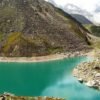
Situated at 3,658 meters in the Bhyundar Valley, the valley of flowers in the Chamoli district sprawls over a vast expanse of 87.50 sq. Kms, measuring 8 km long and 2 km wide, is the second zone of the Nanda Devi Biosphere Reserve with numerous waterfalls, white shiny glaciers and thickets that greet the visitor at every step. Ghangaria is a small hamlet situated at 13 km from Govindghatis the last human habitation center on the way to the Valley of Flowers.

Top 10 Summer Treks in Uttarakhand

The valley of flowers seems to change its color throughout the season from May to October, as it blooms hundreds of different flowers, taking various colors and shades as time progresses. The valley is the home of some rare flowers like the Brahma kamal, the blue poppy and the cobra lily. This place is a much-sought destination for flower lovers, nature lovers, photographers (nature photographers/wildlife photographers), and bird watchers. The valley is very popular among International tourists, and thousands of foreigners come to the Valley of Flowers every year.

Valley of Flowers National Park Travel Tips

Start early from Ghangharia to spend more time in the Valley of Flowers. It is a world heritage site and therefore you need to enter your name in the register, pay the entry fee and declare all plastic bottles you are carrying.

Entry to Valley of Flowers opens at 7:00 AM every morning and the last entry is allowed till 2:00 PM. You should start back around 1 PM so that you can reach back by 5:00 PM.

Carry an extra pair of socks, torches, Raincoats, and Extra Batteries for your Camera. Because you will see every possible opportunity for photography.

The Valley is beautiful in the months of May, June and September. But for the maximum number of flowers, the preferred months are July and August.

History of Valley of Flowers

In the year 1931, three British mountaineers, Frank S. SmytheR.L. Holdsworth and Eric Shipton lost their path while returning from Mt. Kamet. The group accidentally reached a valley that was blanketed with alpine flowers and was left in awe of its beauty, thus naming it “The Valley of Flowers”. One of the climbers, Frank S. Smythe, later wrote the book ‘Valley of Flowers. In 1939, Joan Margaret Legge (21 February 1885 – 4 July 1939), a botanist deputed by the Royal Botanic Garden,s arrived at the valley to study the flowers and while traversing some rocky slopes to collect flowers, she slipped off and lost her life. Her sister later visited the valley after her death and erected a memorial near the spot. Professor Chandra Prakash Kala, a botanist at the Wildlife Institute of India, carried out the research study on the floristics and conservation of the valley of flowers for a decade, beginning in 1993. He invented 520 alpine plants exclusively growing in this National Park and authored two important books – “The Valley of Flowers – Myth and Reality” and “Ecology and Conservation of the Valley of Flowers National Park, Garhwal Himalaya.

Management System

The National Park is administered by the Uttarakhand State Forestry Department, the National Ministry of Environment and Forests, India. There is no settlement in the park and grazing has been banned since 1983. The park is open only during summer from June to October and it is covered by heavy snow for the rest of the year.

Mythology about the Valley of Flowers

The locals always know about the existence of the valley and it is believed that this area was inhabited by Fairies and Gods.

Entry fee to the Valley of Flowers

  • For Indians: 150 INR
  • For Foreigners: 600 INR

Trek Update: A swift trek route to the Valley of Flowers has been carved which will easily guide you toward the beautiful floral valley. To make your sojourn rewarding, a new motorable bridge has been built in Govindghat connecting 4 Km towards the Valley of Flowers till Pulna village. So now tourists have to visit only 10 Km to reach Ghangaria(base camp of the Valley of Flower trek).

Travel Guide Valley of Flowers

Planning to visit the Valley of Flowers, but you are not sure about the most popular way, so here we are to help you. Check the details here.

Day 1: Rishikesh – Joshimath (255 Km) 9 Hours

  • Road Distance: 255 Km
  • Time Taken: 9 Hours
  • Altitude Change: 372 meters at Rishikesh to 1875 meters at Rishikesh.

Early morning leave Rishikesh for Joshimath it will take up to 9 to 10 hours to reach. Joshimath is 255 km away from Rishikesh, and it is the winter abode of Lord Badrinath. You’ll reach Joshimath by evening, and check in at any hotel that suits you for a night’s stay.  You can get direct buses from Rishikesh bus station to Joshimath if you are looking for a comfortable journey you can also book a taxi to Joshimath from Rishikesh.

Garhwali Traveller tip 1: To save money, use public transport to Joshimath. In case of no direct bus to Joshimath, break your journey into parts to reach your destination or go for sharable vehicles like Maxx service or Tata Sumos which are easily available.

Road routeRishikesh – Devprayag – Srinagar – Rudraprayag – Karanprayag – Nandprayag – Chamoli – Joshimath

Day 2: Joshimath – Govindghat – Ghangaria

  • Road distance: 20 Km
  • Trekking distance: 1 hour by road and 6 hours for a trek(trekking distance may vary depending upon your speed and stamina)
  • Trek grade: Moderate
  • Altitude change: 1828 meters at Govindghat and 3049 meters at Ghangaria

After breakfast, drive to Govindghat which is about 22 km away from Joshimath. Start your trek journey towards Ghangaria with a packed lunch. Ghangaria is also known as Govind Dham, it is the base camp for Hemkund Sahib and the Valley of Flowers trek. After completing the 10 km trek journey, you will reach Ghangaria where you will spend the night.

Note: The distance of 4 Km from Govindghat to Pulna village is motorable. Earlier you had to walk 14 km to reach Valley of Flowers National Park. But after the 2013 flood in Uttarakhand, a new route has been constructed by the Uttarakhand government for travelers visiting Hemkund Sahib and the Valley of Flowers.

Garhwali Traveller travel tip 2: If trekking is tough for you then there is also a good option for you at Govindghat, there are plenty of ponies. You can book them for your journey to Ghangaria. However, to enjoy the views and trek route, we will recommend trying to trek yourself to be strong.

Day 3: Ghangaria – Valley of Flowers – Ghangaria

  • Trekking distance: 7.5 Kms for both sides
  • Time took: 2 hours for one side(depending on your strength and speed)
  • Trek grade: Easy
  • Altitude change: 3049 meters at Ghangaria and 3658 meters at Valley of Flowers

Your hard work and the journey will finally pay off in the form of a beautiful Valley of Flowers. Here you will see flowers you have never seen before, exotic Himalayan flowers and wildlife flora and many more.

Day 4: Ghangaria – Govindghat – Joshimath

Now it’s time to return home, post breakfast, start your 10 Kms trek to Govindghat and then drive to Joshimath via Badrinath. On reaching Joshimath, check in for the hotels to stay for the night.

Day 5: Joshimath – Rishikesh

After having breakfast, drive to Rishikesh and say goodbye to the beautiful hills.

Note: You can extend your stay at Ghangaria for one more day and visit Hemkund Sahib as well, which is 6 Kms from Ghangaria.

Valley of Flowers National Park Highlights

  • Easy trek for beginners
  • One of the most beautiful valleys in the world
  • More than 500+ flower species and plants are found here
  • The valley changes its color throughout the season
  • A huge variety of birds and butterflies
  • Snow-covered mountains and glaciers visible from the valley
  • Beautiful waterfalls, streams, lush green meadows and forests during the trek to the valley

Valley of Flowers National Park Overview

  • The Temperature in June: 6 to 16 degrees Celcius
  • Trek to Valley of Flowers starts from: Govindghat or Pulna village
  • Trek distance: 17 Km
  • Trek grade: Easy for professionals and difficult trek for beginners
  • Trek duration: 3 days
  • Location: Chamoli District
  • Recommended stay: 4 days minimum
  • Altitude range: 3500 meters
  • Nearest railway station: Rishikesh, 273 Kms
  • Nearest airport: Jolly Grant Airport, Dehradun, 292 Kms
  • Famous for: Trekking, Flowers, Flora and Fauna, UNESCO Site, Vegetation
  • Best times to visit Valley of Flowers: May, June, July, August, September, October and November

What is the best time to visit the Valley of Flowers?

The Valley of Flowers is open for visitors from June to October. However, the best time to visit is between July and August when the flowers are in full bloom.

How do I reach the Valley of Flowers?

The Valley of Flowers is located in Uttarakhand, India. The nearest airport is in Dehradun, and the nearest railway station is in Rishikesh. From there, you can hire a taxi or take a bus to Govindghat and then trek to the Valley of Flowers.

Is there an entry fee for the Valley of Flowers?

Yes, there is an entry fee for the Valley of Flowers. Indian visitors need to pay INR 150 per person, and foreign visitors need to pay INR 600 per person. The fee is valid for three days.

What is the difficulty level of the trek to the Valley of Flowers?

The trek to the Valley of Flowers is considered moderate in difficulty. The trail is around 14 km long and has a gradual ascent. However, it can be tiring for those who are not used to trekking.

DeoriaTal Lake Travel Guide Rudraprayag Uttarakhand

Deoriatal Lake

Deoriatal Lake is one of the beautiful lakes of Uttarakhand. It is a pristine lake in the Ukhimath area of Rudraprayag district. It is a popular place to visit in Rudraprayag. Deoriatal is a beautiful lake situated at a height of, 2438 meters above sea level. In the early morning time on a clear day, Deoriatal blesses the tourists with miraculous reflections of Chaukhamba Peaks on its crystal clear water.

DeoriaTal is an easy trek for beginners. If you want to extend the trek you can also trek to Bisuri Tal, Chopta via Rohini Bugyal and even to the Tungnath Trek and Chandrashila Trek.

Why is Deoriatal Famous?

The beauty of this translucent lake attracts visitors from all around the world. DeoriaTal falls under the Kedarnath Musk Deer Sanctuary, in the early morning, you can see a

The lake is situated up into a lush green inclined field surrounded by dense green forest. DeoriaTal is a popular trekking destination in the region because of its ease of access and natural scenic beauty. DeoriaTal lies in the Kedarnath Musk Deer Sanctuary region. Therefore, an overnight stay at DeoriaTal is recommended. Few animals near the lake. This beautiful and majestic lake offers a panoramic view of ChaukhambaNeelkanthaBandarpunchKalanag Peaks and Kedar Ranges.

At DeoriaTal there are two things to experience, the first one being the real world and the other one being the reflection of the beautiful surroundings on the lake.

The lake is situated up into a lush green inclined field surrounded by dense green forest. DeoriaTal is a popular trekking destination in the region because of its ease of access and natural scenic beauty. DeoriaTal lies in the Kedarnath Musk Deer Sanctuary region. Therefore, an overnight stay at DeoriaTal is recommended.

Activities to do in Deoria Tal

Other than trekking, Deoriatal Lake is a perfect picnic, destination. Devariyatal is an easy trekking destination in the Himalayas rather than a tourist paradise. There is not much more sightseeing available at Deoria Tal apart from the majestic Himalayan peaks that are visible from Deoriatal like ChaukhambaSumeruMeru and Kedar Dome and some more.

Camping: Deoriatal is an ideal location for camping with friends and family. Camping just beside the lake is an amazing and peaceful experience. The reflection of Chaukhamba peak can be seen clearly on the Deoriatal.

Trekking: The trekking route to Deoria Tal is easy to medium grade. The 2 Km trek offers some breathtaking bird’s-eye views of Saari village and its lush green fields.

Village Tourism: Sari is the last village before the Deoria Tal trek starts. You can walk around the village and learn about their way of life and culture. The people are warm and welcoming.

Bird Watching: The meadows, lake water, jungle and secluded location make it a habitat for various species of birds. You will see many birds in the proximity of the lake itself. Many wildlife photographers and bird watchers come here every year.

Deoria Tal Travel Tips

Deoria Tal trek is an easy, medium-grade travel route, it is just a 2 Km trek from the last Saari village. The location is perfect for trekkers, groups, kids and families also.

Littering in and around the lake is a punishable offense and visitors and trekkers must take extra care of nature not to pollute the lake and location.

DeoriaTal Lake comes under the preview Kedarnath Wildlife Sanctuary. So, follow the proper guidelines outlined by forest authorities to protect the region.

Staying in Deoria Tal

Deoriatal lake is a very beautiful Tal (pond) at a height of 2,400 meters in Uttarakhand. Due to its pristine nature, camping is allowed at Deoria Tal under the vigilance of forest officials there. A forest rest house is available for staying at Deoria Tal. One has to trek 2 Km downhill from Devriyatal to Sari village to find accommodation. Few budget guesthouses are available there.

Food Guide Deoria Tal Trek

There are small shops located some 100 meters away from the lake where food items are prepared and served. The shacks have limited food items and a menu, so you would have to manage. Food facilities are also available in Sari village, where local food joints and restaurants are available. Packaged food can also be carried to Devriyatal, but make sure not to leave the waste there.

Overview Deoria Tal

  • Location: Rudraprayag, Garhwal
  • Deoriatal Trek, Distance: 3 km
  • Trek starts from Saari Village
  • Altitude range: 2438 meters
  • Trek Grade: Easy
  • Nearest Railway station: Rishikesh, 194 Kms
  • Nearest Airport: Jolly Grant Airport, Dehradun (208 Kms)
  • Recommended Stay: 2 Days
  • Best times to visit Deoria Tal Trek: Jan, Feb, March, April, May, June, September, October, Nov and December (Throughout the year)

Mussoorie Uttarakhand Travel Guide and Places to Visit

Mussoorie – The Queen of Hills

Mussoorie, Dehradun near hill station is located at a distance of 35 Km from Dehradun. Mussoorie is a beautiful and peaceful hill station of Uttarakhand which is located at a height of 2005 Meters above sea level. Mussoorie is situated at the foothills of the Himalayas and is also known as the Queen of Hills. Mussoorie is one of the top hill stations of India, which is famous as a Honeymoon destination, Mall Road, International schools, Himalayan Views, and a Weekend trip destination.

History of Mussoorie

Mussoorie the name of the place was named after the famous plant of Mussoorie “Shrub Mansoor”. These plants are found in large quantities in the Mussoorie region. The history of Mussoorie starts from the year 1825 when a shooting lodge was constructed by the British military officer captain Young and Mr Shore who were the Superintendent of Revenues at Dehradun.

Why Visit Mussoorie?

For seeing the beautiful green hills and majestic view of the Shivalik Himalayan Ranges and Doon valley. Mussoorie attracts thousands of tourists per day, both domestic and international tourists. Mussoorie is not only famous for its scenic beauty, it is also an important centre of business & education. As you know, some highly reputed International Schools are in Mussoorie.

The best time to visit Mussoorie is in winter to see the real beauty of nature, clouds and snow here.

What is Mussoorie famous for?

Mussoorie is basically famous for Hill station, Mall road, Shopping, Restaurants and High reputed luxury farmhouses, properties, ancient kothis, places and Expensive International Schools.

Mussoorie is preferred as a destination for friend groups, kids, families, Foreigners, Corporates and for Couples to enjoy their Honeymoon.

Mussoorie is famous for the following activities: New Year & Christmas, Hill Station, Honeymoon Location, Leisure, Ropeways, Shopping, Weekly trips, Historical.

Note: It is recommended to visit in winter to enjoy the snow-covered Mussoorie.

Places to visit in Mussoorie

  • Kempty Falls
  • Sir George Everest House
  • Mussoorie Lake
  • Jharipaani Falls
  • Lal Tibba
  • Bhatta Falls
  • Cloud’s End
  • Gun Hills
  • Sohan Art and Heritage Site
  • Jwala Devi Temple

Overview Mussoorie

  • Temperature: 26 (Max) and 7 (Min) in March
  • Location: Dehradun, Garhwal
  • Stay (Recommended): 2 days
  • Nearest Railway Station: Dehradun (36 Km)
  • Nearest Airport: Jolly Grant Airport, Dehradun (60 Km)
  • Famous for: Hill Station, Mall Road, Shopping, International Schools, Kempty Falls
  • Best time to visit: January to December (All the months of the year), but a recommended destination in winters to enjoy the snow.

Chopta Uttarakhand– Mini Switzerland of Uttarakhand

Chopta Hill Station Travel Guide

Chopta in Uttarakhand, also known as the “Mini Switzerland” of Uttarakhand, is located in the Rudraprayag District of Uttarakhand State. Chopta Hill station is located at an altitude of 2700 meters from sea level. If you are in Rudraprayag and want to visit the places near Rudraprayag and Chopta can be the dream destination for you.

Chopta is surrounded by dense green forest and offers a beautiful view of the Snow-Covered Himalayan Ranges and the Green Meadows.

It is also the starting point of the Tungnath Mandir(also known as Panch Kedar Temple) and Chandrashila Summit. The Chopta region is rich in flora and fauna, with a large quantity of Rhododendron and Deodar trees all around. If you are planning a Chopta Tour, then below is the list of activities and places to visit in Chopta, Uttarakhand.

Best Places to See in Chopta

Chopta is a very beautiful hill station and a superb trekking destination in the Dev Bhoomi Uttarakhand, which is surrounded by evergreen forests with the views of the Himalayan Ranges. Chopta not only attracts Indian tourists but also International tourists and trekkers all around the year. Chopta is the base of many trekking destinations like TungnathChandrashilla, etc. Chopta can be the perfect winter destination for you and your family as well as with the friend groups where you can enjoy the beautiful nature and cotton snow.

For nature lovers and trekking lovers, Chopta is a must-visit destination in Uttarakhand. Apart from Chopta, you can visit various places and make your journey more enjoyable. There are more destinations to explore from Chopta, such as the Himalayan Ranges and other natural beauty of Uttarakhand. There are many more beautiful and historical places in Uttarakhand to explore. From Temples to hill stations and the beauty of the lakes in Uttarakhand like Deoriatal lake, Tehri Lake, and many more.

Chopta The Center of Panch Kedar

Chopta is the centre of all Panch Kedars(Shiva Temples) Two on the left side (Kedarnath and Madmaheshwar) and two on the other right side(Rudranath and Kalpeshwar Mahadev) and one on the top of Chopta which is Tungnath. Tungnath is the highest Shiva Temple in the world. The positive energy at this place is unmatched, visit here and feel the energy. Uttarakhand Heaven.

Nearby Places to Visit in Chopta

Tungnath Temple

Tungnath is the highest temple of Lord Shiva, perched at an elevation of 3,680 m above sea level. The sanctity of the region of Tungnath is considered unsurpassed. Tungnath is one of the Panch Kedar and Shiva’s arm is worshipped here.

Chandrashilla

Chandrashila can be reached after a little more than 1 km easy grade trek from Tungnath. From Chandrashila one can enjoy 360-degree panoramic views of the gigantic Himalayas. Chandrashila is the highest point of the mountain, on which Tungnath Temple and Chopta are located.

Reasons to Visit Chopta Hill Station

Off Beat Tour

Perfect Weekend Destination amidst the Beautiful Himalayan Ranges of Uttarakhand.

Easy Route

Chopta is an easily accessible road from Delhi, RishikeshHaridwar, and Dehradun.

In Budget Destination

Being a scheduled destination, it is a budget-friendly destination.

Nature Beauty

Chopta is filled with Green Meadows and surrounded by the mighty Himalayan Ranges.

Chamoli Garhwal Uttarakhand and Places to Visit

Chamoli district is the pride of the Uttarakhand state with the major pilgrimage center of the country like BadrinathHemkund Sahib, and Joshimath, Snow is covered with the Himalayan peaks and natural sceneries.

The Chamoli in Uttarakhand is said to be able to attract any visitor with its mystic charm and pristine natural beauty. The lush green hilly forests are a real paradise for trekking, mountain climbing, and hiking.

Little villages like Mana village(the first Indian village) and Niti village etc., scattered around the International border with Tibet and climatic cardinalities fulfill the journey with sweet and lovable memories.

Best Places to Visit in Chamoli

Badrinath

Badrinath, one of the Char Dhams of Uttarakhand, is an important pilgrim center of the country. It is flanked by the Nar and Narayan two mountains around, while the Neelkanth Peak forms a splendid backdrop.

Gopeshwar:

The picturesque town of Gopeshwar is famous for the Gopinath Temple, which is an ancient Shiva temple. The main attractions of Gopeshwar are Shiv temple, Vaitarni Kund(a group of temples without idols) and Oak View, Degree college, etc.

Hemkund Sahib

Snow Lake or the Hemkund are situated at a height of 4329 meters. There are seven snow-covered mountains which are collectively known as Hemkund Parvat.

Govind Ghat:

It is set on the junction of the Alaknanda River and Bhyundar or Lakshman Ganga. There is a big Gurudwara here. Govind Ghat is a small town located in the Chamoli district of Uttarakhand, India. It is situated at an elevation of 1,250 meters above sea level and is known for its religious and natural significance.

It’s best to visit Govind Ghat during the summer or spring months as the weather is pleasant, it’s easier to access the trekking routes, and also the best time to enjoy the scenic beauty and adventure sports. Bird and nature lovers are going to find this place as a heaven on earth.

Nanda Devi Raj Jat Yatra:

The internationally renowned festival is held every 12 years and the celebration keeps on for 3 weeks. Nanda Devi Raj Jat Yatra is a 280 Km trek that starts from Nauti village(which lies in Karanprayag) to the peaks of Hemkund or Roopkund.

Nandaprayag:

It is the junction of the Alaknanda River and Mandakini, which is 21 Km away from Karanprayag on the main road route to Badrinath. The Famous Gopalji temple is situated in Nandaprayag. The Fair is hosted here on the occasion of Baisakhi and Janmasthami.

The Panch Prayag:

“Panch Prayag ” or the 5 most sacred river junctions of the Garhwal Himalayas has religious importance. The five Prayags are KaranprayagNandaprayagVishnuprayagRudraprayag, and Devprayag, three of the prayags are situated in the Chamoli district.

Karnaprayag:

Karanprayag town is situated on the sacred junction of Alaknanda and Pindar Rivers (Pindari), a town named after Lord Karna of Mahabharat. The Karna Temple and Uma Devi Temple are located here. It is believed that Lord Surya(Sun) gifted Kavach, Kundal and Tuneer to Kartna at Karnaprayag. Karanprayag town has had its historic importance for centuries. There are some beautiful places to visit near Karanprayag, you can visit like Nauti village, Simli town, Benital, etc.

Auli

Auli is famous for winter games and picnic spots, a world-class winter games and skiing resort, which is 12 Km from Joshimath. The 4 km long ropeway is one of the longest ropeways in India and a 3 Km long slope ranging from a height of 2519 meters is a major attraction. There are many other locations to visit in Auli you can go to.

Joshimath:

The town lies in between the route of the sacred temple Badrinath and the base for trekkers to the famous Valley of Flowers.

Joshimath is a town located in the Chamoli district of Uttarakhand, India. It is situated at an elevation of 1,890 meters above sea level and is known for its religious and historical significance. Joshimath is the epicenter of some holy temples and knowledge from ancient time

Best time to visit Chamoli

The best time to visit Chamoli is in winter (from November to February) to see the pure natural beauty of the mountains here when they get covered with snow. The places in Chamoli can be the perfect winter destinations for you and your loved ones.

The best time to visit Chamoli district in Uttarakhand, India depends on the activities you plan to do and the type of weather you prefer.

  1. Summer (April to June): This is the best time to visit if you want to avoid the colder weather and enjoy the natural beauty of the region. The weather is pleasant, and the snow melts, revealing a lush green landscape. This season also offers the best time to visit the temples and shrines in the district.
  2. Monsoon (July to September): This is the best time to visit if you want to see the region at its greenest, but be prepared for heavy rainfall.
  3. Winter (October to March): This is the best time to visit if you’re interested in skiing or other winter sports, as the snowfall in the region is at its heaviest during this time. However, keep in mind that the temperature can drop significantly during the night and the snow can block some of the roads.
  4. Spring (February to April): This is also a good time to visit as the weather is pleasant, the days are longer and the flowers are blooming, especially in the Valley of Flowers National Park.

Weather in the Chamoli district continuously changes in the rainy season from June to August. So you should check the weather and weather reports of Chamoli before planning a tour so that you don’t have to face any problems in between like roadblocks, etc.

For what is Chamoli known?

Chamoli is a district in the Indian state of Uttarakhand, and it is known for several things:

  1. Adventure tourism: Chamoli is a popular destination for adventure tourism, with activities such as trekking, rock climbing, and river rafting.
  2. Natural beauty: The district is known for its natural beauty, including the Nanda Devi National Park, which is a UNESCO World Heritage Site, and the Valley of Flowers National Park, which is a popular destination for nature enthusiasts.
  3. Religious significance: Chamoli is also known for its religious significance, as it is home to several important Hindu temples and shrines, including the Badrinath Temple, Adibadri, Gopinath temple, Mata Anusuiya Devi temple, and many others, which are one of the most sacred shrines of Hinduism.
  4. Trekking: Chamoli district is also famous for trekking routes that take trekkers through the most picturesque landscapes of the Indian Himalayas. The most famous of them is the Valley of Flowers trek.
  5. Hydroelectric projects: The district is also home to several hydroelectric projects, including the Tehri Dam, which is the highest dam in India and one of the largest hydroelectric projects in the world.
  6. Skiing: Chamoli district is also a popular destination for skiing in India, specially Auli known as the Ski capital of India.
  7. The skiing season in Chamoli district, especially in the ski destination of Auli, typically begins in December and lasts until the end of March. This can vary slightly depending on the snowfall and weather conditions. The best time to go skiing in Auli is from January to February when the snow is at its best and the weather is the most favorable.

How to Reach Chamoli?

By Road:

Chamoli district is well-connected to all the road routes, with important cities and towns of Uttarakhand, like Delhi, UttarPradesh, and Punjab State.

By Train:

The nearest railway station is Rishikesh(202 Km), Haridwar is another station near Rishikesh.

By Air:

The nearest airport to Chamoli is Gauchar Airport, followed by Jolly Grant Airport in Dehradun(221 Km), Public transport and private cabs are available from the Airport to Chamoli. To avail of the heli services from Dehradun to Gauchar, you have to book online at Pawan Hans official website.

Stats of Chamoli District

  • District Headquarters: Gopeshwar, Chamoli
  • The population of Chamoli district: 3,91,114
  • Languages spoken in Chamoli: Garhwali, Hindi, Kumaoni
  • Best season to visit Chamoli: Throughout the year (we will recommend visiting Chamoli in Winters to see the pure beauty of mountains here when they get snow-covered)
  • Literacy rate: 76.25%
  • Area: 7951 sq Km
  • Altitude: 1300 meters

River Rafting in Rishikesh – Pricing Chart and FAQs

River Rafting in Rishikesh Complete Guide

Are you planning a river rafting activity in Rishikesh? So here is the complete information about the rafting and the average package pricing from the different rafting companies in Rishikesh, which will provide you with the complete accommodation, meals and stay in your package.

The rafting season in Rishikesh starts from April to July, basically. There are many rafting companies in Rishikesh that provide rafting services in Rishikesh. Rishikesh is one of the popular rafting destinations in India.

Rafting in Rishikesh is the most popular activity to do in Rishikesh for adventure sports lovers. Indians as well as foreigners come here to enjoy the thrills of Ganga in the form of river rafting. River Ganga, which flows from Gangotri (the origin place of the Ganges) to Rishikesh, is full of many adventurous rapids in between the flow.

River rafting package highlights – Rishikesh

  • Trusted and friendly rafting companies in Rishikesh
  • All the companies have legal licenses provided by the Tourism and Forest department of Uttarakhand.
  • 10+ years of experience in River rafting.
  • Certified and experienced rafting guides.
  • Good choice of corporations and school groups.

Average Cost of River Rafting in Rishikesh

  • Brahampuri to Rishikesh(8 Km) Rs. 800/ person
  • Shivpuri to Rishikesh (16 Km) Rs. 1800/ person
  • Marine Drive to Rishikesh (26 Km) Rs. 2200/ person
  • Kaudiyala to Rishikesh (35 Km) Rs. 2700/ person

The above pricing is the average pricing of rafting in Rishikesh from different travel and rafting companies, whose pricing may vary a little.

Note: Smoking and alcohol consumption are strictly prohibited during rafting. Being overweight and pregnant or having any other suffering, people are not allowed. So make sure you are fit for rafting.

Rafting package includes:

  • Transportation
  • Wetsuits, life jackets, raft and paddles
  • 1 experienced guide will be with you
  • 1-day package includes dinner, breakfast and lunch

Except for river rafting, Rishikesh is very famous for some ancient temples and Ashrams. There are some most beautiful and interesting places to visit in Rishikesh, where you can also visit after.

Frequently asked Questions about Rishikesh Rafting

Is River rafting safe in Rishikesh?

As you all know, rafting is an adventure sport, and you have to follow the instructions provided by your guide. Wear all the safety equipment properly, recheck them, and rafting is safe.

What is the best time for river rafting in Rishikesh?

In May and June, the temperature at Rishikesh touches 35 degrees, and sometimes more. The best time for rafting in Rishikesh is in September. The best time to visit Rishikesh is from March to May.

What is the minimum age for rafting in Rishikesh?

The minimum age required for rafting is 14 years old. Less than that is not allowed for river rafting.

Can kids do rafting in Rishikesh?

Kids below 14 years are not allowed to participate in river rafting at Rishikesh, but some people violate the rule. As well as adults above 60 are also not allowed for rafting. These guidelines are issued by the Uttarakhand Tourism Development Board.

Should we carry Rafting equipment together?

No, you don’t need to carry the rafting equipment together or life jackets etc. All the equipment will be provided by the rafting agency Rishikesh in the rafting package.